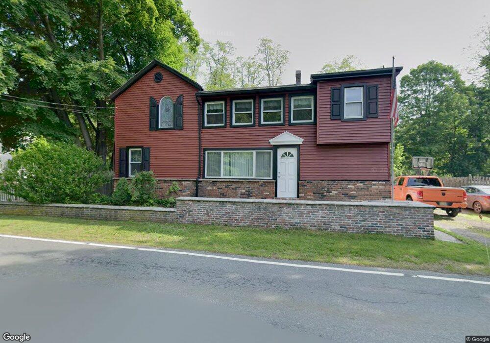
919 Swartswood Rd Newton, NJ 07860
Estimated Value: $284,093 - $491,000
--
Bed
--
Bath
1,881
Sq Ft
$201/Sq Ft
Est. Value
About This Home
This home is located at 919 Swartswood Rd, Newton, NJ 07860 and is currently estimated at $378,273, approximately $201 per square foot. 919 Swartswood Rd is a home located in Sussex County with nearby schools including Stillwater Township School and Kittatinny Regional High School.
Ownership History
Date
Name
Owned For
Owner Type
Purchase Details
Closed on
Dec 21, 2021
Sold by
Goriscak Scott M and Goriscak Terri
Bought by
Goriscak Scott M
Current Estimated Value
Purchase Details
Closed on
Sep 24, 1993
Sold by
Abruzzo Michael
Bought by
Goriscak Scott H
Home Financials for this Owner
Home Financials are based on the most recent Mortgage that was taken out on this home.
Original Mortgage
$109,000
Interest Rate
7%
Create a Home Valuation Report for This Property
The Home Valuation Report is an in-depth analysis detailing your home's value as well as a comparison with similar homes in the area
Home Values in the Area
Average Home Value in this Area
Purchase History
| Date | Buyer | Sale Price | Title Company |
|---|---|---|---|
| Goriscak Scott M | $140,000 | Pietras Lisa J | |
| Goriscak Scott H | $110,000 | -- |
Source: Public Records
Mortgage History
| Date | Status | Borrower | Loan Amount |
|---|---|---|---|
| Previous Owner | Goriscak Scott H | $109,000 |
Source: Public Records
Tax History Compared to Growth
Tax History
| Year | Tax Paid | Tax Assessment Tax Assessment Total Assessment is a certain percentage of the fair market value that is determined by local assessors to be the total taxable value of land and additions on the property. | Land | Improvement |
|---|---|---|---|---|
| 2025 | $6,120 | $168,700 | $54,100 | $114,600 |
| 2024 | $5,925 | $168,700 | $54,100 | $114,600 |
| 2023 | $5,925 | $168,700 | $54,100 | $114,600 |
| 2022 | $5,743 | $168,700 | $54,100 | $114,600 |
| 2021 | $5,616 | $168,700 | $54,100 | $114,600 |
| 2020 | $5,414 | $168,700 | $54,100 | $114,600 |
| 2019 | $5,196 | $168,700 | $54,100 | $114,600 |
| 2018 | $5,209 | $168,700 | $54,100 | $114,600 |
| 2017 | $5,127 | $168,700 | $54,100 | $114,600 |
| 2016 | $4,983 | $168,700 | $54,100 | $114,600 |
| 2015 | $4,953 | $168,700 | $54,100 | $114,600 |
| 2014 | $4,919 | $168,700 | $54,100 | $114,600 |
Source: Public Records
Map
Nearby Homes
- 1055-1057 Rt521
- 1049 County Road 521
- 1071 County Road 521
- 25 County Road 521
- 1024 County Road 619
- 936 Dove Island Rd
- 21 Lake Rd
- 907 Meadowbrook Rd
- 965 Cedar Dr
- 903 Stony Rd
- 8 Possaghi Rd
- 86 County Road 521
- 903 Twin Oaks Rd
- 903 Cedar Dr
- 0 Mount Benevolence Rd
- 905 Gapview Ct
- 30 Old Swartswood Rd
- 992 Stillwater Rd
- 920 Deer Run Rd
- 908 Willow Dr
- 917 Swartswood Rd
- 921 Swartswood Rd
- 913 Swartswood Rd
- 915 Swartswood Rd
- 908 Swartswood Rd
- 929 Swartswood Rd
- 912 Swarouteswood Rd
- 925 Swartswood Rd
- 909 Swartswood Rd
- 906 Swartswood Rd
- 907 Swartswood Rd
- 927 Swartswood Rd
- 904 Swartswood Rd
- 1078 Route 521
- 905 Swartswood Rd
- 197 Newton Swartswood Rd
- 931 Swarouteswood Rd
- 1076 County Road 521
- 903 Swartswood Rd
- 1074 County Road 521