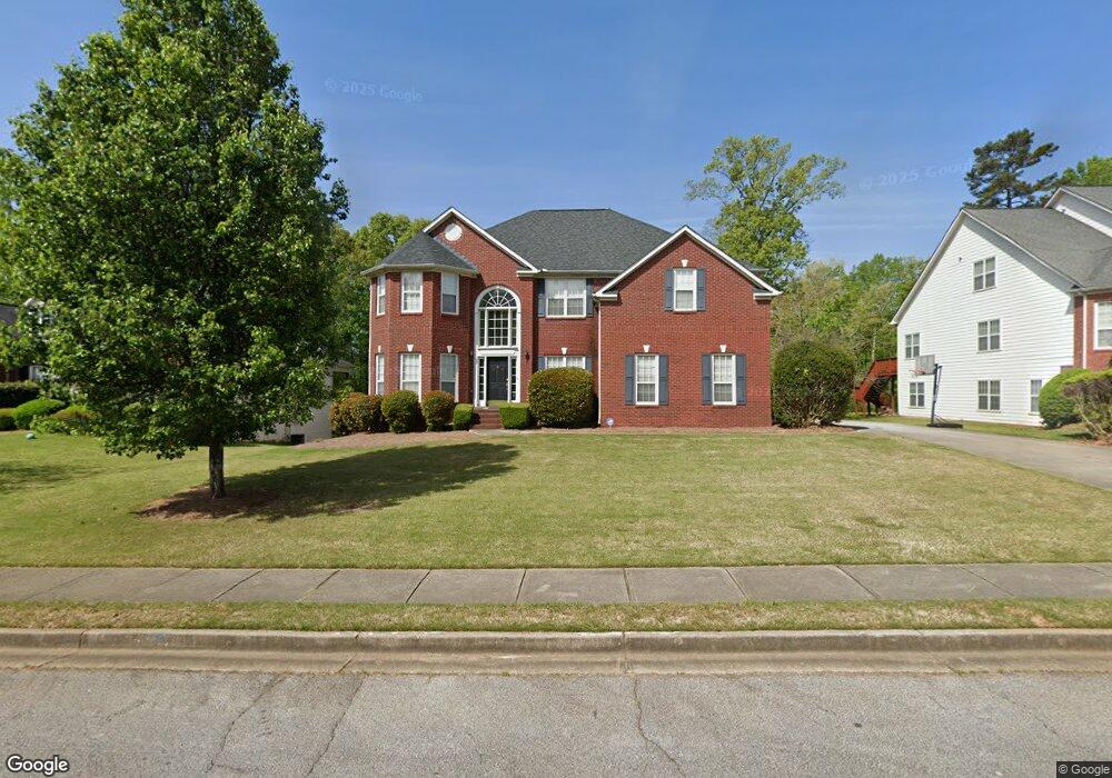
9190 N Links Dr Unit 1A Covington, GA 30014
Estimated Value: $403,420 - $475,000
5
Beds
4
Baths
3,026
Sq Ft
$143/Sq Ft
Est. Value
About This Home
This home is located at 9190 N Links Dr Unit 1A, Covington, GA 30014 and is currently estimated at $432,605, approximately $142 per square foot. 9190 N Links Dr Unit 1A is a home located in Newton County with nearby schools including East Newton Elementary School, Cousins Middle School, and Eastside High School.
Ownership History
Date
Name
Owned For
Owner Type
Purchase Details
Closed on
Aug 7, 2014
Sold by
Malone Stacie B
Bought by
Atlow Karl A
Current Estimated Value
Home Financials for this Owner
Home Financials are based on the most recent Mortgage that was taken out on this home.
Original Mortgage
$185,576
Outstanding Balance
$142,324
Interest Rate
4.5%
Mortgage Type
FHA
Estimated Equity
$290,281
Purchase Details
Closed on
Aug 24, 2001
Sold by
Ryland Group Inc
Bought by
Malone Stacie B
Home Financials for this Owner
Home Financials are based on the most recent Mortgage that was taken out on this home.
Original Mortgage
$180,650
Interest Rate
7.02%
Mortgage Type
New Conventional
Create a Home Valuation Report for This Property
The Home Valuation Report is an in-depth analysis detailing your home's value as well as a comparison with similar homes in the area
Home Values in the Area
Average Home Value in this Area
Purchase History
| Date | Buyer | Sale Price | Title Company |
|---|---|---|---|
| Atlow Karl A | $189,000 | -- | |
| Malone Stacie B | $225,900 | -- |
Source: Public Records
Mortgage History
| Date | Status | Borrower | Loan Amount |
|---|---|---|---|
| Open | Atlow Karl A | $185,576 | |
| Previous Owner | Malone Stacie B | $180,650 |
Source: Public Records
Tax History Compared to Growth
Tax History
| Year | Tax Paid | Tax Assessment Tax Assessment Total Assessment is a certain percentage of the fair market value that is determined by local assessors to be the total taxable value of land and additions on the property. | Land | Improvement |
|---|---|---|---|---|
| 2024 | $4,602 | $152,400 | $22,400 | $130,000 |
| 2023 | $5,122 | $157,600 | $13,200 | $144,400 |
| 2022 | $4,324 | $133,040 | $13,200 | $119,840 |
| 2021 | $4,667 | $128,520 | $13,200 | $115,320 |
| 2020 | $4,715 | $118,200 | $13,200 | $105,000 |
| 2019 | $4,770 | $117,400 | $13,200 | $104,200 |
| 2018 | $4,548 | $110,680 | $13,200 | $97,480 |
| 2017 | $3,736 | $90,920 | $13,200 | $77,720 |
| 2016 | $3,191 | $77,640 | $10,000 | $67,640 |
| 2015 | $2,783 | $67,640 | $10,000 | $57,640 |
| 2014 | $2,545 | $61,880 | $0 | $0 |
Source: Public Records
Map
Nearby Homes
- 10110 Malcolm Ct
- 8193 Monticello St
- 10155 Malcolm Dr
- 10184 Malcolm Dr
- 8239 High Lake Terrace SE
- 7703 Fawn Cir
- 130 S Links Dr
- 7762 Fawn Cir
- 8 Jackson Rd
- 10119 Azalea Dr
- 0 Petty St Unit 10547316
- 0 Petty St Unit 7640177
- 7155 Petty St SW
- 6111 Old Monticello St SE
- 8384 Fairway Dr
- 8370 Fairway Dr
- 9122 Golfview Cir
- 6176 Pinewood Dr SE
- 7120 Chaney Dr SW
- 6169 Pinewood Dr SE
- 9202 N Links Dr
- 9180 N Links Dr Unit 1B
- 9212 N Links Dr
- 9178 N Links Dr Unit 75
- 9178 N Links Dr Unit 1B
- 9106 N Links Ct
- 9203 N Links Dr Unit 1B
- 9172 N Links Dr Unit 74
- 9172 N Links Dr Unit 1B
- 10104 N Links Dr Unit 1B
- 9171 N Links Dr Unit 1B
- 9213 N Links Dr Unit 1B
- 9120 N Links Ct
- 9120 N Links Ct
- 9120 N Links Ct Unit 17
- 10103 N Links Dr Unit 1B
- N N Links Dr Unit 62
- N N Links Dr Unit 11
- N N Links Dr Unit 72
- N N Links Dr Unit 10