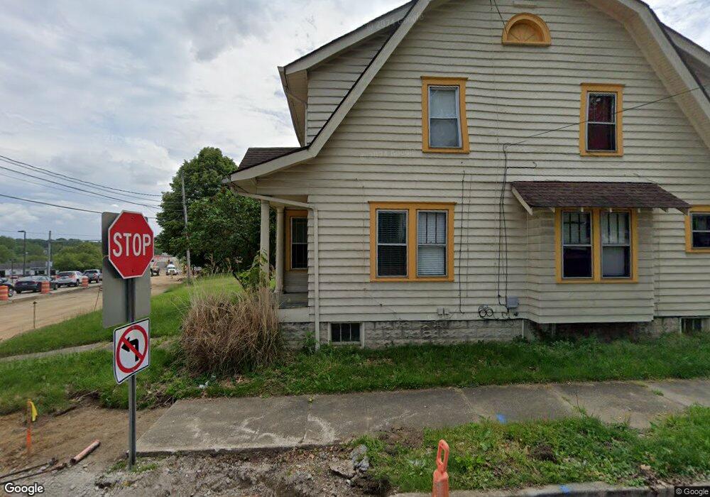
92 94 W State St Barberton, OH 44203
North Barberton NeighborhoodEstimated Value: $169,000 - $240,158
6
Beds
3
Baths
3,342
Sq Ft
$59/Sq Ft
Est. Value
About This Home
This home is located at 92 94 W State St, Barberton, OH 44203 and is currently estimated at $195,790, approximately $58 per square foot. 92 94 W State St is a home located in Summit County with nearby schools including Barberton Middle School, Barberton Intermediate School 3-5, and Barberton High School.
Ownership History
Date
Name
Owned For
Owner Type
Purchase Details
Closed on
Jun 26, 2018
Sold by
Biggs Brett A
Bought by
Exchange Street Holdings Llc
Current Estimated Value
Home Financials for this Owner
Home Financials are based on the most recent Mortgage that was taken out on this home.
Original Mortgage
$61,950
Outstanding Balance
$53,808
Interest Rate
4.6%
Mortgage Type
Future Advance Clause Open End Mortgage
Estimated Equity
$141,982
Purchase Details
Closed on
Feb 3, 2015
Sold by
Biggs William S and Biggs Patricia L
Bought by
The William And Patricia L Biggs Keyston
Purchase Details
Closed on
Jul 8, 2013
Sold by
Mcneill Helen L
Bought by
Biggs William S and Biggs Patricia L
Create a Home Valuation Report for This Property
The Home Valuation Report is an in-depth analysis detailing your home's value as well as a comparison with similar homes in the area
Home Values in the Area
Average Home Value in this Area
Purchase History
| Date | Buyer | Sale Price | Title Company |
|---|---|---|---|
| Exchange Street Holdings Llc | $82,600 | None Available | |
| The William And Patricia L Biggs Keyston | -- | None Available | |
| Biggs William S | -- | Csj Title Box |
Source: Public Records
Mortgage History
| Date | Status | Borrower | Loan Amount |
|---|---|---|---|
| Open | Exchange Street Holdings Llc | $61,950 |
Source: Public Records
Tax History Compared to Growth
Tax History
| Year | Tax Paid | Tax Assessment Tax Assessment Total Assessment is a certain percentage of the fair market value that is determined by local assessors to be the total taxable value of land and additions on the property. | Land | Improvement |
|---|---|---|---|---|
| 2025 | $5,172 | $72,184 | $9,044 | $63,140 |
| 2024 | $3,706 | $72,184 | $9,044 | $63,140 |
| 2023 | $5,172 | $72,184 | $9,044 | $63,140 |
| 2022 | $2,793 | $47,181 | $5,912 | $41,269 |
| 2021 | $2,790 | $47,181 | $5,912 | $41,269 |
| 2020 | $2,731 | $47,180 | $5,910 | $41,270 |
| 2019 | $2,788 | $43,620 | $5,200 | $38,420 |
| 2018 | $2,747 | $43,620 | $5,200 | $38,420 |
| 2017 | $2,783 | $43,620 | $5,200 | $38,420 |
| 2016 | $2,789 | $43,620 | $5,200 | $38,420 |
| 2015 | $2,783 | $43,620 | $5,200 | $38,420 |
| 2014 | $2,768 | $43,620 | $5,200 | $38,420 |
| 2013 | $2,772 | $45,280 | $5,200 | $40,080 |
Source: Public Records
Map
Nearby Homes
- 30 W Hiram St
- 103 Mitchell St
- 818 N Summit St
- 690 Saint Clair Ave
- 44 W Summit St
- 277 Glenn St
- 143 Glenn St
- 0 Romig Ave
- 146 Hermann St
- 137 Hermann St
- 76 Hazelwood Ave
- 0 Wooster Rd N
- 117 Fernwood Ave
- 103 & 103 1/2 Fernwood Ave
- 213 Hermann St
- 645 Madison Ave
- 1924 Caroline Ave
- 1150 Wooster Rd N
- 250 Evergreen St
- 613 Wooster Rd N