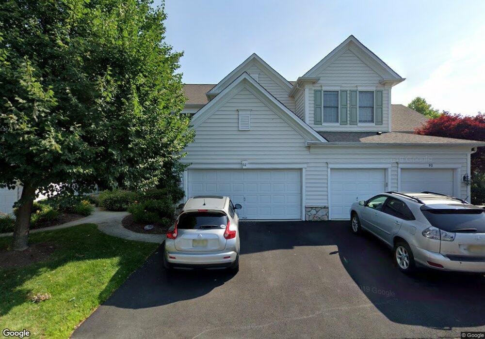
92 Balsam Ct Paramus, NJ 07652
Estimated Value: $956,687 - $1,155,000
3
Beds
4
Baths
2,332
Sq Ft
$449/Sq Ft
Est. Value
About This Home
This home is located at 92 Balsam Ct, Paramus, NJ 07652 and is currently estimated at $1,047,672, approximately $449 per square foot. 92 Balsam Ct is a home located in Bergen County with nearby schools including Paramus High School, Yeshivat Noam School, and Yavneh Academy.
Ownership History
Date
Name
Owned For
Owner Type
Purchase Details
Closed on
Aug 2, 2018
Sold by
Buines Julio and Buines Mariza
Bought by
Park Yang J and Park Hye S
Current Estimated Value
Purchase Details
Closed on
Sep 27, 2002
Sold by
Pulte Home Corp Of The Delawar
Bought by
Bulnes Julio and Bulnes Mariza
Home Financials for this Owner
Home Financials are based on the most recent Mortgage that was taken out on this home.
Original Mortgage
$411,200
Interest Rate
6.18%
Create a Home Valuation Report for This Property
The Home Valuation Report is an in-depth analysis detailing your home's value as well as a comparison with similar homes in the area
Home Values in the Area
Average Home Value in this Area
Purchase History
We collect this data history from publicly available records. To have your information removed, we recommend requesting removal directly through your county’s website.
| Date | Buyer | Sale Price | Title Company |
|---|---|---|---|
| Park Yang J | $710,000 | -- | |
| Bulnes Julio | $514,000 | -- |
Source: Public Records
Mortgage History
We collect this data history from publicly available records. To have your information removed, we recommend requesting removal directly through your county’s website.
| Date | Status | Borrower | Loan Amount |
|---|---|---|---|
| Previous Owner | Bulnes Julio | $411,200 |
Source: Public Records
Tax History
| Year | Tax Paid | Tax Assessment Tax Assessment Total Assessment is a certain percentage of the fair market value that is determined by local assessors to be the total taxable value of land and additions on the property. | Land | Improvement |
|---|---|---|---|---|
| 2025 | $12,388 | $873,100 | $400,000 | $473,100 |
| 2024 | $12,040 | $818,200 | $367,500 | $450,700 |
| 2023 | $11,325 | $784,900 | $350,000 | $434,900 |
| 2022 | $11,325 | $729,700 | $320,000 | $409,700 |
| 2021 | $11,203 | $677,300 | $300,000 | $377,300 |
| 2020 | $10,725 | $672,400 | $300,000 | $372,400 |
| 2019 | $10,124 | $545,500 | $275,000 | $270,500 |
| 2018 | $9,999 | $545,500 | $275,000 | $270,500 |
| 2017 | $9,824 | $545,500 | $275,000 | $270,500 |
| 2016 | $9,557 | $545,500 | $275,000 | $270,500 |
| 2015 | $9,459 | $545,500 | $275,000 | $270,500 |
| 2014 | $9,377 | $545,500 | $275,000 | $270,500 |
Source: Public Records
Map
Nearby Homes
- 122 White Pine Ct
- 218 Paramus Rd
- 9 Hemlock Dr
- 9-09 Elaine Terrace
- 3-23 Saddle River Rd
- 4-21 Saddle River Rd
- 41-01 Geiger Place
- 50 Hemlock Dr
- 10 Williamson Place
- 39-22 Vanore Dr
- 39-23 van Duren Ave
- 17 Feldman Ct
- 210 Hillcrest Dr
- 3-07 Dorothy St Unit 1X
- 39-01 Broadway Unit B
- 3901 Broadway Unit B
- 1-29 Virginia Dr Unit 129B
- 219 N Farview Ave
- 1-30 Virginia Dr Unit 130B
- 5-10 Dorothy St Unit 1X
Your Personal Tour Guide
Ask me questions while you tour the home.