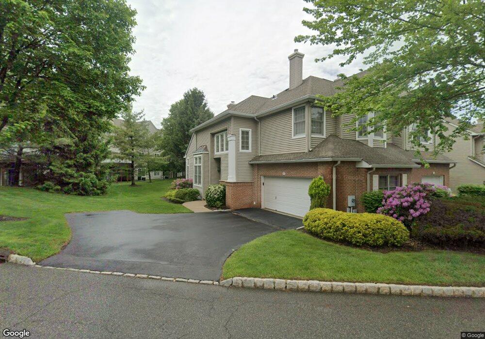
92 Kent Dr Unit C0178 Roseland, NJ 07068
Estimated Value: $742,000 - $854,000
--
Bed
--
Bath
1,890
Sq Ft
$426/Sq Ft
Est. Value
About This Home
This home is located at 92 Kent Dr Unit C0178, Roseland, NJ 07068 and is currently estimated at $804,436, approximately $425 per square foot. 92 Kent Dr Unit C0178 is a home located in Essex County with nearby schools including Lester C. Noecker Elementary School, West Essex Middle School, and West Essex High School.
Ownership History
Date
Name
Owned For
Owner Type
Purchase Details
Closed on
Jul 29, 2007
Sold by
Amsterdam Andrew and Amsterdam Lauren
Bought by
Mooney Charles and Mooney Roberta
Current Estimated Value
Home Financials for this Owner
Home Financials are based on the most recent Mortgage that was taken out on this home.
Original Mortgage
$417,000
Outstanding Balance
$259,673
Interest Rate
6.34%
Mortgage Type
Purchase Money Mortgage
Estimated Equity
$544,763
Purchase Details
Closed on
Nov 18, 1999
Sold by
Daneyko Kenneth
Bought by
Mcginley Peter and Mcginley Claudia
Home Financials for this Owner
Home Financials are based on the most recent Mortgage that was taken out on this home.
Original Mortgage
$333,000
Interest Rate
7.86%
Purchase Details
Closed on
Oct 14, 1997
Sold by
Giannella Rose Ann
Bought by
Daneyko Kenneth and Daneyko Jonna
Create a Home Valuation Report for This Property
The Home Valuation Report is an in-depth analysis detailing your home's value as well as a comparison with similar homes in the area
Home Values in the Area
Average Home Value in this Area
Purchase History
| Date | Buyer | Sale Price | Title Company |
|---|---|---|---|
| Mooney Charles | $680,000 | Old Republic National Title | |
| Mcginley Peter | $370,000 | -- | |
| Daneyko Kenneth | $347,000 | -- |
Source: Public Records
Mortgage History
| Date | Status | Borrower | Loan Amount |
|---|---|---|---|
| Open | Mooney Charles | $417,000 | |
| Previous Owner | Mcginley Peter | $333,000 |
Source: Public Records
Tax History Compared to Growth
Tax History
| Year | Tax Paid | Tax Assessment Tax Assessment Total Assessment is a certain percentage of the fair market value that is determined by local assessors to be the total taxable value of land and additions on the property. | Land | Improvement |
|---|---|---|---|---|
| 2025 | $10,556 | $636,800 | $260,000 | $376,800 |
| 2024 | $10,556 | $636,800 | $260,000 | $376,800 |
| 2022 | $10,648 | $456,000 | $205,000 | $251,000 |
| 2021 | $10,502 | $456,000 | $205,000 | $251,000 |
| 2020 | $10,465 | $456,000 | $205,000 | $251,000 |
| 2019 | $10,369 | $456,000 | $205,000 | $251,000 |
| 2018 | $10,278 | $456,000 | $205,000 | $251,000 |
| 2017 | $10,274 | $456,000 | $205,000 | $251,000 |
| 2016 | $10,114 | $456,000 | $205,000 | $251,000 |
| 2015 | $10,137 | $456,000 | $205,000 | $251,000 |
| 2014 | $9,854 | $456,000 | $205,000 | $251,000 |
Source: Public Records
Map
Nearby Homes
- 88 Kent Dr Unit C0176
- 26 Kent Dr Unit C0145
- 6 Mulford Ct Unit Address 6
- 6 Mulford Ct Unit C0013
- 18 Harkey Ct Unit 63
- 18 Harkey Ct Unit C0063
- 20 Lenape Dr
- 192 Eagle Rock Ave
- 38 Passaic Ave
- 39 Schweinberg Dr Unit 2039
- 30 Schweinberg Dr
- 144 Passaic Ave
- 4 Williamsburg Dr
- 27 3rd Ave
- 58 Leonard Terrace
- 26 Bovensiepen Ct
- 26 Bovensiepen Ct Unit 3526
- 518 Eagle Rock Ave
- 201 Eagle Rock Ave
- 45 Brandon Ave
- 90 Kent Dr Unit C0177
- 86 Kent Dr Unit C0175
- 86 Kent Dr
- 84 Kent Dr Unit C0174
- 96 Kent Dr Unit C0124
- 82 Kent Dr Unit C0173
- 94 Kent Dr Unit C0123
- 98 Kent Dr Unit C0125
- 93 Kent Dr Unit C0115
- 100 Kent Dr
- 89 Kent Dr Unit C0113
- 95 Kent Dr Unit C0116
- 91 Kent Dr Unit C0114
- 102 Kent Dr Unit C0127
- 97 Kent Dr Unit C0117
- 99 Kent Dr Unit C0118
- 104 Kent Dr Unit C0128
- 2 Depaolo Ct Unit C0112
- 28 Depaolo Ct Unit C0099
- 4 Depaolo Ct Unit C0111