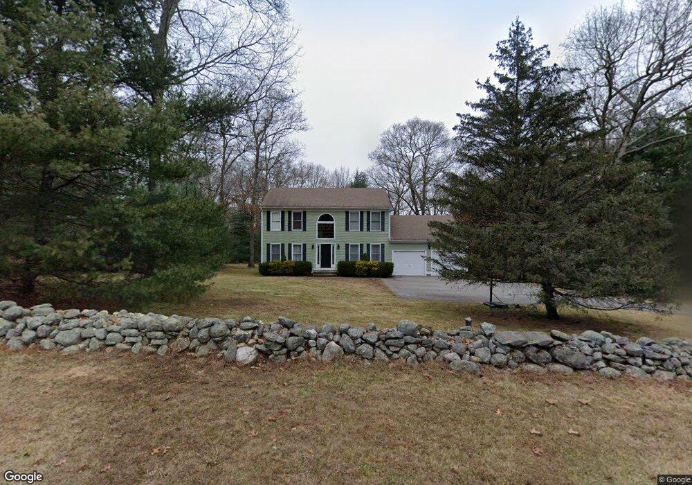
92 Niles Rd Amston, CT 06231
Estimated Value: $433,109 - $567,000
3
Beds
3
Baths
2,176
Sq Ft
$230/Sq Ft
Est. Value
About This Home
This home is located at 92 Niles Rd, Amston, CT 06231 and is currently estimated at $501,527, approximately $230 per square foot. 92 Niles Rd is a home located in Tolland County with nearby schools including Gilead Hill School, Hebron Elementary School, and RHAM Middle School.
Ownership History
Date
Name
Owned For
Owner Type
Purchase Details
Closed on
Oct 21, 2004
Sold by
Maynard Everett and Mynard Lisa
Bought by
Haines Jeffrey and Haines Stephanie
Current Estimated Value
Purchase Details
Closed on
Nov 1, 2001
Sold by
Donovan Paul and Donovan Aline
Bought by
Maynard Everet and Hudson Lisa
Purchase Details
Closed on
Sep 30, 1991
Sold by
Mountain View Ests
Bought by
Donovan Paul and Donovan Aline
Purchase Details
Closed on
Jun 11, 1990
Sold by
Hryniszyn Jaroslaw
Bought by
Donovan Paul
Purchase Details
Closed on
Sep 11, 1989
Sold by
Mountain View Ests
Bought by
Hryniszyn Jaroslaw
Create a Home Valuation Report for This Property
The Home Valuation Report is an in-depth analysis detailing your home's value as well as a comparison with similar homes in the area
Home Values in the Area
Average Home Value in this Area
Purchase History
| Date | Buyer | Sale Price | Title Company |
|---|---|---|---|
| Haines Jeffrey | $295,000 | -- | |
| Maynard Everet | $248,000 | -- | |
| Donovan Paul | $52,000 | -- | |
| Donovan Paul | $229,900 | -- | |
| Hryniszyn Jaroslaw | $66,000 | -- |
Source: Public Records
Mortgage History
| Date | Status | Borrower | Loan Amount |
|---|---|---|---|
| Open | Hryniszyn Jaroslaw | $279,450 | |
| Closed | Hryniszyn Jaroslaw | $277,000 |
Source: Public Records
Tax History
| Year | Tax Paid | Tax Assessment Tax Assessment Total Assessment is a certain percentage of the fair market value that is determined by local assessors to be the total taxable value of land and additions on the property. | Land | Improvement |
|---|---|---|---|---|
| 2025 | $8,195 | $222,390 | $52,640 | $169,750 |
| 2024 | $7,672 | $222,390 | $52,640 | $169,750 |
| 2023 | $7,381 | $222,390 | $52,640 | $169,750 |
| 2022 | $7,050 | $222,390 | $52,640 | $169,750 |
| 2021 | $6,921 | $190,510 | $52,610 | $137,900 |
| 2020 | $6,921 | $190,510 | $52,610 | $137,900 |
| 2019 | $7,058 | $190,510 | $52,610 | $137,900 |
| 2018 | $7,133 | $190,510 | $52,610 | $137,900 |
| 2017 | $7,049 | $190,510 | $52,610 | $137,900 |
| 2016 | $7,487 | $210,070 | $86,520 | $123,550 |
| 2015 | $7,563 | $210,070 | $86,520 | $123,550 |
| 2014 | $7,510 | $210,070 | $86,520 | $123,550 |
Source: Public Records
Map
Nearby Homes
- 33 Northam Rd
- 40 Hillcrest Dr
- 12 Rondaly Rd
- 2 Lots on Deepwood Dr
- 0 Deepwood Dr
- 31 Uncas Dr
- 21 Bass Lake Rd
- 282 Deepwood Dr
- 485 Deepwood Dr
- 0 Ryan Terrace Unit 24144446
- 76 Park Rd
- 0 Wildwood Dr
- 47 Park Rd
- 5 Vicki Ln Unit 5
- 231 Windham Ave
- 27 Greenwich Place
- 75 Brindlewood Path
- 45 Hoadly Rd
- 111 Old Hartford Rd
- 39 Jaffee Terrace
Your Personal Tour Guide
Ask me questions while you tour the home.