Estimated Value: $237,000 - $256,000
3
Beds
2
Baths
1,304
Sq Ft
$187/Sq Ft
Est. Value
About This Home
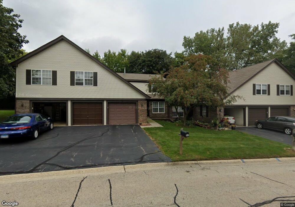
This home is located at 92 Pine Cir, Cary, IL 60013 and is currently estimated at $244,457, approximately $187 per square foot. 92 Pine Cir is a home located in McHenry County with nearby schools including Deer Path Elementary School, Cary Jr High School, and Cary-Grove High School.
Ownership History
Date
Name
Owned For
Owner Type
Purchase Details
Closed on
Aug 11, 2009
Sold by
Hand Donald R and Hand Audrey R
Bought by
Weber Stephanie
Current Estimated Value
Home Financials for this Owner
Home Financials are based on the most recent Mortgage that was taken out on this home.
Original Mortgage
$139,428
Outstanding Balance
$90,908
Interest Rate
5.21%
Mortgage Type
FHA
Estimated Equity
$153,549
Purchase Details
Closed on
Dec 7, 2001
Sold by
Denk William C and Denk Erin E
Bought by
Hand Linda J
Home Financials for this Owner
Home Financials are based on the most recent Mortgage that was taken out on this home.
Original Mortgage
$91,000
Interest Rate
6.52%
Purchase Details
Closed on
Apr 15, 1997
Sold by
Brodsky Jay M and Brodsky Jacqueline L
Bought by
Denk William C and Denk Erin E
Home Financials for this Owner
Home Financials are based on the most recent Mortgage that was taken out on this home.
Original Mortgage
$90,469
Interest Rate
7.92%
Mortgage Type
FHA
Create a Home Valuation Report for This Property
The Home Valuation Report is an in-depth analysis detailing your home's value as well as a comparison with similar homes in the area
Home Values in the Area
Average Home Value in this Area
Purchase History
| Date | Buyer | Sale Price | Title Company |
|---|---|---|---|
| Weber Stephanie | $142,000 | Attorneys Title Guaranty Fun | |
| Hand Linda J | $114,750 | -- | |
| Denk William C | $91,000 | -- |
Source: Public Records
Mortgage History
| Date | Status | Borrower | Loan Amount |
|---|---|---|---|
| Open | Weber Stephanie | $139,428 | |
| Previous Owner | Hand Linda J | $91,000 | |
| Previous Owner | Denk William C | $90,469 |
Source: Public Records
Tax History
| Year | Tax Paid | Tax Assessment Tax Assessment Total Assessment is a certain percentage of the fair market value that is determined by local assessors to be the total taxable value of land and additions on the property. | Land | Improvement |
|---|---|---|---|---|
| 2024 | $4,596 | $62,573 | $12,923 | $49,650 |
| 2023 | $4,440 | $55,964 | $11,558 | $44,406 |
| 2022 | $3,870 | $47,326 | $10,431 | $36,895 |
| 2021 | $3,665 | $44,090 | $9,718 | $34,372 |
| 2020 | $3,544 | $42,529 | $9,374 | $33,155 |
| 2019 | $3,459 | $40,705 | $8,972 | $31,733 |
| 2018 | $3,058 | $35,883 | $8,288 | $27,595 |
| 2017 | $2,976 | $33,804 | $7,808 | $25,996 |
| 2016 | $2,927 | $31,705 | $7,323 | $24,382 |
| 2013 | -- | $33,748 | $6,831 | $26,917 |
Source: Public Records
Map
Nearby Homes
- 717 Wellington Ln
- 1161 Amber Dr
- 134 Bright Oaks Cir
- 12 Oak Valley Dr
- 317 Sterling Cir
- 2819 Sun Valley Dr
- 3005 Green Meadow Ln
- 0 Kaper Dr
- 3712 3 Oaks Rd
- 6305 Robert Rd
- 6418 Carrie Ct
- 1163 E Danbury Dr
- 349 Park Ave
- LOT 02 Three Oaks Rd
- 3408 Royal Woods Dr
- Lots 2,3,4 Northwest Hwy
- 237 Foxford Dr
- 5 Echo Hill Rd
- Lot 10 Grove Ln
- Lot 11 Grove Ln
Your Personal Tour Guide
Ask me questions while you tour the home.