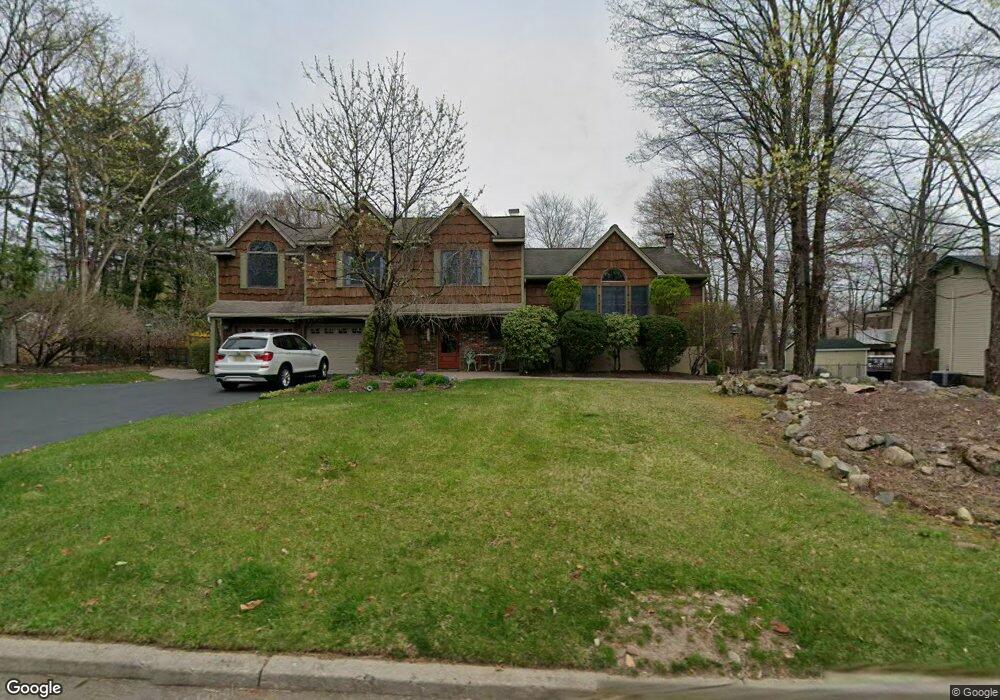
92 Rolling Ridge Rd West Milford, NJ 07480
Estimated Value: $674,678 - $767,000
--
Bed
--
Bath
3,095
Sq Ft
$230/Sq Ft
Est. Value
About This Home
This home is located at 92 Rolling Ridge Rd, West Milford, NJ 07480 and is currently estimated at $713,170, approximately $230 per square foot. 92 Rolling Ridge Rd is a home located in Passaic County with nearby schools including Macopin Middle School and West Milford High School.
Ownership History
Date
Name
Owned For
Owner Type
Purchase Details
Closed on
Mar 30, 2013
Sold by
Hogan Thomas E
Bought by
Hogan Robyne M
Current Estimated Value
Purchase Details
Closed on
Sep 4, 1996
Sold by
Maple Dave Bobbi
Bought by
Hogan Thomas and Hogan Robyne
Home Financials for this Owner
Home Financials are based on the most recent Mortgage that was taken out on this home.
Original Mortgage
$165,000
Outstanding Balance
$13,706
Interest Rate
7.83%
Estimated Equity
$699,464
Create a Home Valuation Report for This Property
The Home Valuation Report is an in-depth analysis detailing your home's value as well as a comparison with similar homes in the area
Home Values in the Area
Average Home Value in this Area
Purchase History
| Date | Buyer | Sale Price | Title Company |
|---|---|---|---|
| Hogan Robyne M | -- | None Available | |
| Hogan Thomas | $218,000 | -- |
Source: Public Records
Mortgage History
| Date | Status | Borrower | Loan Amount |
|---|---|---|---|
| Open | Hogan Thomas | $165,000 |
Source: Public Records
Tax History Compared to Growth
Tax History
| Year | Tax Paid | Tax Assessment Tax Assessment Total Assessment is a certain percentage of the fair market value that is determined by local assessors to be the total taxable value of land and additions on the property. | Land | Improvement |
|---|---|---|---|---|
| 2025 | $16,921 | $426,800 | $109,500 | $317,300 |
| 2024 | $17,009 | $417,400 | $109,500 | $307,900 |
| 2022 | $16,145 | $417,400 | $109,500 | $307,900 |
| 2021 | $15,799 | $417,400 | $109,500 | $307,900 |
| 2020 | $15,632 | $417,400 | $109,500 | $307,900 |
| 2019 | $15,423 | $417,400 | $109,500 | $307,900 |
| 2018 | $15,385 | $417,400 | $109,500 | $307,900 |
| 2017 | $15,456 | $417,400 | $109,500 | $307,900 |
| 2016 | $15,481 | $417,400 | $109,500 | $307,900 |
| 2015 | $15,302 | $417,400 | $109,500 | $307,900 |
| 2014 | $14,930 | $417,400 | $109,500 | $307,900 |
Source: Public Records
Map
Nearby Homes
- 11 Eagles Nest Terrace
- 24 Eagles Nest Terrace
- 33 Eagles Nest Terrace
- 2 Iron Hill
- 2 Heritage Dr
- 60 Eagles Nest Terrace
- 68 Heritage Dr
- 82 Heritage Dr
- 91 Heritage Dr
- 0 Rock Ledge Rd Unit 25030488
- 0 Rock Ledge Rd Unit 3983243
- 54 Nosenzo Pond Rd
- 0 Laurel Hollow
- 16 Pond View Dr
- 43 Bisset Dr
- 1731 MacOpin Rd
- 7 Rockburn Pass
- 5 Bisset Dr
- 1772 MacOpin Rd
- 17 Camelot Dr
- 96 Rolling Ridge Rd
- 91 Rolling Ridge Rd
- 87 Rolling Ridge Rd
- 82 Rolling Ridge Rd
- 83 Rolling Ridge Rd
- 27 Baron Rd
- 34 Carteret St
- 7 Fox Ct
- 101 Rolling Ridge Rd
- 104 Rolling Ridge Rd
- 31 Carteret St
- 30 Olde Hickory Rd
- 21 Baron Rd
- 26 Olde Hickory Rd
- 76 Vreeland Rd
- 107 Rolling Ridge Rd
- 108 Rolling Ridge Rd
- 80 Vreeland Rd
- 15 Baron Rd
- 28 Baron Rd