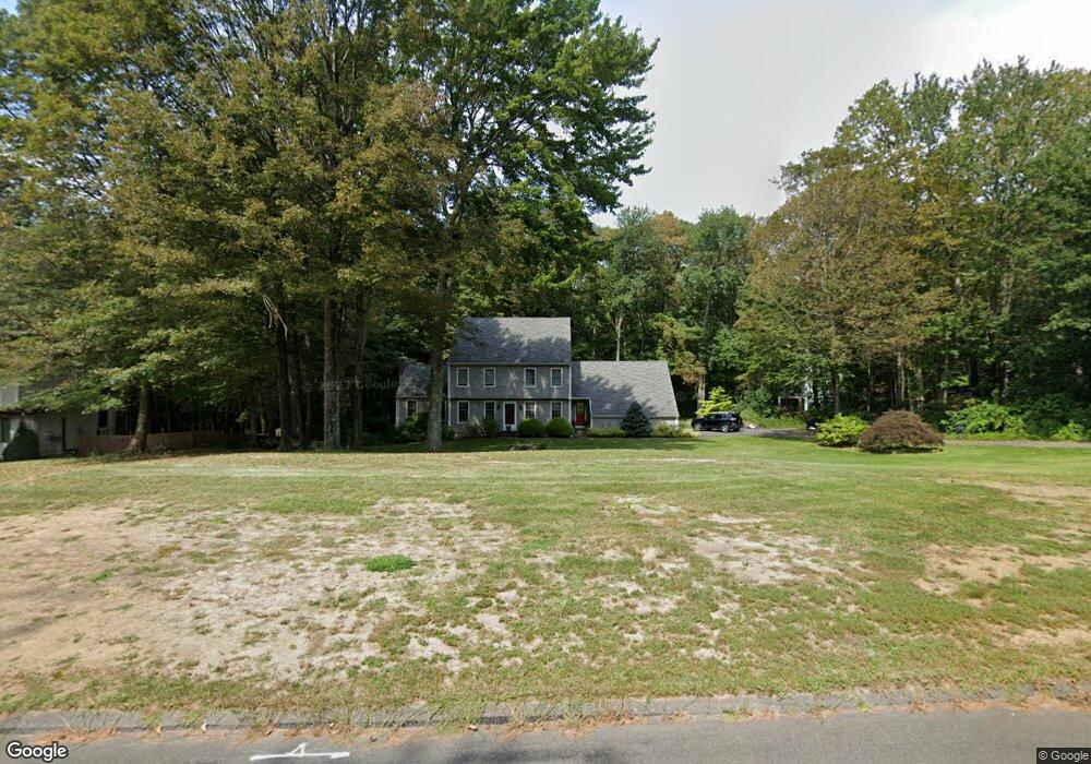
92 Satari Dr Coventry, CT 06238
Estimated Value: $484,000 - $525,000
3
Beds
3
Baths
2,068
Sq Ft
$244/Sq Ft
Est. Value
About This Home
This home is located at 92 Satari Dr, Coventry, CT 06238 and is currently estimated at $505,481, approximately $244 per square foot. 92 Satari Dr is a home located in Tolland County with nearby schools including Coventry Grammar School, George Hersey Robertson School, and Capt. Nathan Hale School.
Ownership History
Date
Name
Owned For
Owner Type
Purchase Details
Closed on
Jul 14, 1993
Sold by
Dime Sb Ny
Bought by
Mccarthy Michael and Mccarthy Rosemary
Current Estimated Value
Home Financials for this Owner
Home Financials are based on the most recent Mortgage that was taken out on this home.
Original Mortgage
$145,600
Interest Rate
7.4%
Mortgage Type
Unknown
Purchase Details
Closed on
Apr 18, 1990
Sold by
Mitchell Regina
Bought by
Harwood Melvin
Purchase Details
Closed on
Sep 7, 1988
Sold by
Marvonek Robert
Bought by
Harwood Melvin
Purchase Details
Closed on
Jul 31, 1987
Sold by
Satari Shah
Bought by
Marvoneh Rovert
Create a Home Valuation Report for This Property
The Home Valuation Report is an in-depth analysis detailing your home's value as well as a comparison with similar homes in the area
Home Values in the Area
Average Home Value in this Area
Purchase History
| Date | Buyer | Sale Price | Title Company |
|---|---|---|---|
| Mccarthy Michael | $182,000 | -- | |
| Mccarthy Michael | $182,000 | -- | |
| Harwood Melvin | $12,000 | -- | |
| Harwood Melvin | $284,900 | -- | |
| Marvoneh Rovert | $64,000 | -- |
Source: Public Records
Mortgage History
| Date | Status | Borrower | Loan Amount |
|---|---|---|---|
| Closed | Marvoneh Rovert | $30,000 | |
| Closed | Marvoneh Rovert | $142,000 | |
| Closed | Marvoneh Rovert | $145,600 |
Source: Public Records
Tax History
| Year | Tax Paid | Tax Assessment Tax Assessment Total Assessment is a certain percentage of the fair market value that is determined by local assessors to be the total taxable value of land and additions on the property. | Land | Improvement |
|---|---|---|---|---|
| 2025 | $7,610 | $320,300 | $68,400 | $251,900 |
| 2024 | $7,275 | $218,400 | $62,200 | $156,200 |
| 2023 | $6,932 | $218,400 | $62,200 | $156,200 |
| 2022 | $6,803 | $218,400 | $62,200 | $156,200 |
| 2021 | $6,803 | $218,400 | $62,200 | $156,200 |
| 2020 | $6,808 | $218,400 | $62,200 | $156,200 |
| 2019 | $7,036 | $218,500 | $62,200 | $156,300 |
| 2018 | $6,933 | $215,300 | $62,200 | $153,100 |
| 2017 | $6,890 | $215,300 | $62,200 | $153,100 |
| 2016 | $6,717 | $215,300 | $62,200 | $153,100 |
| 2015 | $6,717 | $215,300 | $62,200 | $153,100 |
| 2014 | $6,161 | $216,400 | $68,300 | $148,100 |
Source: Public Records
Map
Nearby Homes
- 151 Pine Hill Rd
- 93 Dockerel Rd
- 0 Mile Hill Rd
- 16 Higgins Way
- 7 Laurelwood Ln Unit Lot 15
- 12 Laurelwood Ln Unit lot 8
- 5 Laurelwood Ln Unit lot 16
- 279 Mark Dr
- 64 Columbine Rd
- 23 Neville St
- 395 Grant Hill Rd Unit Lot21
- 395 Grant Hill (Mill Race Drive) Lot #21 Rd
- 0 Boston Turnpike Unit 24128587
- 37 Wolf Hill Rd Unit Lot 40
- 37 Wolf Hill Lot (#40) Rd
- 25 Wolf Hill Rd
- 39 Josephine Way
- 38 Josephine Way
- 32 Josephine Way
- 26 Josephine Way
Your Personal Tour Guide
Ask me questions while you tour the home.