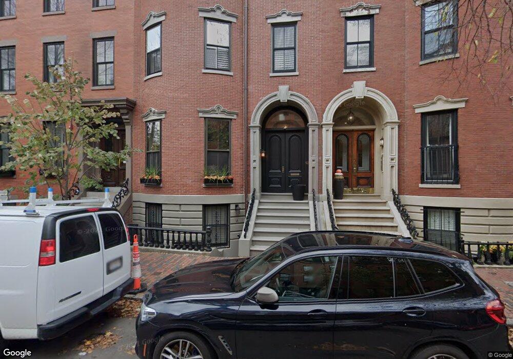
92 Waltham St Unit 1B Boston, MA 02118
South End NeighborhoodEstimated Value: $878,882 - $1,319,000
1
Bed
1
Bath
832
Sq Ft
$1,294/Sq Ft
Est. Value
About This Home
This home is located at 92 Waltham St Unit 1B, Boston, MA 02118 and is currently estimated at $1,076,221, approximately $1,293 per square foot. 92 Waltham St Unit 1B is a home located in Suffolk County with nearby schools including Kingsley Montessori School and Cathedral High School.
Ownership History
Date
Name
Owned For
Owner Type
Purchase Details
Closed on
Nov 27, 2019
Sold by
Baccari Kim M
Bought by
Kim M Baccari T 2019
Current Estimated Value
Purchase Details
Closed on
Jul 19, 2007
Sold by
Mcloughlin Peter J and Ahern Edward T
Bought by
Baccari Kim M
Home Financials for this Owner
Home Financials are based on the most recent Mortgage that was taken out on this home.
Original Mortgage
$378,000
Interest Rate
6.54%
Mortgage Type
Purchase Money Mortgage
Create a Home Valuation Report for This Property
The Home Valuation Report is an in-depth analysis detailing your home's value as well as a comparison with similar homes in the area
Home Values in the Area
Average Home Value in this Area
Purchase History
| Date | Buyer | Sale Price | Title Company |
|---|---|---|---|
| Kim M Baccari T 2019 | -- | None Available | |
| Baccari Kim M | $420,000 | -- | |
| Baccari Kim M | $420,000 | -- |
Source: Public Records
Mortgage History
| Date | Status | Borrower | Loan Amount |
|---|---|---|---|
| Previous Owner | Baccari Kim M | $378,000 |
Source: Public Records
Tax History Compared to Growth
Tax History
| Year | Tax Paid | Tax Assessment Tax Assessment Total Assessment is a certain percentage of the fair market value that is determined by local assessors to be the total taxable value of land and additions on the property. | Land | Improvement |
|---|---|---|---|---|
| 2025 | $9,093 | $785,200 | $0 | $785,200 |
| 2024 | $8,306 | $762,000 | $0 | $762,000 |
| 2023 | $8,021 | $746,800 | $0 | $746,800 |
| 2022 | $8,046 | $739,500 | $0 | $739,500 |
| 2021 | $7,736 | $725,000 | $0 | $725,000 |
| 2020 | $7,147 | $676,800 | $0 | $676,800 |
| 2019 | $6,925 | $657,000 | $0 | $657,000 |
| 2018 | $6,492 | $619,500 | $0 | $619,500 |
| 2017 | $6,248 | $590,000 | $0 | $590,000 |
| 2016 | $5,188 | $471,600 | $0 | $471,600 |
| 2015 | $5,469 | $451,600 | $0 | $451,600 |
| 2014 | $5,157 | $409,900 | $0 | $409,900 |
Source: Public Records
Map
Nearby Homes
- 33 Union Park Unit 4
- 32 Hanson St Unit 2
- 36 Milford St Unit 1
- 18 Milford St Unit 1
- 18 Milford St Unit 2
- 528 Tremont St Unit 4
- 2A Milford St Unit 12
- 9 Bond St
- 296 Shawmut Ave Unit PH
- 320 Shawmut Ave Unit 4
- 596 Tremont St Unit 2
- 34 Dwight St Unit 1
- 57 Warren Ave Unit 3
- 39 Warren Ave Unit G
- 16-24 Union Park St
- 251 Shawmut Ave Unit 2
- 20 Dwight St Unit 2
- 1395 Washington St Unit PH3
- 1395 Washington St Unit 306
- 1395 Washington St Unit 501
- 92 Waltham St Unit 2
- 92 Waltham St Unit 1A
- 92 Waltham St Unit 1A
- 90 Waltham St Unit 3
- 90 Waltham St Unit 1
- 90 Waltham St
- 90 Waltham St Unit 2
- 94 Waltham St Unit 6
- 94 Waltham St Unit 5
- 94 Waltham St Unit 2
- 94 Waltham St Unit 1
- 94 Waltham St Unit Five
- 94 Waltham St Unit 3 94
- 88 Waltham St Unit 7
- 88 Waltham St Unit 6
- 88 Waltham St Unit 5
- 88 Waltham St Unit 4
- 88 Waltham St Unit 3
- 88 Waltham St Unit 2
- 88 Waltham St Unit 1