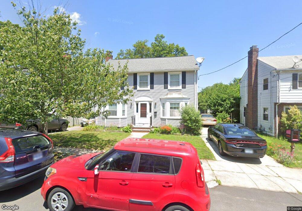
92 Wilcox Ave Pawtucket, RI 02860
Oak Hill NeighborhoodEstimated Value: $692,000 - $742,644
3
Beds
2
Baths
1,724
Sq Ft
$412/Sq Ft
Est. Value
About This Home
This home is located at 92 Wilcox Ave, Pawtucket, RI 02860 and is currently estimated at $709,661, approximately $411 per square foot. 92 Wilcox Ave is a home located in Providence County with nearby schools including International Charter School, Blackstone Academy Charter School, and Ocean Tides School.
Ownership History
Date
Name
Owned For
Owner Type
Purchase Details
Closed on
Sep 12, 2025
Sold by
Vance Nancy S
Bought by
Nancy S Vance Ret
Current Estimated Value
Purchase Details
Closed on
Apr 1, 1992
Sold by
Mer Benjamin
Bought by
Vance William
Home Financials for this Owner
Home Financials are based on the most recent Mortgage that was taken out on this home.
Original Mortgage
$100,000
Interest Rate
8.73%
Mortgage Type
Purchase Money Mortgage
Create a Home Valuation Report for This Property
The Home Valuation Report is an in-depth analysis detailing your home's value as well as a comparison with similar homes in the area
Home Values in the Area
Average Home Value in this Area
Purchase History
| Date | Buyer | Sale Price | Title Company |
|---|---|---|---|
| Nancy S Vance Ret | -- | -- | |
| Vance William | $135,000 | -- | |
| Vance William | $135,000 | -- |
Source: Public Records
Mortgage History
| Date | Status | Borrower | Loan Amount |
|---|---|---|---|
| Previous Owner | Vance William | $100,000 |
Source: Public Records
Tax History
| Year | Tax Paid | Tax Assessment Tax Assessment Total Assessment is a certain percentage of the fair market value that is determined by local assessors to be the total taxable value of land and additions on the property. | Land | Improvement |
|---|---|---|---|---|
| 2025 | $7,486 | $569,300 | $345,800 | $223,500 |
| 2024 | $7,025 | $569,300 | $345,800 | $223,500 |
| 2023 | $6,918 | $408,400 | $193,400 | $215,000 |
| 2022 | $6,771 | $408,400 | $193,400 | $215,000 |
| 2021 | $6,771 | $408,400 | $193,400 | $215,000 |
| 2020 | $7,646 | $366,000 | $208,900 | $157,100 |
| 2019 | $7,646 | $366,000 | $208,900 | $157,100 |
| 2018 | $7,368 | $366,000 | $208,900 | $157,100 |
| 2017 | $7,604 | $334,700 | $175,500 | $159,200 |
| 2016 | $7,327 | $334,700 | $175,500 | $159,200 |
| 2015 | $7,327 | $334,700 | $175,500 | $159,200 |
| 2014 | $6,904 | $299,400 | $146,300 | $153,100 |
Source: Public Records
Map
Nearby Homes
- 51 Wilcox Ave
- 5 Lowden St
- 122 Lowden St
- 18 Dunnell Ave
- 6 Alfred Stone Rd
- 349 Pleasant St
- 345 Pleasant St
- 68 Maryland Ave
- 136 Hillside Ave
- 126 Dunnell Ave
- 167 George St
- 11 Sherman St
- 159 Dunnell Ave
- 327 Rhode Island Ave
- 32 Carver St
- 80 Hillside Ave
- 60 Nassau St
- 44 Pawtucket Ave
- 71 Birchland Ave
- 750 Elmgrove Ave
- 86 Wilcox Ave
- 98 Wilcox Ave
- 145 Sheffield Ave
- 5 Raleigh Ave
- 149 Sheffield Ave
- 139 Sheffield Ave
- 93 Wilcox Ave
- 99 Wilcox Ave
- 129 Sheffield Ave
- 87 Wilcox Ave
- 76 Wilcox Ave
- 79 Wilcox Ave
- 105 Wilcox Ave
- 68 Wilcox Ave
- 73 Wilcox Ave
- 121 Sheffield Ave
- 110 Wilcox Ave
- 50 Blaisdell Ave
- 111 Wilcox Ave
- 69 Wilcox Ave
Your Personal Tour Guide
Ask me questions while you tour the home.