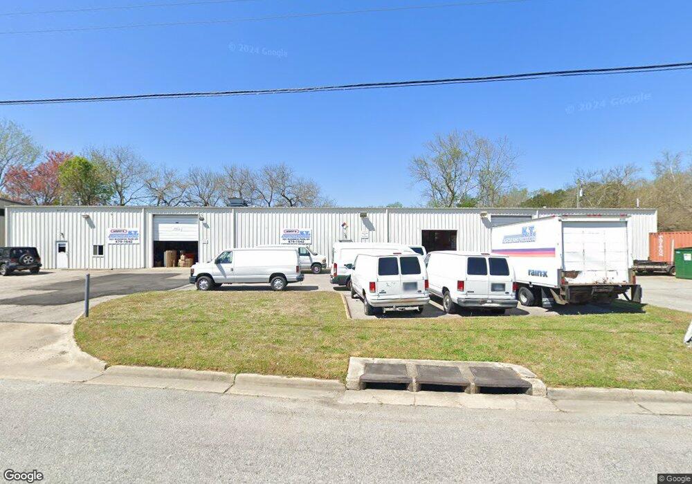
920 Business Park Dr Chesapeake, VA 23320
Indian River NeighborhoodEstimated Value: $1,112,246
--
Bed
--
Bath
8,750
Sq Ft
$127/Sq Ft
Est. Value
About This Home
This home is located at 920 Business Park Dr, Chesapeake, VA 23320 and is currently estimated at $1,112,246, approximately $127 per square foot. 920 Business Park Dr is a home located in Chesapeake City with nearby schools including Georgetown Primary School, Sparrow Road Intermediate School, and Indian River Middle.
Ownership History
Date
Name
Owned For
Owner Type
Purchase Details
Closed on
Jun 26, 2014
Sold by
Hi Dust Body Shop Inc
Bought by
Reel Issues Charters Llc
Current Estimated Value
Home Financials for this Owner
Home Financials are based on the most recent Mortgage that was taken out on this home.
Original Mortgage
$500,000
Outstanding Balance
$381,279
Interest Rate
4.19%
Mortgage Type
Commercial
Estimated Equity
$730,967
Create a Home Valuation Report for This Property
The Home Valuation Report is an in-depth analysis detailing your home's value as well as a comparison with similar homes in the area
Home Values in the Area
Average Home Value in this Area
Purchase History
| Date | Buyer | Sale Price | Title Company |
|---|---|---|---|
| Reel Issues Charters Llc | $625,000 | -- |
Source: Public Records
Mortgage History
| Date | Status | Borrower | Loan Amount |
|---|---|---|---|
| Open | Reel Issues Charters Llc | $500,000 |
Source: Public Records
Tax History Compared to Growth
Tax History
| Year | Tax Paid | Tax Assessment Tax Assessment Total Assessment is a certain percentage of the fair market value that is determined by local assessors to be the total taxable value of land and additions on the property. | Land | Improvement |
|---|---|---|---|---|
| 2025 | $7,795 | $734,800 | $244,800 | $490,000 |
| 2024 | $7,795 | $771,800 | $244,800 | $527,000 |
| 2023 | $8,048 | $798,600 | $244,800 | $553,800 |
| 2022 | $8,223 | $814,200 | $244,800 | $569,400 |
| 2021 | $7,679 | $731,300 | $244,800 | $486,500 |
| 2020 | $7,779 | $740,900 | $244,800 | $496,100 |
| 2019 | $7,716 | $734,900 | $244,800 | $490,100 |
| 2018 | $7,431 | $707,700 | $217,600 | $490,100 |
| 2017 | $7,431 | $707,700 | $217,600 | $490,100 |
| 2016 | $7,197 | $685,400 | $217,600 | $467,800 |
| 2015 | $7,097 | $675,900 | $217,600 | $458,300 |
| 2014 | $6,993 | $666,000 | $217,600 | $448,400 |
Source: Public Records
Map
Nearby Homes
- 1941 Miller Ave
- 1237 Jadens Way
- 748 Cardover Ave
- 2100 Lockard Ave
- 1938 Engle Ave
- 2023 Sparrow Rd
- 645 Milby Dr
- 6464 Duquesne Place
- 728 Bloom Ave
- 6415 Duquesne Place
- 1736 Lockard Ave
- 1980 Woodgate Arch
- 1357 Glyndon Dr
- 837 Providence Rd
- 1906 Devonwood Common
- 1718 Sparrow Rd
- 1332 Drexel Cir
- 1273 Clydesdale Ln
- 517 Dent Place
- 1213 Clydesdale Ln
- 916 Business Park Dr
- 929 Business Park Dr
- 921 Business Park Dr
- 913 Business Park Dr
- 2210 Paramont Ave
- 933 Business Park Dr
- 908 Business Park Dr
- 2223 Haverford Dr
- 2225 Haverford Dr
- 2221 Haverford Dr
- 2219 Haverford Dr
- 2227 Haverford Dr
- 2231 Haverford Dr
- 2233 Haverford Dr
- 2217 Haverford Dr
- 2237 Haverford Dr
- 2220 Haverford Dr
- 2226 Haverford Dr
- 2224 Haverford Dr
- 2215 Haverford Dr