Estimated Value: $231,000 - $248,000
3
Beds
3
Baths
1,730
Sq Ft
$140/Sq Ft
Est. Value
About This Home
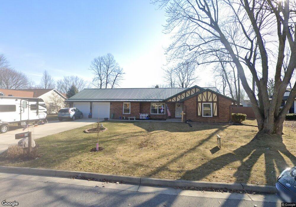
This home is located at 920 Christopher Cir, Ada, OH 45810 and is currently estimated at $241,491, approximately $139 per square foot. 920 Christopher Cir is a home located in Hardin County with nearby schools including Ada Elementary School and Ada High School.
Ownership History
Date
Name
Owned For
Owner Type
Purchase Details
Closed on
Mar 26, 2014
Sold by
Hess Yong Ae and Scott Yong Ae
Bought by
Hess Yong Ae and Hess Alan L
Current Estimated Value
Home Financials for this Owner
Home Financials are based on the most recent Mortgage that was taken out on this home.
Original Mortgage
$137,255
Outstanding Balance
$39,098
Interest Rate
3.25%
Mortgage Type
FHA
Estimated Equity
$202,393
Purchase Details
Closed on
Dec 16, 2008
Sold by
Smith Larry S and Smith Heidi K
Bought by
Scott Yong Ae
Purchase Details
Closed on
Jun 17, 2008
Sold by
Osbun Vicki M and Coldiron Vicki M
Bought by
Smith Larry S and Smith Heidi K
Purchase Details
Closed on
Jun 12, 1992
Create a Home Valuation Report for This Property
The Home Valuation Report is an in-depth analysis detailing your home's value as well as a comparison with similar homes in the area
Home Values in the Area
Average Home Value in this Area
Purchase History
| Date | Buyer | Sale Price | Title Company |
|---|---|---|---|
| Hess Yong Ae | -- | Stella Title Agency Inc | |
| Scott Yong Ae | -- | None Available | |
| Smith Larry S | $92,000 | None Available | |
| -- | -- | -- |
Source: Public Records
Mortgage History
| Date | Status | Borrower | Loan Amount |
|---|---|---|---|
| Open | Hess Yong Ae | $137,255 | |
| Closed | Scott Yong Ae | $0 |
Source: Public Records
Tax History
| Year | Tax Paid | Tax Assessment Tax Assessment Total Assessment is a certain percentage of the fair market value that is determined by local assessors to be the total taxable value of land and additions on the property. | Land | Improvement |
|---|---|---|---|---|
| 2024 | $2,765 | $62,270 | $7,540 | $54,730 |
| 2023 | $2,759 | $62,270 | $7,540 | $54,730 |
| 2022 | $2,647 | $51,410 | $7,180 | $44,230 |
| 2021 | $2,878 | $51,410 | $7,180 | $44,230 |
| 2020 | $2,922 | $51,410 | $7,180 | $44,230 |
| 2019 | $2,835 | $48,900 | $6,840 | $42,060 |
| 2018 | $2,769 | $48,390 | $6,840 | $41,550 |
| 2017 | $2,726 | $48,390 | $6,840 | $41,550 |
| 2016 | $2,526 | $46,230 | $3,860 | $42,370 |
| 2015 | $2,020 | $46,230 | $3,860 | $42,370 |
| 2014 | $2,496 | $46,230 | $3,860 | $42,370 |
| 2013 | $2,489 | $43,500 | $3,860 | $39,640 |
Source: Public Records
Map
Nearby Homes
- 820 S Main St
- 710 S Main St
- 722 S Johnson St
- 318 Willeke Ave
- 1689 County Road 50
- 314 E University Ave
- 308-310 S Simon St
- 210 N Gilbert St
- 211 S Main St
- 510 E Lehr Ave Unit 510R
- 2959 County Road 60
- 327 W North Ave
- 420 N Simon St
- 530 N Main St
- 442 Edwards St
- 629 N Main St
- 724 N Main St
- 503 E North Ave
- 746 N Main St Unit 61
- 746 N Main St Unit 63
- 923 Christopher Cir
- 925 Christopher Cir
- 924 Christopher Cir
- 912 Christopher Cir
- 1009 Southern View Dr
- 1009 Southernview St
- 927 Christopher Cir
- 928 Christopher Cir
- 1003 Southernview St Unit 1007
- 1011 Southernview St
- 908 Christopher Cir
- 911 Christopher Cir
- 915 Southernview St
- 931 Christopher Cir
- 1010 Southernview St
- 909 Southernview St
- 2003 Southernview St
Your Personal Tour Guide
Ask me questions while you tour the home.