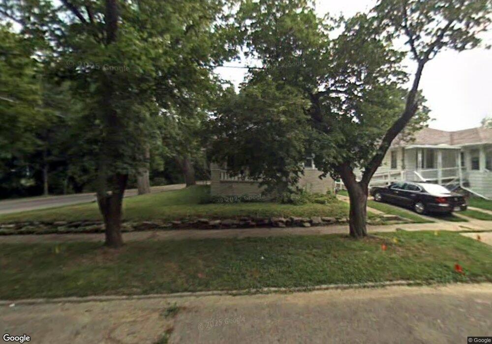
920 Kennelworth Ave Flint, MI 48503
Central Park-Fairfield Village NeighborhoodEstimated Value: $65,641 - $104,000
2
Beds
1
Bath
1,009
Sq Ft
$85/Sq Ft
Est. Value
About This Home
This home is located at 920 Kennelworth Ave, Flint, MI 48503 and is currently estimated at $85,910, approximately $85 per square foot. 920 Kennelworth Ave is a home located in Genesee County with nearby schools including Pierce Elementary School, Flint Southwestern Classical Academy, and Flint Cultural Center Academy.
Ownership History
Date
Name
Owned For
Owner Type
Purchase Details
Closed on
Nov 13, 2020
Sold by
Genesee County Land Bank Authority
Bought by
Lewis Rodderick D and Lewis Roderick D
Current Estimated Value
Purchase Details
Closed on
Dec 19, 2019
Sold by
Genesee County Treasurer
Bought by
Genesee County Land Bank Authority
Purchase Details
Closed on
Jan 22, 2001
Sold by
Bankers Tr Co Of Calif
Bought by
Vance Michael A
Purchase Details
Closed on
Jan 12, 2001
Sold by
Vance Michael A and Vance Nancy A
Bought by
Thomas Rosalind
Create a Home Valuation Report for This Property
The Home Valuation Report is an in-depth analysis detailing your home's value as well as a comparison with similar homes in the area
Home Values in the Area
Average Home Value in this Area
Purchase History
| Date | Buyer | Sale Price | Title Company |
|---|---|---|---|
| Lewis Rodderick D | $7,000 | None Available | |
| Genesee County Land Bank Authority | -- | None Available | |
| Vance Michael A | $9,242 | Guaranty Title | |
| Thomas Rosalind | $31,000 | Guaranty Title Company |
Source: Public Records
Tax History Compared to Growth
Tax History
| Year | Tax Paid | Tax Assessment Tax Assessment Total Assessment is a certain percentage of the fair market value that is determined by local assessors to be the total taxable value of land and additions on the property. | Land | Improvement |
|---|---|---|---|---|
| 2025 | $989 | $22,900 | $0 | $0 |
| 2024 | $920 | $16,500 | $0 | $0 |
| 2023 | $902 | $12,900 | $0 | $0 |
| 2022 | $0 | $11,100 | $0 | $0 |
| 2021 | $912 | $8,900 | $0 | $0 |
| 2020 | $268 | $0 | $0 | $0 |
| 2019 | $662 | $8,600 | $0 | $0 |
| 2018 | $647 | $8,700 | $0 | $0 |
| 2017 | $630 | $0 | $0 | $0 |
| 2016 | $627 | $0 | $0 | $0 |
| 2015 | -- | $0 | $0 | $0 |
| 2014 | -- | $0 | $0 | $0 |
| 2012 | -- | $12,700 | $0 | $0 |
Source: Public Records
Map
Nearby Homes
- 930 Belmont Ave
- 841 E 8th St
- 911 E 7th St
- 1510 S Franklin Ave
- 915 E Court #206 St Unit 206
- 915 E Court St Unit 104
- 915 E Court St
- 903 E Court St
- 2010 Crocker Ave
- 420 Pingree Ave
- 1110 Pingree Ave
- 1018 Lafayette St
- 2029 Aitken Ave
- 2050 Ferris Ave
- 1623 Montclair Ave
- 621 Pierson St
- 410 E 4th St
- 1601 Wayne St
- A Avenue
- 2013 E Court St
- 916 Kennelworth Ave
- 912 Kennelworth Ave
- 921 Kennelworth Ave
- 1610 Brookside Dr
- 904 Kennelworth Ave
- 913 Kennelworth Ave
- 908 Kennelworth Ave
- 909 Kennelworth Ave
- 1614 Woodlawn Park Dr
- 1611 Avon St
- 900 Kennelworth Ave
- 1710 Woodlawn Park Dr
- 905 Kennelworth Ave
- 1616 Brookside Dr
- 1626 Brookside Dr
- 901 Kennelworth Ave
- 1506 Brookside Dr
- 1513 Avon St
- 916 E Wellington Ave
- 912 E Wellington Ave