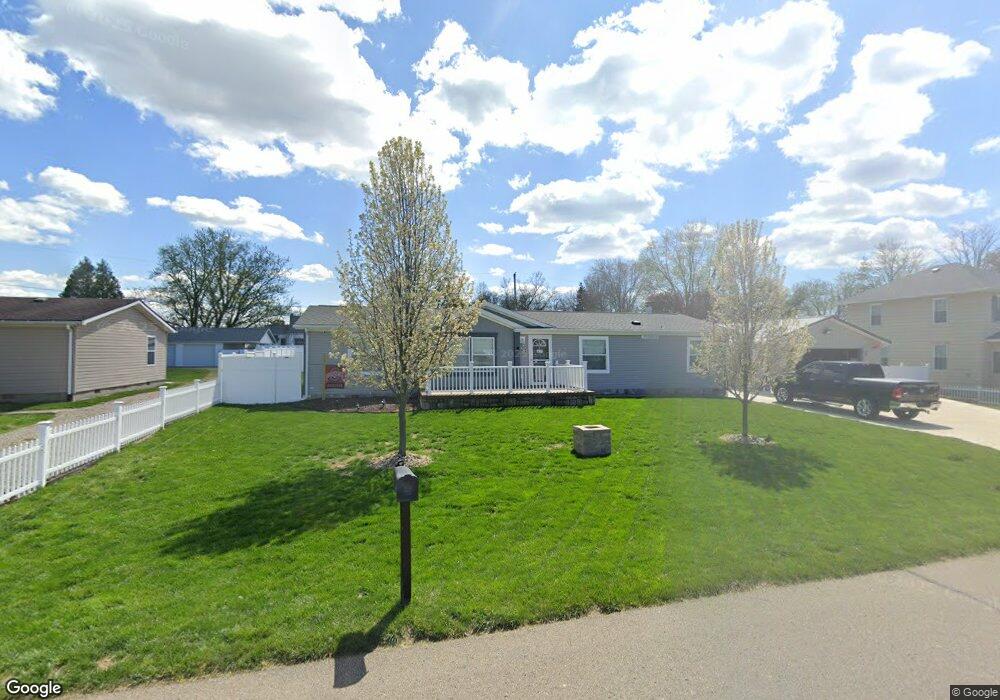
920 Leonard Ave Zanesville, OH 43701
Estimated Value: $28,000 - $158,000
1
Bed
1
Bath
632
Sq Ft
$140/Sq Ft
Est. Value
About This Home
This home is located at 920 Leonard Ave, Zanesville, OH 43701 and is currently estimated at $88,667, approximately $140 per square foot. 920 Leonard Ave is a home located in Muskingum County with nearby schools including John McIntire Elementary School, Zanesville Middle School, and Zanesville High School.
Ownership History
Date
Name
Owned For
Owner Type
Purchase Details
Closed on
Sep 30, 2025
Sold by
Boetcher Holli L and Hill Kelli
Bought by
Hill William J
Current Estimated Value
Home Financials for this Owner
Home Financials are based on the most recent Mortgage that was taken out on this home.
Original Mortgage
$100,000
Outstanding Balance
$100,000
Interest Rate
8%
Mortgage Type
New Conventional
Estimated Equity
-$11,333
Purchase Details
Closed on
Dec 28, 1994
Sold by
Owens Gregory L
Bought by
Brown Richard R and Brown Carole
Create a Home Valuation Report for This Property
The Home Valuation Report is an in-depth analysis detailing your home's value as well as a comparison with similar homes in the area
Home Values in the Area
Average Home Value in this Area
Purchase History
| Date | Buyer | Sale Price | Title Company |
|---|---|---|---|
| Hill William J | $150,000 | None Listed On Document | |
| Brown Richard R | $20,000 | -- |
Source: Public Records
Mortgage History
| Date | Status | Borrower | Loan Amount |
|---|---|---|---|
| Open | Hill William J | $100,000 |
Source: Public Records
Tax History Compared to Growth
Tax History
| Year | Tax Paid | Tax Assessment Tax Assessment Total Assessment is a certain percentage of the fair market value that is determined by local assessors to be the total taxable value of land and additions on the property. | Land | Improvement |
|---|---|---|---|---|
| 2024 | $349 | $2,380 | $2,380 | $0 |
| 2023 | $332 | $1,750 | $1,750 | $0 |
| 2022 | $334 | $1,750 | $1,750 | $0 |
| 2021 | $334 | $1,750 | $1,750 | $0 |
| 2020 | $329 | $1,575 | $1,575 | $0 |
| 2019 | $329 | $1,575 | $1,575 | $0 |
| 2018 | $336 | $1,575 | $1,575 | $0 |
| 2017 | $328 | $1,610 | $1,610 | $0 |
| 2016 | $328 | $1,610 | $1,610 | $0 |
| 2015 | $342 | $1,610 | $1,610 | $0 |
| 2013 | $349 | $1,610 | $1,610 | $0 |
Source: Public Records
Map
Nearby Homes
- 0 Leonard Ave Unit 4200634
- 835 Princeton Ave
- 801 Leonard Ave
- 830 Bethesda Dr Unit 4
- 765 Wabash Ave
- 753 Leonard Ave
- 2411 Bell St
- 1035 Somers St
- 0 W Ray Dr
- 36C W Ray Dr
- 36B Harding Rd
- 0 W Ray- 36c Dr
- 0 Harding- 36b Rd
- 0 E Ray- 36a Dr
- 2036 Marion Ave
- 36A E Ray Dr
- 530 N Ray Dr
- 464 Coventry Cir
- 427 Harding Rd
- 435 Westview Dr
- 900 Leonard Ave
- 925 Leonard Ave
- 927 Leonard Ave
- 901 Leonard Ave
- 931 Leonard Ave
- 950 Leonard Ave
- 915 Wabash Ave
- 905 Wabash Ave
- 954 Leonard Ave
- 929 Wabash Ave
- 939 Wabash Ave
- 945 Leonard Ave
- 877 Leonard Ave
- 878 Leonard Ave
- 2616 Rich St
- 2608 Rich St
- 941 Wabash Ave
- 877 Leonard Ave
- 958 Leonard Ave
- 957 Leonard Ave