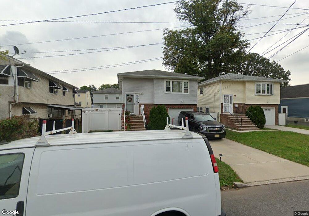
920 Union St Linden, NJ 07036
Estimated Value: $505,761 - $637,000
Studio
--
Bath
1,750
Sq Ft
$325/Sq Ft
Est. Value
About This Home
This home is located at 920 Union St, Linden, NJ 07036 and is currently estimated at $569,440, approximately $325 per square foot. 920 Union St is a home located in Union County with nearby schools including School No. 5, Joseph E. Soehl Middle School, and Linden High School.
Ownership History
Date
Name
Owned For
Owner Type
Purchase Details
Closed on
Aug 26, 2022
Sold by
Garrett Simmons
Bought by
Simmons Garrett and Simmons Alana
Current Estimated Value
Purchase Details
Closed on
Mar 30, 2009
Sold by
Early Clarence and Early Beulah
Bought by
Simmons Garrett
Home Financials for this Owner
Home Financials are based on the most recent Mortgage that was taken out on this home.
Original Mortgage
$203,500
Interest Rate
4.93%
Mortgage Type
FHA
Create a Home Valuation Report for This Property
The Home Valuation Report is an in-depth analysis detailing your home's value as well as a comparison with similar homes in the area
Home Values in the Area
Average Home Value in this Area
Purchase History
| Date | Buyer | Sale Price | Title Company |
|---|---|---|---|
| Simmons Garrett | -- | Stewart Title Guaranty Company | |
| Simmons Garrett | -- | Stewart Title Guaranty Company | |
| Simmons Garrett | $240,000 | Multiple |
Source: Public Records
Mortgage History
| Date | Status | Borrower | Loan Amount |
|---|---|---|---|
| Previous Owner | Simmons Garrett | $203,500 |
Source: Public Records
Tax History
| Year | Tax Paid | Tax Assessment Tax Assessment Total Assessment is a certain percentage of the fair market value that is determined by local assessors to be the total taxable value of land and additions on the property. | Land | Improvement |
|---|---|---|---|---|
| 2025 | $8,059 | $114,600 | $44,000 | $70,600 |
| 2024 | $7,882 | $114,600 | $44,000 | $70,600 |
| 2023 | $7,882 | $114,600 | $44,000 | $70,600 |
| 2022 | $7,923 | $114,600 | $44,000 | $70,600 |
| 2021 | $7,964 | $114,600 | $44,000 | $70,600 |
| 2020 | $7,921 | $114,600 | $44,000 | $70,600 |
| 2019 | $7,895 | $114,600 | $44,000 | $70,600 |
| 2018 | $7,893 | $114,600 | $44,000 | $70,600 |
| 2017 | $7,722 | $114,600 | $44,000 | $70,600 |
| 2016 | $7,479 | $114,600 | $44,000 | $70,600 |
| 2015 | $7,193 | $114,600 | $44,000 | $70,600 |
| 2014 | $7,054 | $114,600 | $44,000 | $70,600 |
Source: Public Records
Map
Nearby Homes
- 830 E Curtis St
- 811 Jackson Ave
- 807 Carnegie St
- 1202 Warren St
- 721 E Curtis St
- 291 E 12th Ave
- 3 Fern St
- 1129 Spruce St
- 918 Bower St
- 914 Bower St
- 215 Victory St
- 1022 Frank St
- 506 Bower St
- 142 Bonna Villa Ave
- 1310 E Henry St
- 609 Harrison Place
- 1025 Rivington St
- 505 Saint Marks St Unit 2
- 832 Bergen Ave
- 925 Essex Ave
- 914 Union St
- 1119 W Baltimore Ave
- 910 Union St
- 919 E Curtis St
- 923 E Curtis St
- 925 E Curtis St
- 915 E Curtis St
- 1230 Union St
- 931 E Curtis St
- 915 Union St
- 1201 W Baltimore Ave Unit 1
- 1201 W Baltimore Ave Unit 1R
- 1201 W Baltimore Ave Unit 2F
- 913 Union St Unit 1
- 913 Union St
- 1198 Lincoln St
- 1200 Lincoln St
- 1204 Lincoln St
- 1208 Lincoln St
- 1208 Lincoln St Unit 2
Your Personal Tour Guide
Ask me questions while you tour the home.