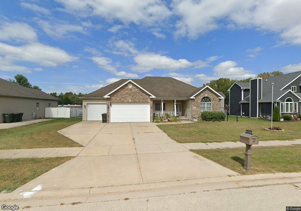
920 W First St Braidwood, IL 60408
Estimated Value: $300,000 - $329,000
3
Beds
2
Baths
1,771
Sq Ft
$178/Sq Ft
Est. Value
About This Home
This home is located at 920 W First St, Braidwood, IL 60408 and is currently estimated at $315,082, approximately $177 per square foot. 920 W First St is a home located in Will County with nearby schools including Reed-Custer Intermediate School, Reed-Custer Middle School, and Reed-Custer High School.
Ownership History
Date
Name
Owned For
Owner Type
Purchase Details
Closed on
Jul 13, 2007
Sold by
Standard Bank & Trust Co
Bought by
Woodrum Kenneth W and Woodrum Susan L
Current Estimated Value
Home Financials for this Owner
Home Financials are based on the most recent Mortgage that was taken out on this home.
Original Mortgage
$144,000
Interest Rate
6.71%
Mortgage Type
Purchase Money Mortgage
Create a Home Valuation Report for This Property
The Home Valuation Report is an in-depth analysis detailing your home's value as well as a comparison with similar homes in the area
Home Values in the Area
Average Home Value in this Area
Purchase History
| Date | Buyer | Sale Price | Title Company |
|---|---|---|---|
| Woodrum Kenneth W | $215,000 | First American Title |
Source: Public Records
Mortgage History
| Date | Status | Borrower | Loan Amount |
|---|---|---|---|
| Previous Owner | Woodrum Kenneth W | $144,000 |
Source: Public Records
Tax History Compared to Growth
Tax History
| Year | Tax Paid | Tax Assessment Tax Assessment Total Assessment is a certain percentage of the fair market value that is determined by local assessors to be the total taxable value of land and additions on the property. | Land | Improvement |
|---|---|---|---|---|
| 2024 | $4,798 | $87,774 | $15,210 | $72,564 |
| 2023 | $4,798 | $78,615 | $13,623 | $64,992 |
| 2022 | $4,155 | $71,338 | $12,362 | $58,976 |
| 2021 | $4,002 | $68,090 | $11,799 | $56,291 |
| 2020 | $3,770 | $64,510 | $11,179 | $53,331 |
| 2019 | $3,530 | $60,916 | $10,556 | $50,360 |
| 2018 | $3,373 | $58,292 | $10,101 | $48,191 |
| 2017 | $3,301 | $57,149 | $9,903 | $47,246 |
| 2016 | $3,559 | $55,269 | $9,577 | $45,692 |
| 2015 | $3,450 | $53,842 | $9,330 | $44,512 |
| 2014 | $3,450 | $53,842 | $9,330 | $44,512 |
| 2013 | $3,450 | $57,585 | $9,979 | $47,606 |
Source: Public Records
Map
Nearby Homes
- 116 S English St
- 1055 W Main St
- 1065 W Main St
- 1034 Madison Ave
- 1018 Madison Ave
- 999 W Cermak Rd
- 1021 W Cermak Rd
- 910 W Kennedy Rd
- 998 W Kennedy Rd
- 642 W Bergera Rd
- 303 N Division St
- 837 Blackhawk Dr
- 443 W Main St
- 495 N Division St
- 340 N Walker St
- 886 Western Ave
- 584 N Division St
- 0000 N Division St
- 0 S Will Rd
- 605 N Division St
- 944 W 1st St
- 944 W First St
- 906 W First St
- 906 W 1st St
- 218 N English St
- 198 N English St
- 215 N Cook St
- 252 N English St
- 194 N English St
- 245 N Cook St
- 274 N English St
- 175 N Cook St
- 286 N English St
- 156 N English St
- 265 N Cook St
- 206 N Cook St
- 0000 N Cook St
- 236 N Cook St
- 285 N Cook St
- 163 N Cook St