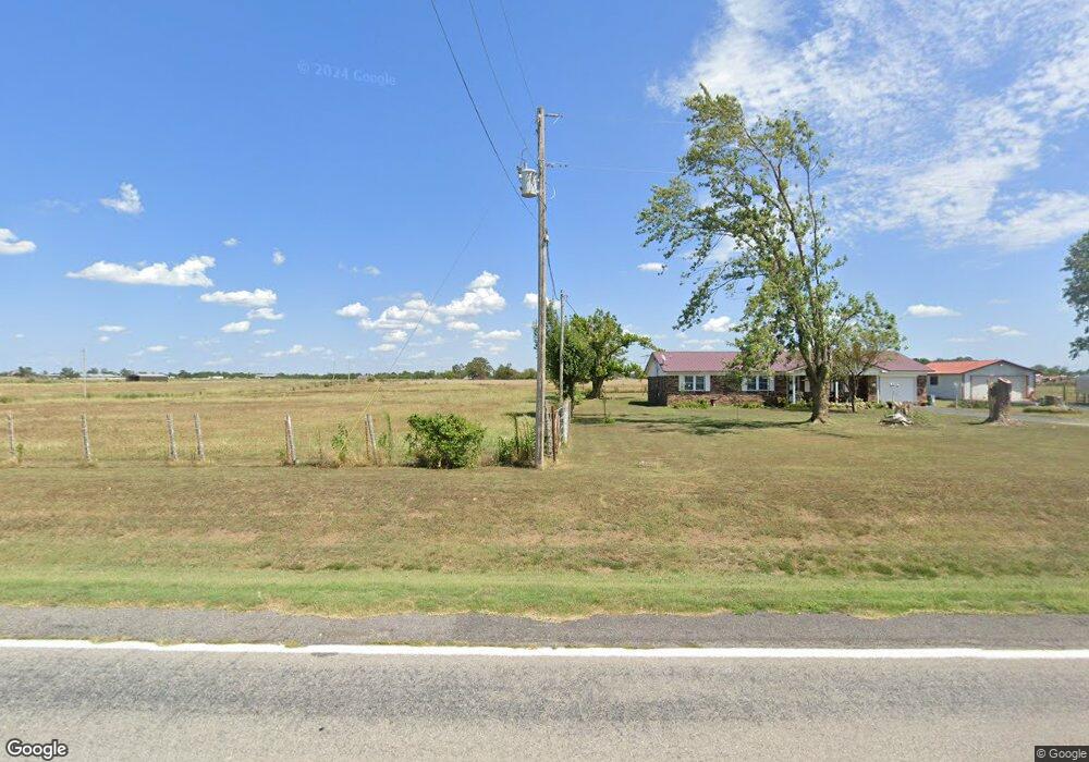
9200 S Highway 43 Gentry, AR 72734
Estimated Value: $412,000 - $1,006,147
--
Bed
--
Bath
2,530
Sq Ft
$250/Sq Ft
Est. Value
About This Home
This home is located at 9200 S Highway 43, Gentry, AR 72734 and is currently estimated at $631,287, approximately $249 per square foot. 9200 S Highway 43 is a home located in Benton County with nearby schools including Gentry Intermediate School, Gentry Primary School, and Gentry Middle School.
Ownership History
Date
Name
Owned For
Owner Type
Purchase Details
Closed on
Sep 15, 2023
Sold by
Victory Church Nwa Inc
Bought by
Victory Church Nwa Inc
Current Estimated Value
Purchase Details
Closed on
Dec 27, 1991
Bought by
Johnston Tr
Purchase Details
Closed on
Dec 2, 1986
Bought by
Johnston
Purchase Details
Closed on
Dec 1, 1982
Bought by
Skull Creek Dev Co-Ball Fam Tr
Create a Home Valuation Report for This Property
The Home Valuation Report is an in-depth analysis detailing your home's value as well as a comparison with similar homes in the area
Home Values in the Area
Average Home Value in this Area
Purchase History
| Date | Buyer | Sale Price | Title Company |
|---|---|---|---|
| Victory Church Nwa Inc | -- | None Listed On Document | |
| Johnston Tr | -- | -- | |
| Johnston | -- | -- | |
| Skull Creek Dev Co-Ball Fam Tr | $78,000 | -- | |
| Skull Creek Dev Co | -- | -- | |
| John Mcguire Tr-John Mcguire | -- | -- |
Source: Public Records
Tax History Compared to Growth
Tax History
| Year | Tax Paid | Tax Assessment Tax Assessment Total Assessment is a certain percentage of the fair market value that is determined by local assessors to be the total taxable value of land and additions on the property. | Land | Improvement |
|---|---|---|---|---|
| 2025 | $4,459 | $107,736 | $14,353 | $93,383 |
| 2024 | $3,991 | $115,724 | $14,353 | $101,371 |
| 2023 | $3,688 | $90,822 | $6,232 | $84,590 |
| 2022 | $3,174 | $71,200 | $6,230 | $64,970 |
| 2021 | $2,903 | $71,200 | $6,230 | $64,970 |
| 2020 | $2,642 | $49,630 | $5,020 | $44,610 |
| 2019 | $2,642 | $49,630 | $5,020 | $44,610 |
| 2018 | $538 | $10,010 | $3,310 | $6,700 |
| 2017 | $538 | $10,010 | $3,310 | $6,700 |
| 2016 | $538 | $10,010 | $3,310 | $6,700 |
| 2015 | $565 | $11,300 | $4,600 | $6,700 |
| 2014 | $3,787 | $76,890 | $4,600 | $72,290 |
Source: Public Records
Map
Nearby Homes
- 23632 Coon Hollow Rd
- 24530 & 24540 Coon's Hollow Rd
- 24530 & 24540 Coon Hollow Rd
- 23775 Carlton Dr
- 9065 Pine Grove Rd
- 24530 Coon's Hollow Rd
- 0 Ruby Hall Rd Unit 25-289
- 0 Ruby Hall Rd Unit 1296833
- 0 W Mountain Rd Unit 1318276
- 0 Carlton Dr Unit 1312560
- TBD Ruby Hall Rd
- 23963 Floyd Moore Rd
- Tract 1 E 495 Rd
- TBD N Bloomfield Rd
- 22842 Carlton Dr
- 22006 Bozarth Cemetery Rd
- 0 Bozarth Cemetery Rd
- 22443 Floyd Moore Rd
- 22338 Floyd Moore Rd
- 23540 Arkansas 12
- 9206 S Highway 43
- 8882 S Highway 43
- 8882 S Highway 43
- 9064 S Highway 43
- 9064 S Highway 43
- 9068 S Highway 43
- 9068 S Highway 43
- 9132 S Highway 43
- 23933 Falling Springs Rd
- 23901 Falling Springs Rd
- 23901 Falling Springs Rd
- 24532 Welch Rd
- 24532 Welch Rd
- 9208 S Highway 43
- 9260 S Highway 43
- 23575 Falling Springs Rd
- 8690 Hwy 43 East Side
- 9309 S Highway 43
- 9604 Ruby Hall Rd
- 8615 S Highway 43