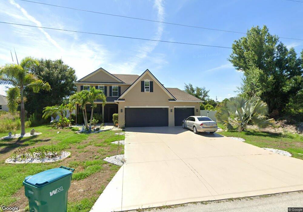
9201 Arberg Cir Port Charlotte, FL 33981
Gulf Cove NeighborhoodEstimated Value: $341,851 - $518,000
4
Beds
3
Baths
1,090
Sq Ft
$397/Sq Ft
Est. Value
About This Home
This home is located at 9201 Arberg Cir, Port Charlotte, FL 33981 and is currently estimated at $432,463, approximately $396 per square foot. 9201 Arberg Cir is a home located in Charlotte County with nearby schools including Myakka River Elementary School, L.A. Ainger Middle School, and Lemon Bay High School.
Ownership History
Date
Name
Owned For
Owner Type
Purchase Details
Closed on
Aug 27, 2025
Sold by
Carmelo Giunta Trust and Vazquez Robin
Bought by
Giunta Louis J
Current Estimated Value
Purchase Details
Closed on
Apr 24, 2015
Sold by
Maronda Homes Inc Of Florida
Bought by
Giunta Carmelo
Purchase Details
Closed on
May 6, 2005
Sold by
Dubois Eddy J
Bought by
Maronda Homes Inc Of Florida
Purchase Details
Closed on
Nov 29, 1993
Sold by
Nationsbank Fl N A
Bought by
Dubois Eddy J
Create a Home Valuation Report for This Property
The Home Valuation Report is an in-depth analysis detailing your home's value as well as a comparison with similar homes in the area
Home Values in the Area
Average Home Value in this Area
Purchase History
| Date | Buyer | Sale Price | Title Company |
|---|---|---|---|
| Giunta Louis J | $100 | None Listed On Document | |
| Giunta Carmelo | $199,900 | Steel City Title Inc | |
| Maronda Homes Inc Of Florida | $46,500 | Paramount Title Corporation | |
| Dubois Eddy J | $9,300 | -- |
Source: Public Records
Tax History Compared to Growth
Tax History
| Year | Tax Paid | Tax Assessment Tax Assessment Total Assessment is a certain percentage of the fair market value that is determined by local assessors to be the total taxable value of land and additions on the property. | Land | Improvement |
|---|---|---|---|---|
| 2024 | $4,698 | $338,848 | $20,400 | $318,448 |
| 2023 | $4,698 | $310,979 | $22,950 | $288,029 |
| 2022 | $4,478 | $261,603 | $20,400 | $241,203 |
| 2021 | $4,071 | $203,778 | $7,650 | $196,128 |
| 2020 | $4,080 | $206,260 | $7,990 | $198,270 |
| 2019 | $3,765 | $186,320 | $9,350 | $176,970 |
| 2018 | $3,608 | $186,564 | $9,350 | $177,214 |
| 2017 | $3,430 | $173,233 | $8,925 | $164,308 |
| 2016 | $2,577 | $159,329 | $0 | $0 |
| 2015 | $3,318 | $162,070 | $0 | $0 |
| 2014 | $284 | $2,104 | $0 | $0 |
Source: Public Records
Map
Nearby Homes
- 9186 Arberg St
- 9177 Arberg St
- 9178 Arberg St
- 9171 Waldrep St
- 13283 Keystone Blvd
- 9239 Harvester St
- 9193 Arberg St
- 13244 Jura Ln
- 9235 Waldrep St
- 9155 Agate St
- 9228 Agate St
- 9203 Agate St
- 13332 Keystone Blvd
- 9267 Waldrep St
- 9219 Canna St
- 13151 Keystone Blvd
- 9243 Waldrep St
- 9314 Harvester St
- 13313 Clarence Ln
- 13305 Blake Dr
- 9201 Arberg St
- 9209 Arberg St
- 9204 Waldrep St
- 9218 Arberg St
- 9225 Arberg St
- 9226 Arberg St
- 9195 Waldrep St
- 9233 Arberg St
- 13267 Keystone Blvd
- 9199 Harvester St
- 13251 Keystone Blvd
- 9220 Waldrep St
- 9234 Arberg St
- 9219 Waldrep St
- 9228 Waldrep St
- 13234 Jura Ln
- 9172 Agate St
- 9180 Agate St
- 9182 Agate St
- 9227 Waldrep St