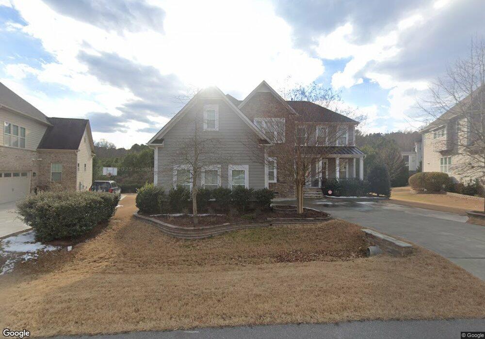
9204 Cobalt Ridge Way Cary, NC 27519
Green Level NeighborhoodEstimated Value: $1,129,078 - $1,252,000
5
Beds
5
Baths
4,173
Sq Ft
$285/Sq Ft
Est. Value
About This Home
This home is located at 9204 Cobalt Ridge Way, Cary, NC 27519 and is currently estimated at $1,187,270, approximately $284 per square foot. 9204 Cobalt Ridge Way is a home located in Wake County with nearby schools including Mills Park Elementary School, Mills Park Middle School, and Green Level High School.
Ownership History
Date
Name
Owned For
Owner Type
Purchase Details
Closed on
Jun 26, 2015
Sold by
M I Homes Of Raleigh Llc
Bought by
Ramaswamy Sridhar and Bayankaram Revathi
Current Estimated Value
Home Financials for this Owner
Home Financials are based on the most recent Mortgage that was taken out on this home.
Original Mortgage
$67,100
Outstanding Balance
$52,430
Interest Rate
3.92%
Mortgage Type
Credit Line Revolving
Estimated Equity
$1,134,840
Create a Home Valuation Report for This Property
The Home Valuation Report is an in-depth analysis detailing your home's value as well as a comparison with similar homes in the area
Home Values in the Area
Average Home Value in this Area
Purchase History
| Date | Buyer | Sale Price | Title Company |
|---|---|---|---|
| Ramaswamy Sridhar | $611,500 | Attorney |
Source: Public Records
Mortgage History
| Date | Status | Borrower | Loan Amount |
|---|---|---|---|
| Open | Ramaswamy Sridhar | $67,100 | |
| Open | Ramaswamy Sridhar | $417,000 |
Source: Public Records
Tax History Compared to Growth
Tax History
| Year | Tax Paid | Tax Assessment Tax Assessment Total Assessment is a certain percentage of the fair market value that is determined by local assessors to be the total taxable value of land and additions on the property. | Land | Improvement |
|---|---|---|---|---|
| 2025 | $8,615 | $1,002,749 | $270,000 | $732,749 |
| 2024 | $8,428 | $1,002,749 | $270,000 | $732,749 |
| 2023 | $5,948 | $591,655 | $140,000 | $451,655 |
| 2022 | $5,727 | $591,655 | $140,000 | $451,655 |
| 2021 | $5,611 | $591,655 | $140,000 | $451,655 |
| 2020 | $5,641 | $591,655 | $140,000 | $451,655 |
| 2019 | $6,252 | $582,035 | $140,000 | $442,035 |
| 2018 | $5,866 | $582,035 | $140,000 | $442,035 |
| 2017 | $5,637 | $582,035 | $140,000 | $442,035 |
| 2016 | $5,552 | $582,035 | $140,000 | $442,035 |
| 2015 | $1,181 | $120,000 | $120,000 | $0 |
Source: Public Records
Map
Nearby Homes
- 1012 Holland Bend Dr
- 2013 Austin Pond Dr
- 449 Christian Creek Place
- 105 Jessfield Place
- 301 Crayton Oak Dr
- 6017 Mentmore Place
- 1139 Grogans Mill Dr
- 413 Westfalen Dr
- 4109 Piney Gap Dr
- 2005 Mill Gate Ln
- 1001 Overdrift Ln
- 403 Windboard St
- Ashdale Plan at Millstone
- Kendrick Plan at Millstone
- Stoneridge Plan at Millstone
- Dunmore Plan at Millstone
- Halstead Plan at Millstone
- 1005 Overdrift Ln
- 317 Castle Rock Ln
- 1021 Ferson Rd
- 9208 Cobalt Ridge Way
- 9200 Cobalt Ridge Way
- 9205 Cobalt Ridge Way
- 9153 Cobalt Ridge Way
- 1532 Furlong Loop
- 9152 Cobalt Ridge Way
- 9148 Cobalt Ridge Way
- 9149 Cobalt Ridge Way
- 1528 Furlong Loop
- 1525 Furlong Loop
- 9136 Cobalt Ridge Way
- 9145 Cobalt Ridge Way
- 1517 Furlong Loop
- 1524 Furlong Loop
- 9132 Cobalt Ridge Way
- 9141 Cobalt Ridge Way
- 1513 Furlong Loop
- 1520 Furlong Loop
- 9228 Cobalt Ridge Way
- 9128 Cobalt Ridge Way