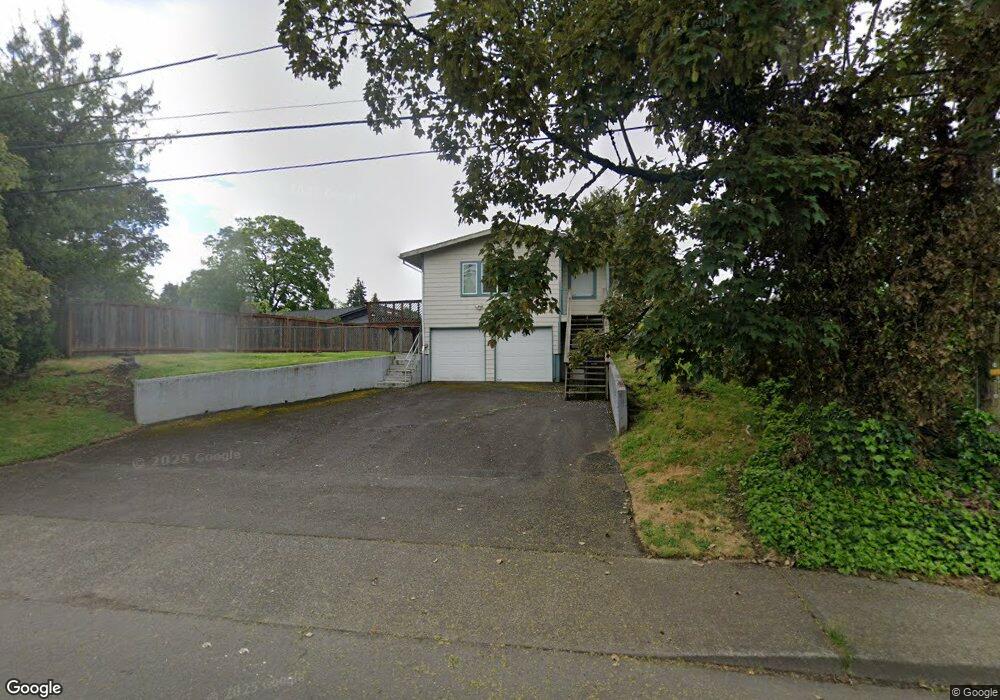
9206 E Burnside St Portland, OR 97216
Montavilla NeighborhoodEstimated Value: $407,000 - $484,000
3
Beds
3
Baths
1,670
Sq Ft
$273/Sq Ft
Est. Value
About This Home
This home is located at 9206 E Burnside St, Portland, OR 97216 and is currently estimated at $455,259, approximately $272 per square foot. 9206 E Burnside St is a home located in Multnomah County with nearby schools including Vestal Elementary School, Leodis V. McDaniel High School, and Columbia Christian School.
Ownership History
Date
Name
Owned For
Owner Type
Purchase Details
Closed on
Jun 23, 2009
Sold by
Naylor Jack
Bought by
Williams Juli A and Williams Alicia R
Current Estimated Value
Home Financials for this Owner
Home Financials are based on the most recent Mortgage that was taken out on this home.
Original Mortgage
$195,395
Outstanding Balance
$123,852
Interest Rate
4.83%
Mortgage Type
FHA
Estimated Equity
$331,407
Purchase Details
Closed on
Sep 13, 2001
Sold by
Naylor Jack
Bought by
Naylor Jack and Ruth Naylor I
Create a Home Valuation Report for This Property
The Home Valuation Report is an in-depth analysis detailing your home's value as well as a comparison with similar homes in the area
Home Values in the Area
Average Home Value in this Area
Purchase History
| Date | Buyer | Sale Price | Title Company |
|---|---|---|---|
| Williams Juli A | $199,000 | Chicago Title Insurance Co | |
| Naylor Jack | -- | -- |
Source: Public Records
Mortgage History
| Date | Status | Borrower | Loan Amount |
|---|---|---|---|
| Open | Williams Juli A | $195,395 |
Source: Public Records
Tax History Compared to Growth
Tax History
| Year | Tax Paid | Tax Assessment Tax Assessment Total Assessment is a certain percentage of the fair market value that is determined by local assessors to be the total taxable value of land and additions on the property. | Land | Improvement |
|---|---|---|---|---|
| 2024 | $4,849 | $181,220 | -- | -- |
| 2023 | $4,662 | $175,950 | $0 | $0 |
| 2022 | $4,562 | $170,830 | $0 | $0 |
| 2021 | $4,484 | $165,860 | $0 | $0 |
| 2020 | $4,114 | $161,030 | $0 | $0 |
| 2019 | $3,963 | $156,340 | $0 | $0 |
| 2018 | $3,846 | $151,790 | $0 | $0 |
| 2017 | $3,686 | $147,370 | $0 | $0 |
| 2016 | $3,373 | $143,080 | $0 | $0 |
| 2015 | $3,285 | $138,920 | $0 | $0 |
| 2014 | $3,236 | $134,880 | $0 | $0 |
Source: Public Records
Map
Nearby Homes
- 9023 SE Ankeny St Unit 9025
- 9016-9022 SE Ankeny St
- 9145 SE Oak St
- 104 SE 88th Ave
- 47 NE 87th Ave
- 15 SE 86th Ave
- 9145 NE Glisan St Unit 9149
- 9311 SE Alder St
- 205 NE Billingher Dr
- 8605 SE Washington St
- 758 NE 91st Ave Unit 1
- 8504 NE Glisan St
- 9715 NE Glisan St
- 237 SE 83rd Ave
- 313 SE 83rd Ave
- 817 NE 94th Ave
- 9737 NE Irving St
- 827 NE 90th Ave Unit 827
- 900 NE 91st Ave
- 835 NE 93rd Ave
- 25 SE 93rd Ave
- 9160 E Burnside St
- 9211 SE Ankeny St
- 9150 E Burnside St
- 19 SE 93rd Ave
- 9161 SE Ankeny St
- 9225 SE Ankeny St
- 9138 E Burnside St
- 9138 E Burnside St
- 9149 SE Ankeny St
- 9153 SE Ankeny St
- 9143 SE Ankeny St
- 9132 E Burnside St
- 24 SE 93rd Ave
- 0 Hartzog - 9205 E Burnside Bristol - 105 Ne 92nd Place Unit 2591403-6312596
- 0 Hartzog - 9205 E Burnside Bristol - 105 Ne 92nd Place Unit 2591403-3931548
- 9205 E Burnside St
- 22 NE 92nd Place
- 30 SE 93rd Ave
- 9133 SE Ankeny St