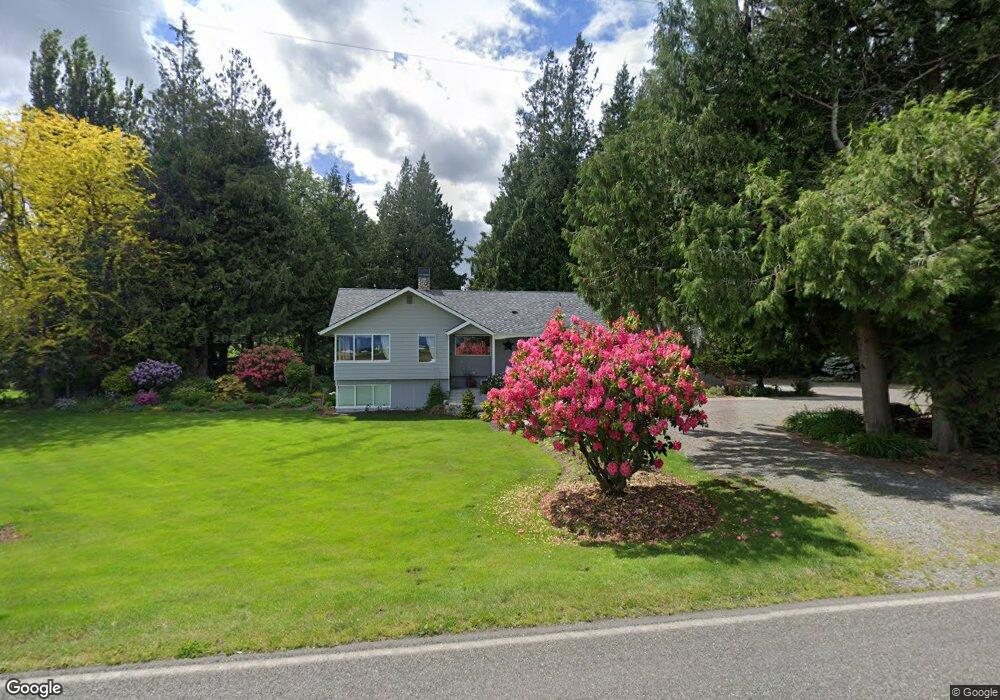
9207 Benson Rd Lynden, WA 98264
Estimated Value: $589,000 - $813,840
3
Beds
2
Baths
1,580
Sq Ft
$474/Sq Ft
Est. Value
About This Home
This home is located at 9207 Benson Rd, Lynden, WA 98264 and is currently estimated at $749,460, approximately $474 per square foot. 9207 Benson Rd is a home located in Whatcom County with nearby schools including Lynden High School, Lynden Christian School, and Ebenezer Christian School.
Ownership History
Date
Name
Owned For
Owner Type
Purchase Details
Closed on
Jun 21, 2023
Sold by
Honcoop Leonard M
Bought by
Honcoop Beverly J
Current Estimated Value
Purchase Details
Closed on
Apr 8, 1999
Sold by
Heeringa Stanley and Gross Dorothy
Bought by
Honcoop Leonard M and Honcoop Beverly J
Home Financials for this Owner
Home Financials are based on the most recent Mortgage that was taken out on this home.
Original Mortgage
$166,500
Interest Rate
6.91%
Create a Home Valuation Report for This Property
The Home Valuation Report is an in-depth analysis detailing your home's value as well as a comparison with similar homes in the area
Home Values in the Area
Average Home Value in this Area
Purchase History
| Date | Buyer | Sale Price | Title Company |
|---|---|---|---|
| Honcoop Beverly J | -- | Accommodation/Courtesy Recordi | |
| Honcoop Leonard M | $210,000 | Charter Title Corporation |
Source: Public Records
Mortgage History
| Date | Status | Borrower | Loan Amount |
|---|---|---|---|
| Previous Owner | Honcoop Leonard M | $166,500 |
Source: Public Records
Tax History Compared to Growth
Tax History
| Year | Tax Paid | Tax Assessment Tax Assessment Total Assessment is a certain percentage of the fair market value that is determined by local assessors to be the total taxable value of land and additions on the property. | Land | Improvement |
|---|---|---|---|---|
| 2024 | $5,620 | $672,635 | $250,500 | $422,135 |
| 2023 | $5,620 | $748,380 | $193,946 | $554,434 |
| 2022 | $5,210 | $686,573 | $177,928 | $508,645 |
| 2021 | $4,696 | $536,379 | $139,005 | $397,374 |
| 2020 | $4,022 | $439,652 | $113,938 | $325,714 |
| 2019 | $3,883 | $387,367 | $100,388 | $286,979 |
| 2018 | $3,910 | $380,816 | $98,690 | $282,126 |
| 2017 | $3,458 | $316,341 | $92,518 | $223,823 |
| 2016 | $3,479 | $297,919 | $87,130 | $210,789 |
| 2015 | $3,122 | $297,919 | $87,130 | $210,789 |
| 2014 | -- | $289,760 | $84,744 | $205,016 |
| 2013 | -- | $263,179 | $76,970 | $186,209 |
Source: Public Records
Map
Nearby Homes
- 2111 Greenview Ln
- 424 Island Green Way
- 0 Island Green Way
- 325 Island Green Way
- 8872 Depot Rd Unit 203
- 1877 Emerald Way
- 8844 Depot Rd Unit B204
- 300 Homestead Blvd Unit 104
- 1739 Emerald Way
- 8780 Depot Rd Unit 207
- 8780 Depot Rd Unit 308
- 8780 Depot Rd Unit 309
- 872 Sunrise Dr
- 885 Sunrise Dr
- 600 Sunrise Dr
- 761 Sunrise Dr
- 114 Twin Sister Loop
- 805 Cedar Dr
- 107 Springview Dr
- 9586 Bender Rd
- 9199 Benson Rd
- 9222 Benson Rd
- 9262 Benson Rd
- 9175 Benson Rd
- 9271 Benson Rd
- 9147 Benson Rd
- 511 Pangborn Rd
- 510 Pangborn Rd
- 575 Pangborn Rd
- 9135 Benson Rd
- 528 Pangborn Rd
- 562 Pangborn Rd
- 570 Pangborn Rd
- 540 Pangborn Rd
- 643 Pangborn Rd
- 582 Pangborn Rd
- 9242 Benson Rd
- 644 Pangborn Rd
- 9284 Double Ditch Rd
- 9146 Double Ditch Rd