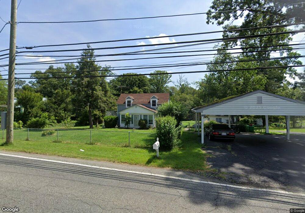
9208 Dangerfield Rd Clinton, MD 20735
Estimated Value: $291,000 - $356,137
3
Beds
2
Baths
728
Sq Ft
$447/Sq Ft
Est. Value
About This Home
This home is located at 9208 Dangerfield Rd, Clinton, MD 20735 and is currently estimated at $325,534, approximately $447 per square foot. 9208 Dangerfield Rd is a home located in Prince George's County with nearby schools including Melwood Elementary School, James Madison Middle School, and Frederick Douglass High School.
Ownership History
Date
Name
Owned For
Owner Type
Purchase Details
Closed on
Oct 19, 2005
Sold by
Robinson Joseph S
Bought by
Robinson Joseph S
Current Estimated Value
Home Financials for this Owner
Home Financials are based on the most recent Mortgage that was taken out on this home.
Original Mortgage
$202,400
Outstanding Balance
$115,325
Interest Rate
6.8%
Mortgage Type
Adjustable Rate Mortgage/ARM
Estimated Equity
$210,209
Purchase Details
Closed on
Mar 8, 1999
Sold by
King Richard E
Bought by
Robinson Joseph S
Purchase Details
Closed on
Jul 18, 1972
Sold by
Irby Helen J
Bought by
King Richard E and King Anna L
Create a Home Valuation Report for This Property
The Home Valuation Report is an in-depth analysis detailing your home's value as well as a comparison with similar homes in the area
Home Values in the Area
Average Home Value in this Area
Purchase History
| Date | Buyer | Sale Price | Title Company |
|---|---|---|---|
| Robinson Joseph S | -- | -- | |
| Robinson Joseph S | $117,500 | -- | |
| King Richard E | $22,000 | -- |
Source: Public Records
Mortgage History
| Date | Status | Borrower | Loan Amount |
|---|---|---|---|
| Open | Robinson Joseph S | $202,400 |
Source: Public Records
Tax History
| Year | Tax Paid | Tax Assessment Tax Assessment Total Assessment is a certain percentage of the fair market value that is determined by local assessors to be the total taxable value of land and additions on the property. | Land | Improvement |
|---|---|---|---|---|
| 2025 | $3,447 | $226,200 | $100,000 | $126,200 |
| 2024 | $3,447 | $218,100 | -- | -- |
| 2023 | $3,348 | $210,000 | $0 | $0 |
| 2022 | $2,245 | $201,900 | $100,000 | $101,900 |
| 2021 | $6,333 | $199,100 | $0 | $0 |
| 2020 | $6,170 | $196,300 | $0 | $0 |
| 2019 | $2,771 | $193,500 | $100,000 | $93,500 |
| 2018 | $2,932 | $188,000 | $0 | $0 |
| 2017 | $2,859 | $182,500 | $0 | $0 |
| 2016 | -- | $177,000 | $0 | $0 |
| 2015 | $2,702 | $177,000 | $0 | $0 |
| 2014 | $2,702 | $177,000 | $0 | $0 |
Source: Public Records
Map
Nearby Homes
- 10104 Dangerfield Rd
- 9401 Cheltenham Ave
- 8108 Sonar Rd
- 7804 New Ascot Ln
- 9104 Rama Ct
- 9009 Eldon Dr
- 8719 Brazke Ct
- 9106 Helmsley Dr
- 8518 Cedar Chase Dr
- 9015 Helmsley Dr
- 7502 Milligan Ln
- 7408 Milligan Ln
- 8305 Deborah St
- 0 Dangerfield Rd
- 9613 Quiet Brook Ln
- 9602 Stuart Ln
- 9745 Quiet Brook Ln
- 9915 Quiet Brook Ln
- 8826 Creekway Dr
- 8013 Poplar Hill Dr
- 9210 Dangerfield Rd
- 9207 Dangerfield Rd
- 8204 Foxhall Rd
- 9204 Dangerfield Rd
- 9300 Dangerfield Rd
- 8202 Foxhall Rd
- 8311 Echo Ln
- 9126 Banleigh Ln
- 9124 Banleigh Ln
- 9203 Dangerfield Rd
- 9122 Banleigh Ln
- 8200 Foxhall Rd
- 9200 Dangerfield Rd
- 8205 Foxhall Rd
- 8203 Foxhall Rd
- 9120 Banleigh Ln
- 9306 Dangerfield Rd
- 9304 Dangerfield Rd
- 8201 Foxhall Rd
- 8110 Foxhall Rd
Your Personal Tour Guide
Ask me questions while you tour the home.