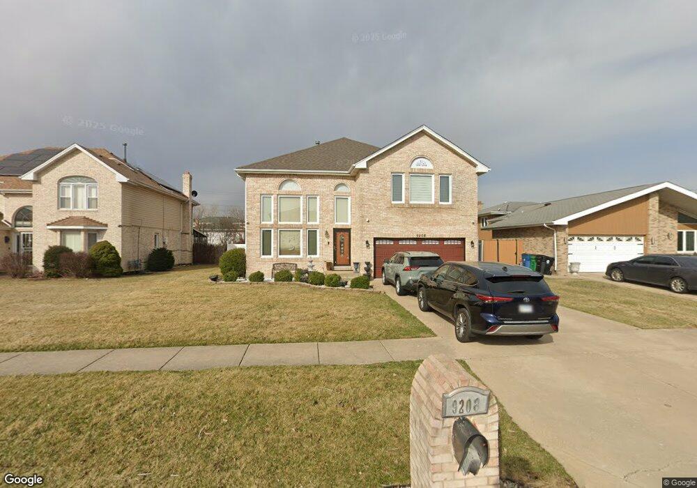
9208 Thomas Ave Bridgeview, IL 60455
Little Palestine NeighborhoodEstimated Value: $561,017 - $639,000
5
Beds
4
Baths
3,300
Sq Ft
$181/Sq Ft
Est. Value
About This Home
This home is located at 9208 Thomas Ave, Bridgeview, IL 60455 and is currently estimated at $596,754, approximately $180 per square foot. 9208 Thomas Ave is a home located in Cook County with nearby schools including Dorn Elementary School, Glen Oaks Elementary School, and H H Conrady Jr High School.
Ownership History
Date
Name
Owned For
Owner Type
Purchase Details
Closed on
Mar 8, 2017
Sold by
First Midwest Bank
Bought by
Muthana Yousef Mahmoud
Current Estimated Value
Purchase Details
Closed on
Jun 1, 1994
Sold by
Kruszewski Lech and Kruszewski Stella
Bought by
Elmosa Anwar and Elmosa Fulleh
Home Financials for this Owner
Home Financials are based on the most recent Mortgage that was taken out on this home.
Original Mortgage
$169,700
Interest Rate
8.66%
Create a Home Valuation Report for This Property
The Home Valuation Report is an in-depth analysis detailing your home's value as well as a comparison with similar homes in the area
Home Values in the Area
Average Home Value in this Area
Purchase History
| Date | Buyer | Sale Price | Title Company |
|---|---|---|---|
| Muthana Yousef Mahmoud | $370,000 | Old Republic Title | |
| Elmosa Anwar | $243,000 | Attorneys Title Guaranty Fun |
Source: Public Records
Mortgage History
| Date | Status | Borrower | Loan Amount |
|---|---|---|---|
| Previous Owner | Elmosa Anwar | $169,700 |
Source: Public Records
Tax History
| Year | Tax Paid | Tax Assessment Tax Assessment Total Assessment is a certain percentage of the fair market value that is determined by local assessors to be the total taxable value of land and additions on the property. | Land | Improvement |
|---|---|---|---|---|
| 2025 | $13,725 | $45,000 | $5,525 | $39,475 |
| 2024 | $13,725 | $45,000 | $5,525 | $39,475 |
| 2023 | $16,660 | $45,000 | $5,525 | $39,475 |
| 2022 | $16,660 | $44,722 | $4,736 | $39,986 |
| 2021 | $16,318 | $44,720 | $4,735 | $39,985 |
| 2020 | $17,337 | $44,720 | $4,735 | $39,985 |
| 2019 | $15,348 | $38,487 | $4,341 | $34,146 |
| 2018 | $14,992 | $38,487 | $4,341 | $34,146 |
| 2017 | $13,043 | $38,487 | $4,341 | $34,146 |
| 2016 | $13,162 | $32,900 | $3,749 | $29,151 |
| 2015 | $12,532 | $32,900 | $3,749 | $29,151 |
| 2014 | $12,141 | $32,900 | $3,749 | $29,151 |
| 2013 | $11,545 | $33,942 | $3,749 | $30,193 |
Source: Public Records
Map
Nearby Homes
- 9237 S 77th Ave
- 7117 W 93rd St Unit 306
- 9420 S 77th Ct Unit 2E
- 9417 S 78th Ave
- 9435 S 78th Ave
- 7100 W 95th St Unit 111
- 7932 W 93rd St Unit 2A
- 8800 S Harlem Ave Unit 19
- 8800 S Harlem Ave Unit 2300
- 8800 S Harlem Ave Unit 2111
- 8800 S Harlem Ave Unit 1127
- 6932 W 91st St
- 9236 Pembroke Ln
- 9407 S Roberts Rd Unit 3SE
- 9645 S Harlem Ave Unit 1H
- 6906 W 91st St
- 9645 S 78th Ct
- 8808 Cranbrook Ln
- 6934 W 96th St
- 9708 Nottingham Ave Unit 11
- 9204 Thomas Ave
- 9212 Thomas Ave
- 9200 Thomas Ave
- 9216 Thomas Ave
- 9209 Beloit Ave
- 9205 Beloit Ave
- 9213 Beloit Ave
- 9201 Beloit Ave
- 9217 Beloit Ave
- 9220 Thomas Ave
- 9221 Beloit Ave
- 9217 Thomas Ave
- 9224 Thomas Ave
- 9148 Thomas Ave
- 9221 Thomas Ave
- 9225 Beloit Ave
- 9155 Beloit Ave
- 9228 Thomas Ave
- 9210 Beloit Ave Unit 101
- 9210 Beloit Ave Unit G217
Your Personal Tour Guide
Ask me questions while you tour the home.