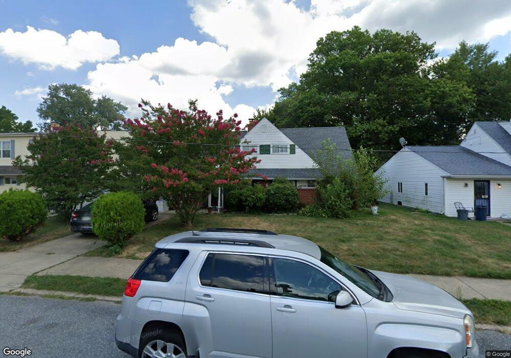
9209 Treaty Rd Philadelphia, PA 19114
Torresdale NeighborhoodEstimated Value: $331,138 - $405,000
--
Bed
--
Bath
1,540
Sq Ft
$247/Sq Ft
Est. Value
About This Home
This home is located at 9209 Treaty Rd, Philadelphia, PA 19114 and is currently estimated at $380,785, approximately $247 per square foot. 9209 Treaty Rd is a home located in Philadelphia County with nearby schools including Thomas Holme School, Lincoln High School, and Meehan Austin Middle School.
Ownership History
Date
Name
Owned For
Owner Type
Purchase Details
Closed on
Jan 27, 2003
Sold by
Levens Patricia L
Bought by
Levens Patricia L and Levens Brittany E
Current Estimated Value
Home Financials for this Owner
Home Financials are based on the most recent Mortgage that was taken out on this home.
Original Mortgage
$126,800
Outstanding Balance
$52,975
Interest Rate
5.86%
Estimated Equity
$327,810
Purchase Details
Closed on
Mar 1, 1999
Sold by
Landay James W and Landay James W
Bought by
Landay James W and Levens Patricia L
Create a Home Valuation Report for This Property
The Home Valuation Report is an in-depth analysis detailing your home's value as well as a comparison with similar homes in the area
Home Values in the Area
Average Home Value in this Area
Purchase History
| Date | Buyer | Sale Price | Title Company |
|---|---|---|---|
| Levens Patricia L | -- | -- | |
| Landay James W | -- | Commonwealth Land Title Ins |
Source: Public Records
Mortgage History
| Date | Status | Borrower | Loan Amount |
|---|---|---|---|
| Open | Levens Patricia L | $126,800 |
Source: Public Records
Tax History Compared to Growth
Tax History
| Year | Tax Paid | Tax Assessment Tax Assessment Total Assessment is a certain percentage of the fair market value that is determined by local assessors to be the total taxable value of land and additions on the property. | Land | Improvement |
|---|---|---|---|---|
| 2026 | $3,830 | $328,900 | $65,780 | $263,120 |
| 2025 | $3,830 | $328,900 | $65,780 | $263,120 |
| 2024 | $3,830 | $328,900 | $65,780 | $263,120 |
| 2023 | $3,830 | $273,600 | $54,720 | $218,880 |
| 2022 | $2,455 | $228,600 | $54,720 | $173,880 |
| 2021 | $3,085 | $0 | $0 | $0 |
| 2020 | $3,085 | $0 | $0 | $0 |
| 2019 | $2,955 | $0 | $0 | $0 |
| 2018 | $2,359 | $0 | $0 | $0 |
| 2017 | $2,779 | $0 | $0 | $0 |
| 2016 | $2,359 | $0 | $0 | $0 |
| 2015 | $2,258 | $0 | $0 | $0 |
| 2014 | -- | $198,500 | $140,154 | $58,346 |
| 2012 | -- | $25,856 | $7,000 | $18,856 |
Source: Public Records
Map
Nearby Homes
- 9202 Treaty Rd
- 9214 Andover Rd
- 9235 Outlook Ave
- 9612 Convent Ave
- 9311 Andover Rd
- 3414 Aubrey Ave
- 9176 Frankford Ave
- 3427 Aubrey Ave
- 2959 Tremont St
- 9328 Academy Rd
- 3416 Holyoke Rd
- 3415 Holyoke Rd
- 9321 Walker St
- 3426 Fitler St
- 3215 Brookdale Rd
- 3526 Fitler St
- 2843 Woodbridge Rd
- 9428 Woodbridge Rd
- 3544 Fitler St
- 4454 Carwithan St
- 9211 Treaty Rd
- 9207 Treaty Rd
- 9213 Treaty Rd
- 9204 Andover Rd
- 9202 Andover Rd
- 9206 Andover Rd
- 9208 Treaty Rd
- 9203 Treaty Rd
- 9210 Treaty Rd
- 3317 Fordham Rd
- 9215 Treaty Rd
- 9206 Treaty Rd
- 3315 Fordham Rd
- 9208 Andover Rd
- 9212 Treaty Rd
- 3319 Fordham Rd
- 9204 Treaty Rd
- 9201 Treaty Rd
- 9214 Treaty Rd
- 9210 Andover Rd