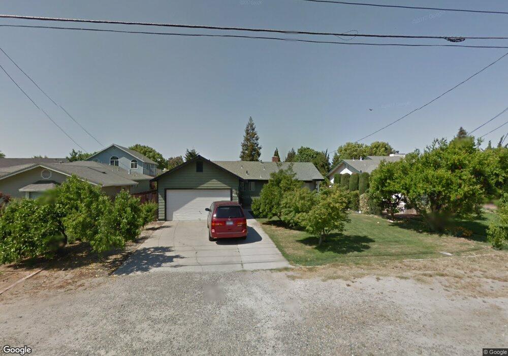
921 E Minnesota Ave Turlock, CA 95382
Estimated Value: $414,000 - $480,000
3
Beds
2
Baths
1,204
Sq Ft
$372/Sq Ft
Est. Value
About This Home
This home is located at 921 E Minnesota Ave, Turlock, CA 95382 and is currently estimated at $448,329, approximately $372 per square foot. 921 E Minnesota Ave is a home located in Stanislaus County with nearby schools including Dennis G. Earl Elementary School, Marvin A. Dutcher Middle School, and Turlock Junior High School.
Ownership History
Date
Name
Owned For
Owner Type
Purchase Details
Closed on
Jul 9, 2002
Sold by
Dwight Norman E and Dwight Martha L
Bought by
Dwight Philip N and Dwight Margery M
Current Estimated Value
Home Financials for this Owner
Home Financials are based on the most recent Mortgage that was taken out on this home.
Original Mortgage
$156,000
Interest Rate
6.7%
Create a Home Valuation Report for This Property
The Home Valuation Report is an in-depth analysis detailing your home's value as well as a comparison with similar homes in the area
Purchase History
| Date | Buyer | Sale Price | Title Company |
|---|---|---|---|
| Dwight Philip N | $195,000 | Chicago Title Co |
Source: Public Records
Mortgage History
| Date | Status | Borrower | Loan Amount |
|---|---|---|---|
| Closed | Dwight Philip N | $156,000 |
Source: Public Records
Tax History
| Year | Tax Paid | Tax Assessment Tax Assessment Total Assessment is a certain percentage of the fair market value that is determined by local assessors to be the total taxable value of land and additions on the property. | Land | Improvement |
|---|---|---|---|---|
| 2025 | $1,558 | $151,965 | $45,927 | $106,038 |
| 2024 | $1,528 | $148,986 | $45,027 | $103,959 |
| 2023 | $1,524 | $146,066 | $44,145 | $101,921 |
| 2022 | $1,503 | $143,203 | $43,280 | $99,923 |
| 2021 | $1,480 | $140,396 | $42,432 | $97,964 |
| 2020 | $1,469 | $138,957 | $41,997 | $96,960 |
| 2019 | $1,443 | $136,233 | $41,174 | $95,059 |
| 2018 | $1,440 | $133,563 | $40,367 | $93,196 |
| 2017 | $1,405 | $130,945 | $39,576 | $91,369 |
| 2016 | $1,310 | $128,378 | $38,800 | $89,578 |
| 2015 | $1,298 | $126,451 | $38,218 | $88,233 |
| 2014 | $1,284 | $123,975 | $37,470 | $86,505 |
Source: Public Records
Map
Nearby Homes
- 3161 Bridgeport Ct
- 3140 Kellogg Ave
- 2293 E Tuolumne Rd
- 0 Hogin Rd Unit MC25187945
- 0 Hogin Rd Unit 225067168
- 3361 Vanderbilt Ave
- 125 Hedstrom Rd
- 1740 Colorado Ave
- 3491 Santos Ct
- 345 Riviera Way
- 1820 N Berkeley Ave
- 2063 Justice Ct
- 3221 Amethyst Way
- 785 Fullerton Dr
- 1460 E Hawkeye Ave
- 2061 Zane Way
- 2041 Zane Way
- 2900 Andre Ln Unit 241
- 100 Pedras Rd
- 3661 La Mancha Place
- 901 E Minnesota Ave
- 931 E Minnesota Ave
- 821 E Minnesota Ave
- 941 E Minnesota Ave
- 819 E Minnesota Ave
- 910 Tornell Ave
- 930 Tornell Ave
- 900 Tornell Ave
- 951 E Minnesota Ave
- 815 E Minnesota Ave
- 940 E Minnesota Ave
- 950 Tornell Ave
- 840 Tornell Ave
- 950 E Minnesota Ave
- 1011 E Minnesota Ave
- 1000 Tornell Ave
- 2600 N Olive Ave
- 2640 N Olive Ave
- 1010 E Minnesota Ave
- 1010 Tornell Ave
Your Personal Tour Guide
Ask me questions while you tour the home.