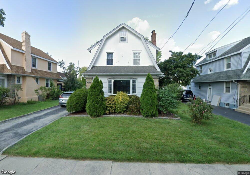
921 Edmonds Ave Drexel Hill, PA 19026
Estimated Value: $277,000 - $334,000
3
Beds
1
Bath
1,518
Sq Ft
$201/Sq Ft
Est. Value
About This Home
This home is located at 921 Edmonds Ave, Drexel Hill, PA 19026 and is currently estimated at $304,762, approximately $200 per square foot. 921 Edmonds Ave is a home located in Delaware County with nearby schools including Hillcrest El School, Drexel Hill Middle School, and Upper Darby High School.
Ownership History
Date
Name
Owned For
Owner Type
Purchase Details
Closed on
Jun 29, 1998
Sold by
Sherlock Frank B and Sherlock Kathryn T
Bought by
Forester Jeffrey A and Logan Claire E
Current Estimated Value
Home Financials for this Owner
Home Financials are based on the most recent Mortgage that was taken out on this home.
Original Mortgage
$131,000
Outstanding Balance
$27,978
Interest Rate
7.5%
Mortgage Type
FHA
Estimated Equity
$276,784
Create a Home Valuation Report for This Property
The Home Valuation Report is an in-depth analysis detailing your home's value as well as a comparison with similar homes in the area
Home Values in the Area
Average Home Value in this Area
Purchase History
| Date | Buyer | Sale Price | Title Company |
|---|---|---|---|
| Forester Jeffrey A | $134,000 | Security Search & Abstract C |
Source: Public Records
Mortgage History
| Date | Status | Borrower | Loan Amount |
|---|---|---|---|
| Open | Forester Jeffrey A | $131,000 |
Source: Public Records
Tax History
| Year | Tax Paid | Tax Assessment Tax Assessment Total Assessment is a certain percentage of the fair market value that is determined by local assessors to be the total taxable value of land and additions on the property. | Land | Improvement |
|---|---|---|---|---|
| 2025 | $7,488 | $177,060 | $54,330 | $122,730 |
| 2024 | $7,488 | $177,060 | $54,330 | $122,730 |
| 2023 | $7,418 | $177,060 | $54,330 | $122,730 |
| 2022 | $7,218 | $177,060 | $54,330 | $122,730 |
| 2021 | $9,733 | $177,060 | $54,330 | $122,730 |
| 2020 | $8,107 | $125,330 | $50,740 | $74,590 |
| 2019 | $7,965 | $125,330 | $50,740 | $74,590 |
| 2018 | $7,873 | $125,330 | $0 | $0 |
| 2017 | $7,668 | $125,330 | $0 | $0 |
| 2016 | $688 | $125,330 | $0 | $0 |
| 2015 | $702 | $125,330 | $0 | $0 |
| 2014 | $688 | $125,330 | $0 | $0 |
Source: Public Records
Map
Nearby Homes
- 840 Lindale Ave
- 904 Penn Ave
- 801 Penn Ave
- 725 Turner Ave
- 1049 Drexel Ave
- 3765 Highland Ave
- 1009 Wilde Ave
- 939 Fariston Dr
- 1228 Old Ln
- 1210 Bryan St
- 642 Ferne Blvd
- 606 Mason Ave
- 1114 Roosevelt Dr
- 1117 Belfield Ave
- 1105 Roosevelt Dr
- 653 Drexel Ave
- 827 Hampshire Rd
- 2548 Irvington Rd
- 1101 Wilson Dr
- 719 Blythe Ave
- 925 Edmonds Ave
- 917 Edmonds Ave
- 929 Edmonds Ave
- 913 Edmonds Ave
- 920 Mason Ave
- 916 Mason Ave
- 924 Mason Ave
- 912 Mason Ave
- 928 Mason Ave
- 920 Edmonds Ave
- 933 Edmonds Ave
- 909 Edmonds Ave
- 924 Edmonds Ave
- 916 Edmonds Ave
- 928 Edmonds Ave
- 908 Mason Ave
- 932 Mason Ave
- 937 Edmonds Ave
- 905 Edmonds Ave
- 932 Edmonds Ave
Your Personal Tour Guide
Ask me questions while you tour the home.