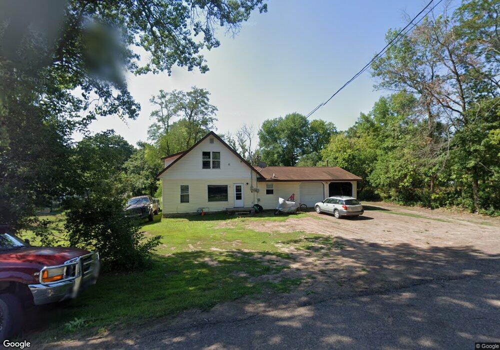
921 Grant St Spooner, WI 54801
Estimated Value: $109,379 - $149,000
3
Beds
1
Bath
1,408
Sq Ft
$92/Sq Ft
Est. Value
About This Home
This home is located at 921 Grant St, Spooner, WI 54801 and is currently estimated at $129,190, approximately $91 per square foot. 921 Grant St is a home located in Washburn County with nearby schools including Spooner Elementary School, Spooner Middle School, and Spooner High School.
Ownership History
Date
Name
Owned For
Owner Type
Purchase Details
Closed on
Dec 18, 2009
Sold by
Wells Fargo Bank Minnesota National Asso
Bought by
Johnson Andrew R and Johnson Kathleen M
Current Estimated Value
Purchase Details
Closed on
Aug 10, 2009
Sold by
Larson Jason G
Bought by
Wells Fargo Bank Minnesota National Asso
Create a Home Valuation Report for This Property
The Home Valuation Report is an in-depth analysis detailing your home's value as well as a comparison with similar homes in the area
Home Values in the Area
Average Home Value in this Area
Purchase History
| Date | Buyer | Sale Price | Title Company |
|---|---|---|---|
| Johnson Andrew R | -- | -- | |
| Wells Fargo Bank Minnesota National Asso | $63,700 | -- |
Source: Public Records
Mortgage History
| Date | Status | Borrower | Loan Amount |
|---|---|---|---|
| Closed | Wells Fargo Bank Minnesota National Asso | $0 |
Source: Public Records
Tax History Compared to Growth
Tax History
| Year | Tax Paid | Tax Assessment Tax Assessment Total Assessment is a certain percentage of the fair market value that is determined by local assessors to be the total taxable value of land and additions on the property. | Land | Improvement |
|---|---|---|---|---|
| 2023 | $1,876 | $74,200 | $21,100 | $53,100 |
| 2022 | $1,731 | $74,200 | $21,100 | $53,100 |
| 2021 | $1,726 | $74,200 | $21,100 | $53,100 |
| 2020 | $1,732 | $74,200 | $21,100 | $53,100 |
| 2019 | $1,666 | $74,200 | $21,100 | $53,100 |
| 2018 | $1,620 | $74,200 | $21,100 | $53,100 |
| 2017 | $1,598 | $74,200 | $21,100 | $53,100 |
| 2016 | $1,590 | $74,200 | $21,100 | $53,100 |
| 2015 | $1,520 | $74,200 | $21,100 | $53,100 |
| 2014 | $1,488 | $74,200 | $21,100 | $53,100 |
| 2012 | $1,499 | $74,200 | $21,100 | $53,100 |
Source: Public Records
Map
Nearby Homes
- Lot 2 Grant St
- 0 Hwy 70 Unit 1594695
- 106 S Summit St
- 924 Superior St
- 607 College St
- 222 Spruce St
- XXX Dur A Bilt Rd
- 409 Poplar St
- XXX Pine Dr
- Lot 1 Lois Lane S Lois Ln SW
- 7395 Miller Rd
- xxx Trails End
- 0 Northland Dr
- N5603 Tower Hill Rd
- N4821 Tozer Lake Rd
- 0 U S 53
- 00 Cable Car Ln
- 5810 Bear Path Ln
- N4461 Tozer Lake Rd
- W8330 Carlton Rd