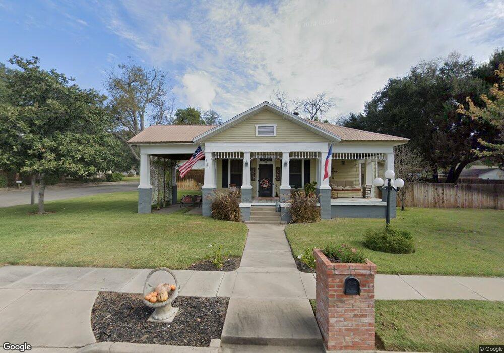
921 N Avenue D Shiner, TX 77984
Estimated Value: $354,266 - $399,000
--
Bed
--
Bath
2,419
Sq Ft
$155/Sq Ft
Est. Value
About This Home
This home is located at 921 N Avenue D, Shiner, TX 77984 and is currently estimated at $376,067, approximately $155 per square foot. 921 N Avenue D is a home located in Lavaca County with nearby schools including Shiner Elementary School, Shiner High School, and Shiner Catholic School.
Ownership History
Date
Name
Owned For
Owner Type
Purchase Details
Closed on
Dec 1, 2011
Sold by
Street Sewell and Street Sherry Lavone
Bought by
Robinson Joshua and Robinson Melissa C
Current Estimated Value
Home Financials for this Owner
Home Financials are based on the most recent Mortgage that was taken out on this home.
Original Mortgage
$255,845
Outstanding Balance
$178,258
Interest Rate
4.4%
Mortgage Type
FHA
Estimated Equity
$197,809
Purchase Details
Closed on
Sep 5, 2007
Sold by
Darilek Ronald E and Darilek Faith A
Bought by
Street Sewell
Home Financials for this Owner
Home Financials are based on the most recent Mortgage that was taken out on this home.
Original Mortgage
$100,000
Interest Rate
6.72%
Create a Home Valuation Report for This Property
The Home Valuation Report is an in-depth analysis detailing your home's value as well as a comparison with similar homes in the area
Home Values in the Area
Average Home Value in this Area
Purchase History
| Date | Buyer | Sale Price | Title Company |
|---|---|---|---|
| Robinson Joshua | -- | -- | |
| Street Sewell | -- | -- |
Source: Public Records
Mortgage History
| Date | Status | Borrower | Loan Amount |
|---|---|---|---|
| Open | Robinson Joshua | $255,845 | |
| Previous Owner | Street Sewell | $100,000 |
Source: Public Records
Tax History Compared to Growth
Tax History
| Year | Tax Paid | Tax Assessment Tax Assessment Total Assessment is a certain percentage of the fair market value that is determined by local assessors to be the total taxable value of land and additions on the property. | Land | Improvement |
|---|---|---|---|---|
| 2024 | $5,283 | $356,646 | $48,015 | $308,631 |
| 2023 | $5,108 | $357,300 | $42,496 | $314,804 |
| 2022 | $5,249 | $326,530 | $33,997 | $292,533 |
| 2021 | $5,254 | $283,024 | $33,997 | $249,027 |
| 2020 | $4,752 | $255,048 | $33,997 | $221,051 |
| 2019 | $4,896 | $249,040 | $33,997 | $215,043 |
| 2018 | $4,451 | $224,921 | $33,997 | $190,924 |
| 2017 | $3,881 | $208,185 | $33,660 | $174,525 |
| 2016 | $3,747 | $210,709 | $33,660 | $177,049 |
| 2015 | -- | $209,093 | $20,250 | $188,843 |
| 2014 | -- | $209,093 | $20,250 | $188,843 |
Source: Public Records
Map
Nearby Homes
- 2978 Farm To Market Road 1891
- TBD Highway 90 Alternate
- 1120 N Avenue D
- 912 N Avenue G
- 403 E 13th St
- 1205 N Avenue G
- 421 E 13th St
- 1322 N Avenue F
- 121 E 15th St
- 421 N Avenue G
- 1514 North Ave E
- 122 North Ave E
- 1515 Moulton St
- 204 N Avenue F
- 409 N Pannewitz St
- 222 August Ave
- 000 Us Hwy 90
- 714 Louisiana Ave
- 913 S Welhausen Ave
- CR 359A Tract 6