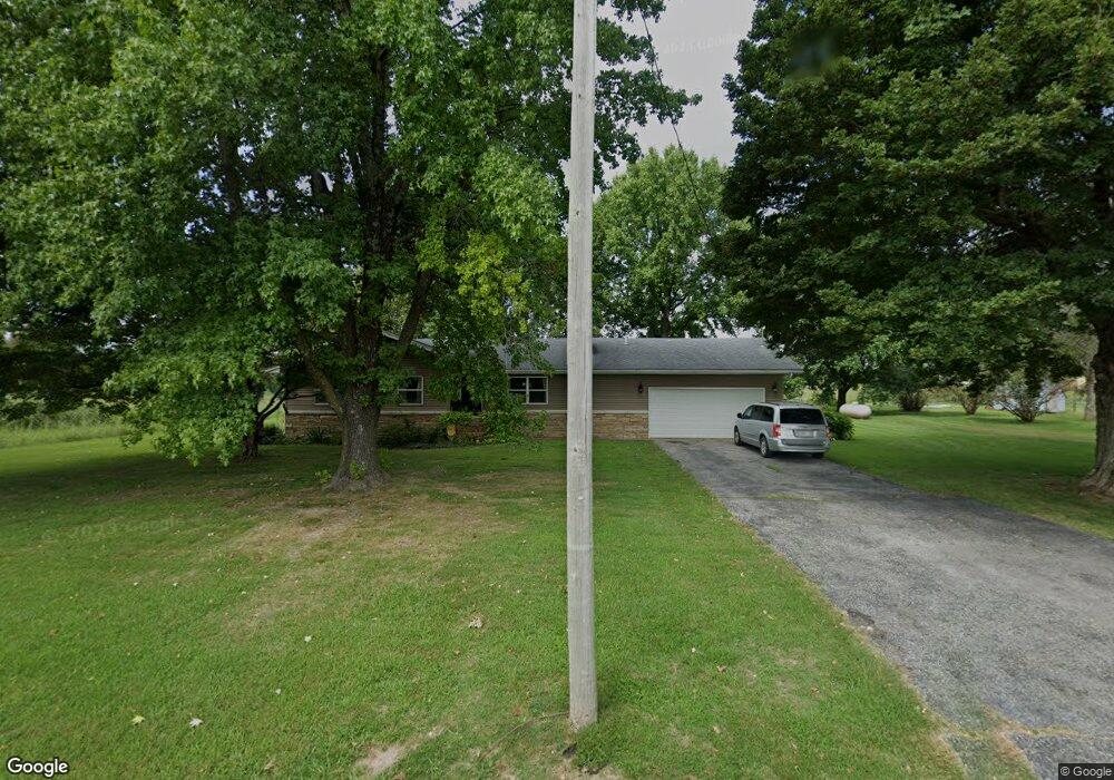
921 N Farm Road 97 Springfield, MO 65802
West Springfield NeighborhoodEstimated Value: $289,000 - $314,244
3
Beds
1
Bath
1,436
Sq Ft
$211/Sq Ft
Est. Value
About This Home
This home is located at 921 N Farm Road 97, Springfield, MO 65802 and is currently estimated at $302,561, approximately $210 per square foot. 921 N Farm Road 97 is a home located in Greene County with nearby schools including Willard Central Elementary School, Willard Intermediate School North, and Willard High School.
Ownership History
Date
Name
Owned For
Owner Type
Purchase Details
Closed on
Mar 26, 2025
Sold by
Walker Luke and Walker Robin
Bought by
Walker Family Trust and Walker
Current Estimated Value
Purchase Details
Closed on
Aug 21, 2015
Sold by
Turk Charles W
Bought by
Walker Luke and Walker Robin
Home Financials for this Owner
Home Financials are based on the most recent Mortgage that was taken out on this home.
Original Mortgage
$75,000
Interest Rate
4.08%
Mortgage Type
Future Advance Clause Open End Mortgage
Create a Home Valuation Report for This Property
The Home Valuation Report is an in-depth analysis detailing your home's value as well as a comparison with similar homes in the area
Home Values in the Area
Average Home Value in this Area
Purchase History
| Date | Buyer | Sale Price | Title Company |
|---|---|---|---|
| Walker Family Trust | -- | None Listed On Document | |
| Walker Luke | -- | None Available |
Source: Public Records
Mortgage History
| Date | Status | Borrower | Loan Amount |
|---|---|---|---|
| Previous Owner | Walker Luke | $75,000 |
Source: Public Records
Tax History Compared to Growth
Tax History
| Year | Tax Paid | Tax Assessment Tax Assessment Total Assessment is a certain percentage of the fair market value that is determined by local assessors to be the total taxable value of land and additions on the property. | Land | Improvement |
|---|---|---|---|---|
| 2025 | $1,789 | $36,830 | $9,270 | $27,560 |
| 2024 | $1,789 | $31,910 | $6,540 | $25,370 |
| 2023 | $1,781 | $31,910 | $6,540 | $25,370 |
| 2022 | $1,537 | $27,290 | $6,540 | $20,750 |
| 2021 | $1,538 | $27,290 | $6,540 | $20,750 |
| 2020 | $1,234 | $23,790 | $6,540 | $17,250 |
| 2019 | $1,230 | $23,790 | $6,540 | $17,250 |
| 2018 | $905 | $17,420 | $6,540 | $10,880 |
| 2017 | $898 | $16,660 | $6,540 | $10,120 |
| 2016 | $854 | $0 | $0 | $0 |
| 2015 | -- | $0 | $0 | $0 |
Source: Public Records
Map
Nearby Homes
- 7593 W Farm Road 124
- 226 N Sunrise Ln
- 489 N Farm Road 89
- 000-Trct 4 N Farm Road 89
- 000-Trct 3 N Farm Road 89
- 636 S Farm Road 89
- 2007 N Farm Road 89
- 8756 W Farm Road 124
- 2548 Arrow Ln N
- 000 W Independence Dr
- 6984 W Cottonwood Rd
- 6789 W Farm Road 144
- Lot 1 S State Highway T
- 7047 W Lone Oak St
- 525 S Farm Road 83
- Lot 3 S Farm Road 83
- Lot 2 S Farm Road 83
- 000 S Farm Road 97
- 2506 N Meadow Lake Dr
- 8302 W Farm Road 144
- 967 N Farm Road 97
- 873 N Farm Road 97
- 880 N Farm Road 97
- 729 N Farm Road 97
- 7608 W Farm Road 128
- 7575 W Farm Road 128
- 1025 N Farm Road 97
- 790 N Farm Road 97 Unit Lot 3
- 790 N Farm Road 97
- 7647 W Farm Road 128
- 918 N Farm Road 97
- 726 N Farm Road 97
- 7674 W Farm Road 128
- 7675 W Farm Road 128
- 669 N Farm Road 97
- 815 N Farm Road 97
- 1137 N Farm Road 97
- 662 N Farm Road 97
- 1197 N Farm Road 97
- 7711 W Farm Road 128