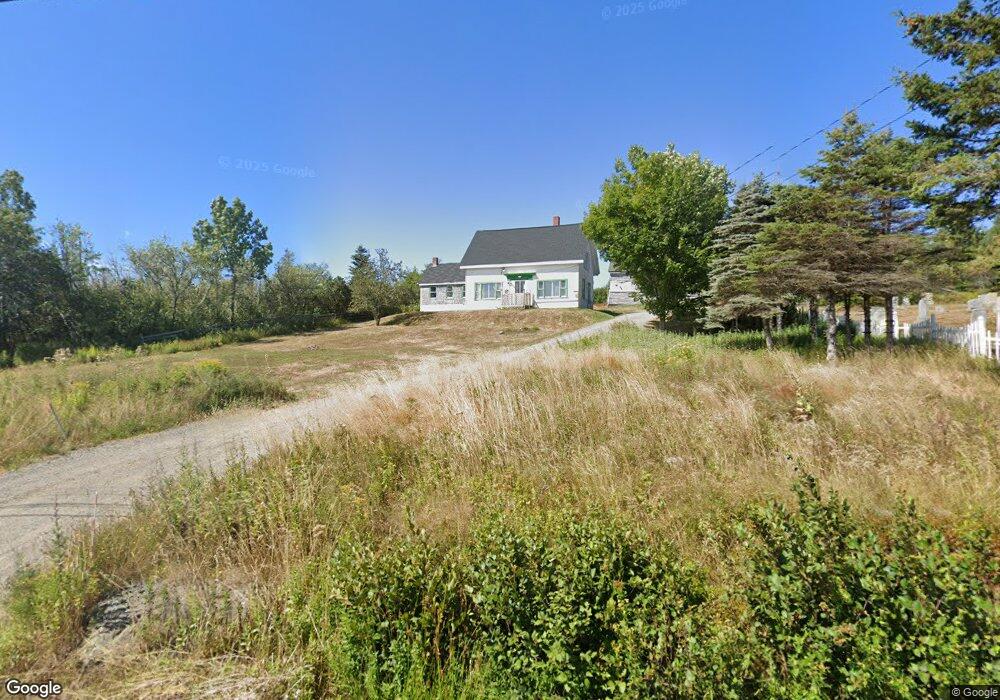
921 Port Rd MacHiasport, ME 04655
Estimated Value: $121,068 - $347,000
3
Beds
1
Bath
1,432
Sq Ft
$129/Sq Ft
Est. Value
About This Home
This home is located at 921 Port Rd, MacHiasport, ME 04655 and is currently estimated at $185,017, approximately $129 per square foot. 921 Port Rd is a home with nearby schools including Fort O'Brien School.
Ownership History
Date
Name
Owned For
Owner Type
Purchase Details
Closed on
Jul 22, 2008
Sold by
Stanford Dan H and Yellowcloud Iris
Bought by
Edwards Michael A
Current Estimated Value
Home Financials for this Owner
Home Financials are based on the most recent Mortgage that was taken out on this home.
Original Mortgage
$195,000
Outstanding Balance
$126,437
Interest Rate
6.17%
Mortgage Type
Commercial
Estimated Equity
$58,580
Create a Home Valuation Report for This Property
The Home Valuation Report is an in-depth analysis detailing your home's value as well as a comparison with similar homes in the area
Home Values in the Area
Average Home Value in this Area
Purchase History
| Date | Buyer | Sale Price | Title Company |
|---|---|---|---|
| Edwards Michael A | -- | -- |
Source: Public Records
Mortgage History
| Date | Status | Borrower | Loan Amount |
|---|---|---|---|
| Open | Edwards Michael A | $195,000 |
Source: Public Records
Tax History Compared to Growth
Tax History
| Year | Tax Paid | Tax Assessment Tax Assessment Total Assessment is a certain percentage of the fair market value that is determined by local assessors to be the total taxable value of land and additions on the property. | Land | Improvement |
|---|---|---|---|---|
| 2024 | $964 | $74,170 | $28,420 | $45,750 |
| 2023 | $868 | $68,870 | $26,220 | $42,650 |
| 2022 | $787 | $63,960 | $25,020 | $38,940 |
| 2021 | $697 | $63,960 | $25,020 | $38,940 |
| 2020 | $800 | $63,960 | $25,020 | $38,940 |
| 2019 | $1,307 | $76,014 | $35,332 | $40,682 |
| 2018 | $1,406 | $76,014 | $35,332 | $40,682 |
| 2017 | $1,330 | $76,014 | $35,332 | $40,682 |
| 2016 | $1,330 | $76,014 | $35,332 | $40,682 |
| 2015 | $1,383 | $76,014 | $35,332 | $40,682 |
| 2014 | $1,383 | $76,014 | $35,332 | $40,682 |
| 2013 | $1,376 | $76,014 | $35,332 | $40,682 |
Source: Public Records
Map
Nearby Homes
- 76 Dunns Point Way
- 1 Puffins Ln
- MarkayEast Puffins Ln
- 576 Port Rd
- 1323 Port Rd
- 366 Port Rd
- 37 Corn Hill Rd
- 4-28 Old Town Rd Old County Rd Rd
- 33 Corn Hill Rd
- 246 Marsh Stream Ln
- Lot16 - 2 Pettegrow Point Rd
- Lot16 Pt 1 Pettegrow Point Rd
- Lot 16 Pettegrow Point Rd
- Lot2A-2 Holway Rd
- 2-2A-001-A Holway Point Rd
- Lot 94 Yoho Head Rd
- 19 Yoho Head Rd
- 85 E Side Rd
- Lot 95 N Duck Cove Rd
- 21-5-3 E Palmer Rd