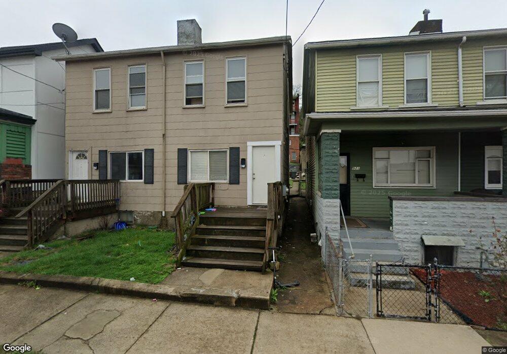
921 Robinson St Unit east side Ridge by p Mc Kees Rocks, PA 15136
Stowe Township NeighborhoodEstimated Value: $47,520 - $107,000
3
Beds
1
Bath
1,056
Sq Ft
$71/Sq Ft
Est. Value
About This Home
This home is located at 921 Robinson St Unit east side Ridge by p, Mc Kees Rocks, PA 15136 and is currently estimated at $74,880, approximately $70 per square foot. 921 Robinson St Unit east side Ridge by p is a home located in Allegheny County with nearby schools including Sto-Rox Primary Center, Sto-Rox Upper Elementary School, and Sto-Rox Junior/Senior High School.
Ownership History
Date
Name
Owned For
Owner Type
Purchase Details
Closed on
Nov 19, 2025
Sold by
Ehasani Nategh Hourdad Trste and Keyhan Golyar Trste
Bought by
Keysani Family Trust and Ehsani
Current Estimated Value
Home Financials for this Owner
Home Financials are based on the most recent Mortgage that was taken out on this home.
Original Mortgage
$101,250
Outstanding Balance
$101,250
Interest Rate
6.3%
Mortgage Type
New Conventional
Estimated Equity
-$26,370
Purchase Details
Closed on
Oct 9, 2024
Sold by
Nine 919 921 Robinson St L L C
Bought by
Keysani Family Trust and Ehasani
Purchase Details
Closed on
Sep 28, 2024
Sold by
919 921 Robinson Street Llc
Bought by
Keysani Family Trust
Purchase Details
Closed on
Nov 29, 2022
Sold by
A R Real Estate L L C
Bought by
Nine 919 921 Robinson St L L C
Purchase Details
Closed on
Apr 4, 2003
Sold by
Patterson Aaron
Bought by
Banks Robert
Create a Home Valuation Report for This Property
The Home Valuation Report is an in-depth analysis detailing your home's value as well as a comparison with similar homes in the area
Home Values in the Area
Average Home Value in this Area
Purchase History
| Date | Buyer | Sale Price | Title Company |
|---|---|---|---|
| Keysani Family Trust | -- | -- | |
| Keysani Family Trust | $60,000 | -- | |
| Keysani Family Trust | $60,000 | -- | |
| Nine 919 921 Robinson St L L C | $80,000 | -- | |
| Banks Robert | $9,000 | -- |
Source: Public Records
Mortgage History
| Date | Status | Borrower | Loan Amount |
|---|---|---|---|
| Open | Keysani Family Trust | $101,250 |
Source: Public Records
Tax History Compared to Growth
Tax History
| Year | Tax Paid | Tax Assessment Tax Assessment Total Assessment is a certain percentage of the fair market value that is determined by local assessors to be the total taxable value of land and additions on the property. | Land | Improvement |
|---|---|---|---|---|
| 2025 | $666 | $15,800 | $3,300 | $12,500 |
| 2024 | $666 | $15,800 | $3,300 | $12,500 |
| 2023 | $639 | $15,800 | $3,300 | $12,500 |
| 2022 | $618 | $15,800 | $3,300 | $12,500 |
| 2021 | $604 | $15,800 | $3,300 | $12,500 |
| 2020 | $604 | $15,800 | $3,300 | $12,500 |
| 2019 | $604 | $15,800 | $3,300 | $12,500 |
| 2018 | $75 | $15,800 | $3,300 | $12,500 |
| 2017 | $590 | $15,800 | $3,300 | $12,500 |
| 2016 | $75 | $15,800 | $3,300 | $12,500 |
| 2015 | $75 | $15,800 | $3,300 | $12,500 |
| 2014 | $550 | $15,800 | $3,300 | $12,500 |
Source: Public Records
Map
Nearby Homes
- 27 Highland Ave
- 709 Fruit Way
- 47 May Ave
- 619 Frederick St
- 83 Frazier Ave
- 82 Harlem Ave
- 107 Ella St
- 214 Erwin Place
- 300 Helen St
- 125 Frazier Ave
- 417 Alexander St
- 1213 Island Ave
- 533 Woodward Ave
- 420 Broadway Ave
- 620 Broadway Ave
- 109 Helen St
- 400 Broadway Ave
- 338 Catherine St
- 634 Broadway Ave
- 113 Ohio St
- 921 Robinson St
- 919 Robinson St
- 919 Robinson St
- 923 Robinson St
- 925 Robinson St
- 917 Robinson St
- 927 Robinson St
- 929 Robinson St
- 931 Robinson St
- 915 Robinson St
- 913 Robinson St
- 908 Island Ave
- 918 Robinson St
- 933 Robinson St
- 920 Robinson St
- 911 Robinson St
- 922 Robinson St
- 922 Island Ave
- 914 Robinson St
- 916 Robinson St