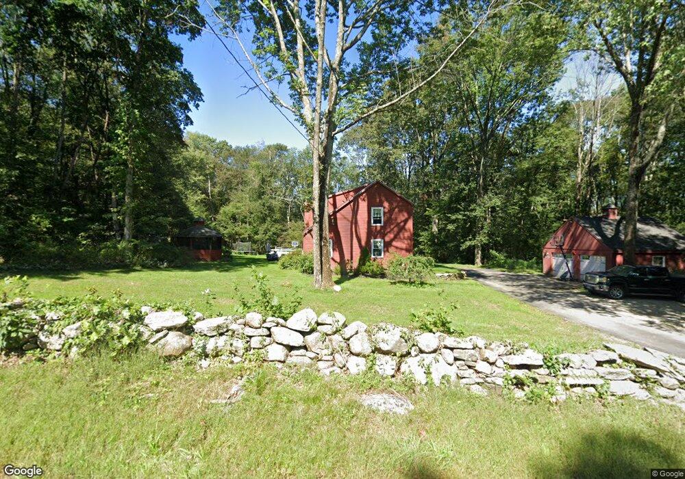
921 Route 171 Woodstock, CT 06281
Estimated Value: $369,000 - $433,000
3
Beds
2
Baths
1,381
Sq Ft
$287/Sq Ft
Est. Value
About This Home
This home is located at 921 Route 171, Woodstock, CT 06281 and is currently estimated at $396,713, approximately $287 per square foot. 921 Route 171 is a home located in Windham County with nearby schools including Woodstock Elementary School, Woodstock Middle School, and The Woodstock Academy.
Ownership History
Date
Name
Owned For
Owner Type
Purchase Details
Closed on
Dec 30, 2004
Sold by
Mobed Jeffrey N and Mobed Desiree E
Bought by
Teal Michael A and Beausoliel Megan T
Current Estimated Value
Home Financials for this Owner
Home Financials are based on the most recent Mortgage that was taken out on this home.
Original Mortgage
$209,000
Outstanding Balance
$104,667
Interest Rate
5.73%
Mortgage Type
Purchase Money Mortgage
Estimated Equity
$292,046
Purchase Details
Closed on
Sep 12, 1995
Sold by
Smith Sharon A
Bought by
Mobed Jeffrey N and Mobed Desiree
Home Financials for this Owner
Home Financials are based on the most recent Mortgage that was taken out on this home.
Original Mortgage
$130,550
Interest Rate
7.8%
Mortgage Type
Purchase Money Mortgage
Create a Home Valuation Report for This Property
The Home Valuation Report is an in-depth analysis detailing your home's value as well as a comparison with similar homes in the area
Home Values in the Area
Average Home Value in this Area
Purchase History
| Date | Buyer | Sale Price | Title Company |
|---|---|---|---|
| Teal Michael A | $220,000 | -- | |
| Mobed Jeffrey N | $128,000 | -- |
Source: Public Records
Mortgage History
| Date | Status | Borrower | Loan Amount |
|---|---|---|---|
| Open | Mobed Jeffrey N | $209,000 | |
| Previous Owner | Mobed Jeffrey N | $130,550 |
Source: Public Records
Tax History Compared to Growth
Tax History
| Year | Tax Paid | Tax Assessment Tax Assessment Total Assessment is a certain percentage of the fair market value that is determined by local assessors to be the total taxable value of land and additions on the property. | Land | Improvement |
|---|---|---|---|---|
| 2025 | $3,798 | $155,600 | $24,600 | $131,000 |
| 2024 | $3,585 | $155,600 | $24,600 | $131,000 |
| 2023 | $3,487 | $155,600 | $24,600 | $131,000 |
| 2022 | $3,244 | $155,600 | $24,600 | $131,000 |
| 2021 | $3,417 | $134,000 | $25,800 | $108,200 |
| 2020 | $2,683 | $109,500 | $25,800 | $83,700 |
| 2019 | $2,683 | $109,500 | $25,800 | $83,700 |
| 2018 | $2,683 | $109,500 | $25,800 | $83,700 |
| 2017 | $2,661 | $109,500 | $25,800 | $83,700 |
| 2016 | $2,774 | $115,400 | $32,100 | $83,300 |
| 2015 | $2,696 | $115,400 | $32,100 | $83,300 |
| 2014 | $2,666 | $115,400 | $32,100 | $83,300 |
Source: Public Records
Map
Nearby Homes
- 0 Connecticut 171
- 175 Pulpit Rock Rd
- 00 Route 171 Unit Lot 1
- 104 Pulpit Rock Rd
- 33 Bassett Hill Rd
- 134 New Sweden Rd
- 4 Perrin Rd
- 145 Perrin Rd
- 189 Center Rd
- 211 New Sweden Rd
- 0 Aplin Hill Ln
- 402 Perrin Rd
- 101 Center Rd
- 80 Bungay Hill Rd
- 101 Child Hill Rd
- 70 Laurel Hill Dr
- 56 Laurel Hill Dr
- 26 Center Rd
- 10 Laurel Hill Dr
- 30 Lyon Rd
- 914 Route 171
- 937 Route 171
- 0 Shields Rd
- 6 Shields Rd
- 12 Shields Rd
- 000 Coatney Hill Rd
- 11 Shields Rd
- 18 Shields Rd
- 000 Rt 171
- 000 Connecticut 171
- XX Connecticut 171
- 6C Connecticut 171
- 00 Rte 171
- 880 Route 171
- 32 Shields Rd
- 852 Route 171
- 327 Pulpit Rock Rd
- 320 Pulpit Rock Rd
- 321 Pulpit Rock Rd
- 966 Route 171