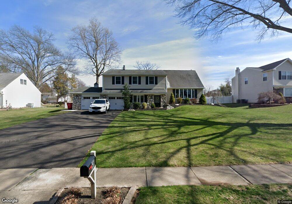
921 Sandy Ln Warminster, PA 18974
Estimated Value: $517,146 - $561,000
--
Bed
2
Baths
1,843
Sq Ft
$296/Sq Ft
Est. Value
About This Home
This home is located at 921 Sandy Ln, Warminster, PA 18974 and is currently estimated at $545,037, approximately $295 per square foot. 921 Sandy Ln is a home located in Bucks County with nearby schools including Willow Dale El School, Log College Middle School, and William Tennent High School.
Ownership History
Date
Name
Owned For
Owner Type
Purchase Details
Closed on
Aug 27, 2004
Sold by
Yaworski Joseph P and Yaworski Lorraine T
Bought by
Costello Robert J and Costello Christine
Current Estimated Value
Home Financials for this Owner
Home Financials are based on the most recent Mortgage that was taken out on this home.
Original Mortgage
$110,000
Outstanding Balance
$55,005
Interest Rate
6.02%
Mortgage Type
Purchase Money Mortgage
Estimated Equity
$490,032
Purchase Details
Closed on
Jan 31, 1972
Bought by
Yaworski Joseph P and Yaworski Lorraine T
Create a Home Valuation Report for This Property
The Home Valuation Report is an in-depth analysis detailing your home's value as well as a comparison with similar homes in the area
Home Values in the Area
Average Home Value in this Area
Purchase History
| Date | Buyer | Sale Price | Title Company |
|---|---|---|---|
| Costello Robert J | $383,000 | Fidelity National Title Insu | |
| Yaworski Joseph P | -- | -- |
Source: Public Records
Mortgage History
| Date | Status | Borrower | Loan Amount |
|---|---|---|---|
| Open | Costello Robert J | $110,000 |
Source: Public Records
Tax History Compared to Growth
Tax History
| Year | Tax Paid | Tax Assessment Tax Assessment Total Assessment is a certain percentage of the fair market value that is determined by local assessors to be the total taxable value of land and additions on the property. | Land | Improvement |
|---|---|---|---|---|
| 2025 | $7,429 | $35,200 | $7,760 | $27,440 |
| 2024 | $7,429 | $35,200 | $7,760 | $27,440 |
| 2023 | $7,201 | $35,200 | $7,760 | $27,440 |
| 2022 | $7,047 | $35,200 | $7,760 | $27,440 |
| 2021 | $6,883 | $35,200 | $7,760 | $27,440 |
| 2020 | $6,786 | $35,200 | $7,760 | $27,440 |
| 2019 | $6,426 | $35,200 | $7,760 | $27,440 |
| 2018 | $6,272 | $35,200 | $7,760 | $27,440 |
| 2017 | $6,088 | $35,200 | $7,760 | $27,440 |
| 2016 | $6,088 | $35,200 | $7,760 | $27,440 |
| 2015 | $6,071 | $35,200 | $7,760 | $27,440 |
| 2014 | $6,071 | $35,200 | $7,760 | $27,440 |
Source: Public Records
Map
Nearby Homes
- 942 Stein Ct
- 919 Lavera Rd
- 905 Holden Ct
- 408 Brandywine Ct Unit YV408
- 512 Germantown Ct
- 1127 Oak Leaf Ln
- 422 Brandywine Ct Unit YV422
- 1117 Lynch Cir
- L:26 Street Rd
- 1075 Roberts Rd
- 949 Marshall Dr
- 1130 W Bristol Rd
- 868 Aster Rd
- 632 Longfellow Ct
- 1067 Log College Dr
- 735 Saint Davids Ave
- 1252 Dahlia Rd
- 875 W Bristol Rd
- 938 Jamison St
- 675 Cheryl Dr