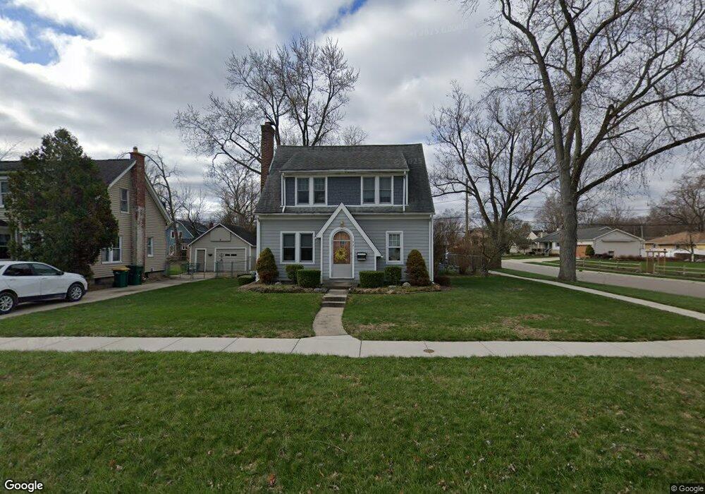
921 State St Brighton, MI 48116
Estimated Value: $400,000 - $503,000
3
Beds
3
Baths
2,010
Sq Ft
$224/Sq Ft
Est. Value
About This Home
This home is located at 921 State St, Brighton, MI 48116 and is currently estimated at $449,534, approximately $223 per square foot. 921 State St is a home located in Livingston County with nearby schools including Hornung Elementary School, Scranton Middle School, and Brighton High School.
Ownership History
Date
Name
Owned For
Owner Type
Purchase Details
Closed on
May 27, 2020
Sold by
Shipley Leslie A
Bought by
Shipley Leslie A and Hicks Ronald E
Current Estimated Value
Home Financials for this Owner
Home Financials are based on the most recent Mortgage that was taken out on this home.
Original Mortgage
$140,000
Interest Rate
3.2%
Mortgage Type
New Conventional
Purchase Details
Closed on
Sep 23, 1999
Sold by
Shipley Gerald A
Bought by
Shipley Leslie A
Create a Home Valuation Report for This Property
The Home Valuation Report is an in-depth analysis detailing your home's value as well as a comparison with similar homes in the area
Home Values in the Area
Average Home Value in this Area
Purchase History
| Date | Buyer | Sale Price | Title Company |
|---|---|---|---|
| Shipley Leslie A | -- | None Available | |
| Shipley Leslie A | -- | -- |
Source: Public Records
Mortgage History
| Date | Status | Borrower | Loan Amount |
|---|---|---|---|
| Closed | Shipley Leslie A | $140,000 |
Source: Public Records
Tax History
| Year | Tax Paid | Tax Assessment Tax Assessment Total Assessment is a certain percentage of the fair market value that is determined by local assessors to be the total taxable value of land and additions on the property. | Land | Improvement |
|---|---|---|---|---|
| 2025 | $3,758 | $184,500 | $0 | $0 |
| 2024 | $3,654 | $176,300 | $0 | $0 |
| 2023 | $3,478 | $170,700 | $0 | $0 |
| 2022 | $4,350 | $130,700 | $0 | $0 |
| 2021 | $4,267 | $156,900 | $0 | $0 |
| 2020 | $4,244 | $151,800 | $0 | $0 |
| 2019 | $4,205 | $130,700 | $0 | $0 |
| 2018 | $3,781 | $124,700 | $0 | $0 |
| 2017 | $3,649 | $121,800 | $0 | $0 |
| 2016 | $3,622 | $113,500 | $0 | $0 |
| 2014 | $3,179 | $95,390 | $0 | $0 |
| 2012 | $3,179 | $87,430 | $0 | $0 |
Source: Public Records
Map
Nearby Homes
- 1018 State St
- 4160 Link Ave
- 109 S 2nd St Unit 17
- 525 Walnut St
- 523 Walnut St
- 7608 Brookdale Ct Unit 81
- 605 Jenny Way Unit 12
- 224 Sean St
- 537 Anne Ave
- 617 Anne Ave
- 8741 Green Willow St Unit 11
- 660 Flint Rd
- 8709 Candlewood Trail Unit 5
- 8719 Meadowbrook Dr Unit 5
- 5306 Hidden Pines Ct
- 521 Carberry Hill
- 502 Stoneywood Dr
- 886 Alpine Dr
- 1010 Oak Ridge Cir
- 4639 Crestway Dr
Your Personal Tour Guide
Ask me questions while you tour the home.