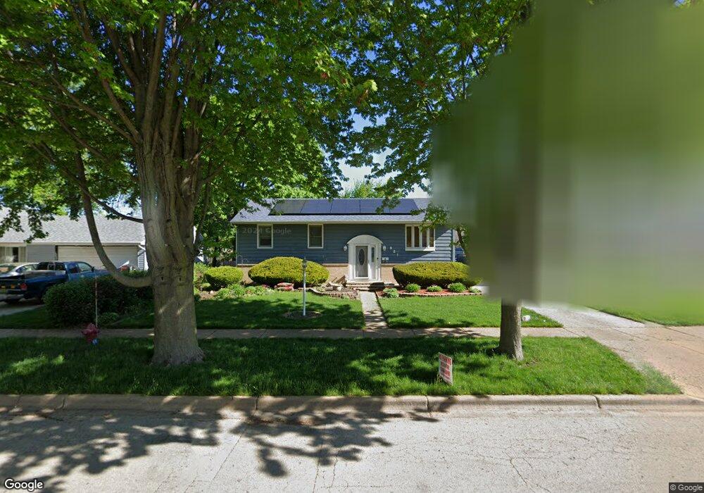
921 Upper Brandon Dr Aurora, IL 60506
North River NeighborhoodEstimated Value: $290,000 - $329,000
4
Beds
1
Bath
2,100
Sq Ft
$144/Sq Ft
Est. Value
About This Home
This home is located at 921 Upper Brandon Dr, Aurora, IL 60506 and is currently estimated at $303,042, approximately $144 per square foot. 921 Upper Brandon Dr is a home located in Kane County with nearby schools including Smith Elementary School, Jewel Middle School, and West Aurora High School.
Ownership History
Date
Name
Owned For
Owner Type
Purchase Details
Closed on
Jan 5, 2001
Sold by
Ford Rhonda J Trogdon
Bought by
Ford Ronald and Ford Rhonda J
Current Estimated Value
Home Financials for this Owner
Home Financials are based on the most recent Mortgage that was taken out on this home.
Original Mortgage
$107,500
Interest Rate
7.43%
Create a Home Valuation Report for This Property
The Home Valuation Report is an in-depth analysis detailing your home's value as well as a comparison with similar homes in the area
Home Values in the Area
Average Home Value in this Area
Purchase History
We collect this data history from publicly available records. To have your information removed, we recommend requesting removal directly through your county’s website.
| Date | Buyer | Sale Price | Title Company |
|---|---|---|---|
| Ford Ronald | -- | Express Title Services |
Source: Public Records
Mortgage History
We collect this data history from publicly available records. To have your information removed, we recommend requesting removal directly through your county’s website.
| Date | Status | Borrower | Loan Amount |
|---|---|---|---|
| Closed | Ford Ronald | $107,500 |
Source: Public Records
Tax History
| Year | Tax Paid | Tax Assessment Tax Assessment Total Assessment is a certain percentage of the fair market value that is determined by local assessors to be the total taxable value of land and additions on the property. | Land | Improvement |
|---|---|---|---|---|
| 2024 | $5,032 | $79,553 | $15,912 | $63,641 |
| 2023 | $4,718 | $71,080 | $14,217 | $56,863 |
| 2022 | $4,767 | $64,854 | $12,972 | $51,882 |
| 2021 | $4,512 | $60,380 | $12,077 | $48,303 |
| 2020 | $5,267 | $62,261 | $11,218 | $51,043 |
| 2019 | $5,054 | $57,687 | $10,394 | $47,293 |
| 2018 | $4,736 | $53,438 | $9,614 | $43,824 |
| 2017 | $4,334 | $48,114 | $8,858 | $39,256 |
| 2016 | $4,188 | $45,420 | $7,593 | $37,827 |
| 2015 | -- | $39,482 | $6,529 | $32,953 |
| 2014 | -- | $37,972 | $6,279 | $31,693 |
| 2013 | -- | $38,588 | $6,190 | $32,398 |
Source: Public Records
Map
Nearby Homes
- 1320 N Elmwood Dr
- 1271 Durham Dr Unit 1
- 757 Crestwood Dr Unit 2
- 1041 N Elmwood Dr
- 691 Old Indian Trail
- 966 N Elmwood Dr
- 1271 N Randall Rd
- 461 Sullivan Rd
- 824 Foran Ln
- 1331 N Glen Cir Unit D
- 450 Michigan Ave
- 1383 S Glen Cir Unit C
- 732 N Fordham Ave
- 1340 Monomoy St Unit C
- 1376 Monomoy St
- 1000 Grand Ave
- 934 Pennsylvania Ave
- 1370 Monomoy St Unit E
- 1421 Heather Dr
- 377 Florida Ave
- 911 Upper Brandon Dr
- 931 Upper Brandon Dr
- 1367 Eastwood Dr
- 901 Upper Brandon Dr Unit 1
- 1369 Eastwood Dr
- 1365 Eastwood Dr
- 941 Upper Brandon Dr Unit 2
- 1371 Eastwood Dr
- 1363 Eastwood Dr
- 1350 Post Rd
- 891 Upper Brandon Dr
- 934 Upper Brandon Dr Unit 2
- 951 Upper Brandon Dr
- 1373 Eastwood Dr
- 1361 Eastwood Dr
- 1341 Foran Ln
- 1340 Post Rd
- 1359 Eastwood Dr
- 1370 Eastwood Dr
- 961 Upper Brandon Dr
Your Personal Tour Guide
Ask me questions while you tour the home.