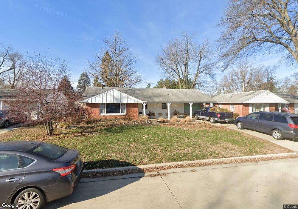
921 Vale St Bloomington, IL 61701
Estimated Value: $181,000 - $202,000
Studio
--
Bath
1,026
Sq Ft
$183/Sq Ft
Est. Value
About This Home
This home is located at 921 Vale St, Bloomington, IL 61701 and is currently estimated at $187,246, approximately $182 per square foot. 921 Vale St is a home located in McLean County with nearby schools including Oakland Elementary School, Bloomington Junior High School, and Bloomington High School.
Ownership History
Date
Name
Owned For
Owner Type
Purchase Details
Closed on
Nov 24, 2010
Sold by
Brandt Peter W and Brandt Janice L
Bought by
Donaldson Steven
Current Estimated Value
Home Financials for this Owner
Home Financials are based on the most recent Mortgage that was taken out on this home.
Original Mortgage
$75,225
Outstanding Balance
$49,430
Interest Rate
4.19%
Estimated Equity
$137,816
Create a Home Valuation Report for This Property
The Home Valuation Report is an in-depth analysis detailing your home's value as well as a comparison with similar homes in the area
Purchase History
| Date | Buyer | Sale Price | Title Company |
|---|---|---|---|
| Donaldson Steven | $94,500 | Mclean County Title |
Source: Public Records
Mortgage History
| Date | Status | Borrower | Loan Amount |
|---|---|---|---|
| Open | Donaldson Steven | $75,225 |
Source: Public Records
Tax History
| Year | Tax Paid | Tax Assessment Tax Assessment Total Assessment is a certain percentage of the fair market value that is determined by local assessors to be the total taxable value of land and additions on the property. | Land | Improvement |
|---|---|---|---|---|
| 2024 | $3,352 | $56,461 | $16,763 | $39,698 |
| 2022 | $3,352 | $45,442 | $13,492 | $31,950 |
| 2021 | $3,100 | $42,477 | $12,612 | $29,865 |
| 2020 | $2,907 | $40,301 | $11,966 | $28,335 |
| 2019 | $2,899 | $40,301 | $11,966 | $28,335 |
| 2018 | $2,887 | $40,301 | $11,966 | $28,335 |
| 2017 | $2,888 | $40,301 | $11,966 | $28,335 |
| 2016 | $2,883 | $40,301 | $11,966 | $28,335 |
| 2015 | $2,830 | $39,768 | $11,808 | $27,960 |
| 2014 | $2,672 | $38,935 | $11,808 | $27,127 |
| 2013 | -- | $39,730 | $12,049 | $27,681 |
Source: Public Records
Map
Nearby Homes
- 1903 Croxton Ave
- 219 Magnolia Dr
- 1010 Arlene Ct Unit 5
- 1826 E Lafayette St
- 42 Harbord Dr
- 1114 E Lafayette St
- 2211 Benjamin Ln Unit 1
- 1926 E Oakland Ave
- 5307 Castlebar Ct
- 5215 Castlebar Dr
- 5214 Belvedere Dr
- 5305 Castlebar Ct
- 2110 E Oakland Ave
- 807 Verkler Ct
- 2118 Eastgate Place
- 917 E Baker St
- 222 Leland St
- 2306 Maysel St
- 1101 Bunn St
- 1510 E Olive St
Your Personal Tour Guide
Ask me questions while you tour the home.