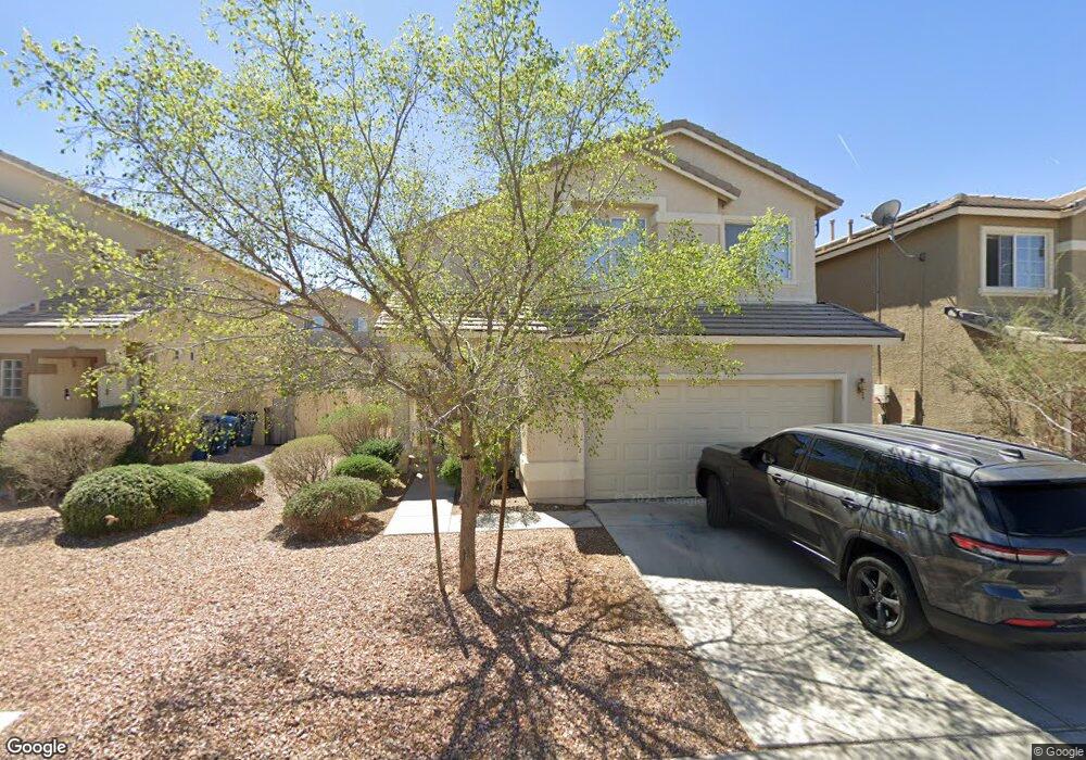
9211 Adamshurst Ave Las Vegas, NV 89148
Estimated Value: $434,327 - $458,000
4
Beds
3
Baths
1,759
Sq Ft
$252/Sq Ft
Est. Value
About This Home
This home is located at 9211 Adamshurst Ave, Las Vegas, NV 89148 and is currently estimated at $443,332, approximately $252 per square foot. 9211 Adamshurst Ave is a home located in Clark County with nearby schools including Wayne N. Tanaka Elementary School, Wilbur & Theresa Faiss Middle School, and Sierra Vista High School.
Ownership History
Date
Name
Owned For
Owner Type
Purchase Details
Closed on
Nov 26, 2002
Sold by
Astoria R R 22 Llc
Bought by
Rosas Joe and Rosas Rebecca A
Current Estimated Value
Home Financials for this Owner
Home Financials are based on the most recent Mortgage that was taken out on this home.
Original Mortgage
$166,675
Outstanding Balance
$70,976
Interest Rate
6.12%
Estimated Equity
$372,356
Create a Home Valuation Report for This Property
The Home Valuation Report is an in-depth analysis detailing your home's value as well as a comparison with similar homes in the area
Home Values in the Area
Average Home Value in this Area
Purchase History
| Date | Buyer | Sale Price | Title Company |
|---|---|---|---|
| Rosas Joe | $168,359 | First American Title Co |
Source: Public Records
Mortgage History
| Date | Status | Borrower | Loan Amount |
|---|---|---|---|
| Open | Rosas Joe | $166,675 | |
| Closed | Rosas Joe | $7,400 |
Source: Public Records
Tax History Compared to Growth
Tax History
| Year | Tax Paid | Tax Assessment Tax Assessment Total Assessment is a certain percentage of the fair market value that is determined by local assessors to be the total taxable value of land and additions on the property. | Land | Improvement |
|---|---|---|---|---|
| 2025 | $1,781 | $108,665 | $38,500 | $70,165 |
| 2024 | $1,730 | $108,665 | $38,500 | $70,165 |
| 2023 | $1,814 | $99,404 | $33,250 | $66,154 |
| 2022 | $1,761 | $88,520 | $28,000 | $60,520 |
| 2021 | $1,631 | $81,989 | $24,500 | $57,489 |
| 2020 | $1,580 | $80,360 | $23,450 | $56,910 |
| 2019 | $1,561 | $77,064 | $21,000 | $56,064 |
| 2018 | $1,490 | $70,147 | $16,450 | $53,697 |
| 2017 | $2,057 | $70,137 | $15,750 | $54,387 |
| 2016 | $1,411 | $62,394 | $11,900 | $50,494 |
| 2015 | $1,408 | $54,202 | $10,850 | $43,352 |
| 2014 | $1,364 | $45,124 | $6,300 | $38,824 |
Source: Public Records
Map
Nearby Homes
- 9267 Shellmont Ct
- 7264 Morrison St
- 9272 Keaton Ave
- 9299 Adamshurst Ave
- 9050 W Warm Springs Rd Unit 1051
- 9050 W Warm Springs Rd Unit 1164
- 9050 W Warm Springs Rd Unit 2058
- 9050 W Warm Springs Rd Unit 2139
- 9050 W Warm Springs Rd Unit 2054
- 9050 W Warm Springs Rd Unit 2177
- 9119 Glennon Ave
- 9289 Nerone Ave
- 9123 Hilverson Ave
- 9074 Glennon Ave
- 8278 Kinleigh Poulson St
- 8272 Kinleigh Poulson St
- 8266 Kinleigh Poulson St
- 8289 Kinleigh Poulson St
- 8284 Kinleigh Poulson St
- 8283 Kinleigh Poulson St
- 9201 Adamshurst Ave
- 9221 Adamshurst Ave
- 9191 Adamshurst Ave
- 9198 Red Currant Ave
- 9204 Red Currant Ave
- 9192 Red Currant Ave
- 7168 Quarterhorse Ln Unit 1
- 9181 Adamshurst Ave
- 7167 Hedgemaple Ct
- 9186 Red Currant Ave
- 9227 Adamshurst Ave
- 9171 Adamshurst Ave
- 9220 Red Currant Ave Unit 1
- 9180 Red Currant Ave
- 9180 Red Currant Ave Unit n/a
- 7162 Quarterhorse Ln Unit 1
- 7161 Hedgemaple Ct Unit 2
- 9233 Adamshurst Ave
- 9174 Red Currant Ave
- 9226 Red Currant Ave Unit 1