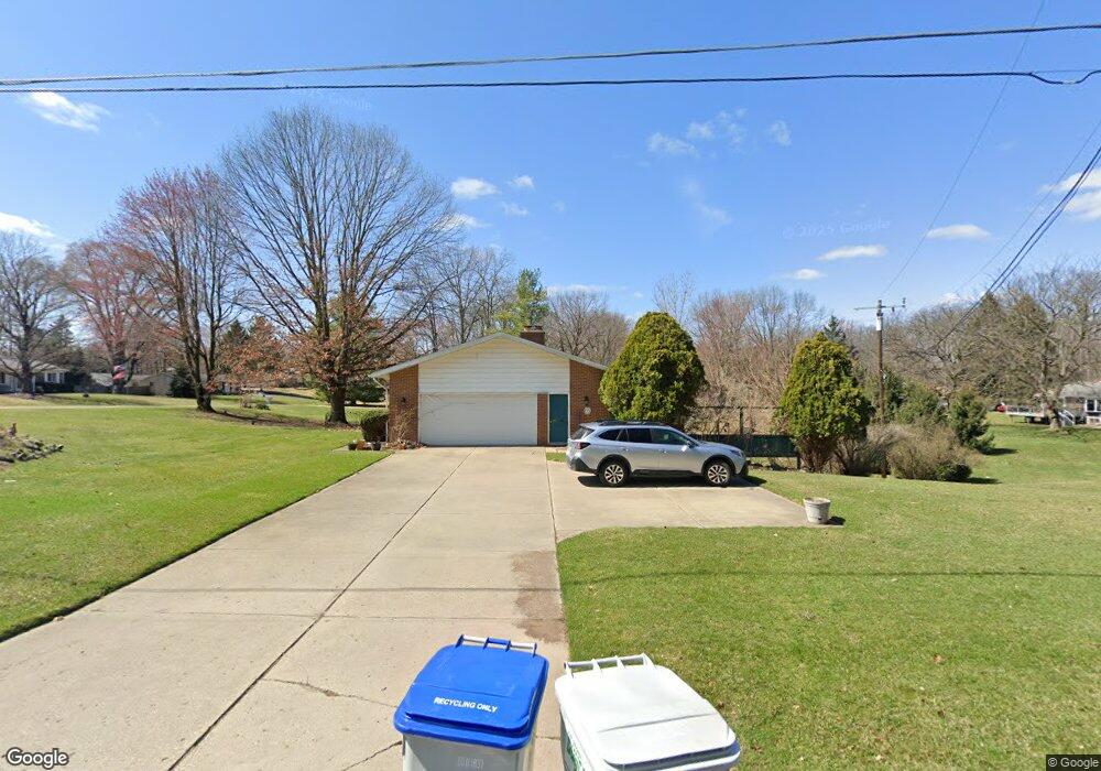
9211 Forest Edge Dr South Lyon, MI 48178
Estimated Value: $306,000 - $400,000
--
Bed
1
Bath
1,067
Sq Ft
$337/Sq Ft
Est. Value
About This Home
This home is located at 9211 Forest Edge Dr, South Lyon, MI 48178 and is currently estimated at $359,956, approximately $337 per square foot. 9211 Forest Edge Dr is a home located in Livingston County with nearby schools including William A. Brummer Elementary School, Centennial Middle School, and South Lyon High School.
Ownership History
Date
Name
Owned For
Owner Type
Purchase Details
Closed on
May 30, 2003
Sold by
Pearce Dennis D and Pearce Laura L
Bought by
Crumley Kevin
Current Estimated Value
Home Financials for this Owner
Home Financials are based on the most recent Mortgage that was taken out on this home.
Original Mortgage
$184,500
Outstanding Balance
$81,523
Interest Rate
5.9%
Mortgage Type
Purchase Money Mortgage
Estimated Equity
$278,433
Create a Home Valuation Report for This Property
The Home Valuation Report is an in-depth analysis detailing your home's value as well as a comparison with similar homes in the area
Home Values in the Area
Average Home Value in this Area
Purchase History
| Date | Buyer | Sale Price | Title Company |
|---|---|---|---|
| Crumley Kevin | $204,900 | Eit Title |
Source: Public Records
Mortgage History
| Date | Status | Borrower | Loan Amount |
|---|---|---|---|
| Open | Crumley Kevin | $184,500 |
Source: Public Records
Tax History Compared to Growth
Tax History
| Year | Tax Paid | Tax Assessment Tax Assessment Total Assessment is a certain percentage of the fair market value that is determined by local assessors to be the total taxable value of land and additions on the property. | Land | Improvement |
|---|---|---|---|---|
| 2025 | $2,898 | $149,200 | $0 | $0 |
| 2024 | $1,952 | $138,500 | $0 | $0 |
| 2023 | $1,862 | $128,300 | $0 | $0 |
| 2022 | $2,366 | $97,000 | $0 | $0 |
| 2021 | $2,366 | $109,000 | $0 | $0 |
| 2020 | $2,355 | $108,400 | $0 | $0 |
| 2019 | $2,378 | $97,000 | $0 | $0 |
| 2018 | $2,345 | $90,600 | $0 | $0 |
| 2017 | $2,382 | $89,200 | $0 | $0 |
| 2016 | $2,417 | $87,000 | $0 | $0 |
| 2014 | $2,340 | $77,000 | $0 | $0 |
| 2012 | $2,340 | $70,500 | $0 | $0 |
Source: Public Records
Map
Nearby Homes
- 12192 Doane Rd
- 11904 Moose Ridge Dr
- 51 Deanna Kay Ct Unit 51
- 50 Deanna Kay Ct Unit 50
- 9870 Cambridge Ct Unit 2
- 9920 Cambridge Ct
- 37 Janes Landing Unit 37
- 28 Loretta Ln Unit 28
- 47 Loretta Ln Unit 47
- 64 Loretta Ln Unit 64
- 25 Loretta Ln Unit 25
- 48 Loretta Ln Unit 48
- 12459 Janes Landing Unit 41
- 12088 Pinebrook Ln
- 9931 Loretta Ln
- 12421 Cambridge Blvd Unit 4
- 12485 Cambridge Blvd Unit 2
- 12493 Cambridge Blvd Unit 44
- 11889 Shenandoah Dr Unit 3
- 12324 Nantucket Dr Unit 1
- 9387 Wild Oaks Cir
- 9397 Wild Oaks Cir
- 9396 Wild Oaks Cir
- 9221 Wild Oaks Cir
- 9386 Wild Oaks Cir
- 9377 Wild Oaks Cir Unit Bldg-Unit
- 9377 Wild Oaks Cir
- 9337 Forest Edge Dr
- 9371 Forest Edge Dr
- 9303 Forest Edge Dr
- 9376 Wild Oaks Cir
- 9367 Wild Oaks Cir
- 9231 Wild Oaks Cir
- 12222 Wild Oaks Cir
- 12145 Doane Rd
- 9241 Wild Oaks Cir
- 12292 Shady Oak Dr
- 9206 Wild Oaks Cir
- 12320 Shady Oak Dr
- 9224 Wild Oaks Cir