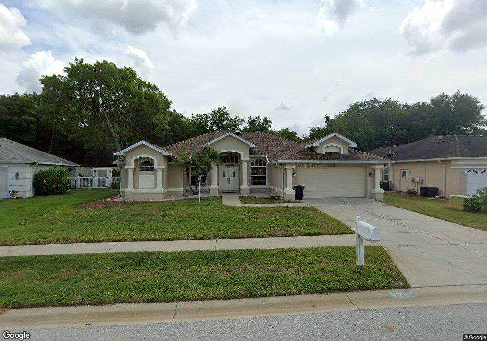
9211 Robin Nest Dr Hudson, FL 34669
Estimated Value: $317,000 - $404,000
Studio
2
Baths
2,235
Sq Ft
$161/Sq Ft
Est. Value
About This Home
This home is located at 9211 Robin Nest Dr, Hudson, FL 34669 and is currently estimated at $358,887, approximately $160 per square foot. 9211 Robin Nest Dr is a home located in Pasco County with nearby schools including West Pasco Education Academy, Hudson Middle School, and Fivay High School.
Ownership History
Date
Name
Owned For
Owner Type
Purchase Details
Closed on
Mar 18, 2016
Sold by
Efina Llc
Bought by
Paquin Doreen
Current Estimated Value
Purchase Details
Closed on
Apr 30, 2015
Sold by
Bank Of America Na
Bought by
Efina Llc
Purchase Details
Closed on
Mar 18, 2015
Sold by
Cornell Mcninney Patricia Gail and Cornell Dolores J
Bought by
Bank Of America Na
Purchase Details
Closed on
Jul 24, 2008
Sold by
Cornell Dolores J
Bought by
Cornell Mcninney Patricia Gail and Cornell Dolores J
Home Financials for this Owner
Home Financials are based on the most recent Mortgage that was taken out on this home.
Original Mortgage
$216,933
Interest Rate
6.21%
Mortgage Type
FHA
Create a Home Valuation Report for This Property
The Home Valuation Report is an in-depth analysis detailing your home's value as well as a comparison with similar homes in the area
Purchase History
| Date | Buyer | Sale Price | Title Company |
|---|---|---|---|
| Paquin Doreen | $180,000 | Peer Title Inc | |
| Efina Llc | $118,000 | Land Title Services | |
| Bank Of America Na | $88,700 | None Available | |
| Cornell Mcninney Patricia Gail | $97,000 | K E L Title Ins Agency Inc |
Source: Public Records
Mortgage History
| Date | Status | Borrower | Loan Amount |
|---|---|---|---|
| Previous Owner | Cornell Mcninney Patricia Gail | $216,933 |
Source: Public Records
Tax History
| Year | Tax Paid | Tax Assessment Tax Assessment Total Assessment is a certain percentage of the fair market value that is determined by local assessors to be the total taxable value of land and additions on the property. | Land | Improvement |
|---|---|---|---|---|
| 2026 | $2,353 | $177,480 | -- | -- |
| 2025 | $2,353 | $177,480 | -- | -- |
| 2024 | $2,353 | $167,620 | -- | -- |
| 2023 | $2,258 | $162,740 | $0 | $0 |
| 2022 | $2,020 | $158,000 | $0 | $0 |
| 2021 | $1,974 | $153,400 | $30,280 | $123,120 |
| 2020 | $1,938 | $151,290 | $19,081 | $132,209 |
| 2019 | $1,898 | $147,890 | $0 | $0 |
| 2018 | $1,857 | $145,133 | $0 | $0 |
| 2017 | $1,845 | $142,148 | $19,081 | $123,067 |
| 2016 | $2,421 | $137,465 | $19,081 | $118,384 |
| 2015 | $2,225 | $131,285 | $19,081 | $112,204 |
| 2014 | $1,903 | $106,697 | $15,348 | $91,349 |
Source: Public Records
Map
Nearby Homes
- 9315 Haas Dr
- 13615 Arden Dr
- 12125 Little Rd
- 9147 Duffer Ct
- 13842 Greyhawk Ct Unit 4
- 13748 Bryndlewood Ct
- 13632 Deventer Ct
- 9043 Tournament Dr
- 13625 Deventer Ct
- 8827 Helmsly Ln
- 13610 Glaze Brook Dr
- 9633 Norm St
- 9301 Tournament Dr
- 9607 Bud St
- 9104 Water Hazard Dr
- 9641 Norm St
- 8716 Helmsly Ln
- 9255 Grouse Way
- 9256 Water Hazard Dr
- 14136 Faldo Ct
- 9219 Robin Nest Dr
- 9203 Robin Nest Dr
- 9227 Robin Nest Dr
- 9212 Robin Nest Dr
- 9146 Robin Nest Dr
- 9220 Robin Nest Dr
- 9147 Robin Nest Dr
- 9228 Robin Nest Dr
- 9219 Debbie Ln
- 9143 Robin Nest Dr
- 13620 Lightning Rod Ct
- 13628 Lightning Rod Ct
- 9135 Robin Nest Dr
- 13614 Lightning Rod Ct
- 9150 Halberg Dr
- 9144 Halberg Dr
- 9138 Halberg Dr
- 9129 Robin Nest Dr
- 9206 Halberg Dr
- 9132 Halberg Dr