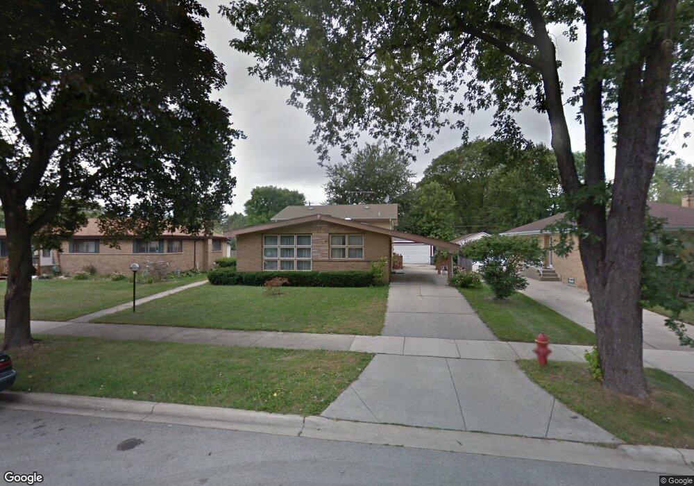
9218 Parkside Ave Morton Grove, IL 60053
Estimated Value: $442,000 - $537,000
3
Beds
3
Baths
1,500
Sq Ft
$333/Sq Ft
Est. Value
About This Home
This home is located at 9218 Parkside Ave, Morton Grove, IL 60053 and is currently estimated at $499,252, approximately $332 per square foot. 9218 Parkside Ave is a home located in Cook County with nearby schools including Park View Elementary School, Niles West High School, and Mesivta Shaarei Adirim.
Ownership History
Date
Name
Owned For
Owner Type
Purchase Details
Closed on
Nov 22, 2021
Sold by
Thomas Diamantis and Thomas Maria H
Bought by
Abdullah Samir Abdulrazaq and Suliman Rajaa
Current Estimated Value
Home Financials for this Owner
Home Financials are based on the most recent Mortgage that was taken out on this home.
Original Mortgage
$360,800
Outstanding Balance
$331,159
Interest Rate
3.11%
Mortgage Type
New Conventional
Estimated Equity
$168,093
Create a Home Valuation Report for This Property
The Home Valuation Report is an in-depth analysis detailing your home's value as well as a comparison with similar homes in the area
Home Values in the Area
Average Home Value in this Area
Purchase History
| Date | Buyer | Sale Price | Title Company |
|---|---|---|---|
| Abdullah Samir Abdulrazaq | $451,000 | Chicago Title |
Source: Public Records
Mortgage History
| Date | Status | Borrower | Loan Amount |
|---|---|---|---|
| Open | Abdullah Samir Abdulrazaq | $360,800 |
Source: Public Records
Tax History Compared to Growth
Tax History
| Year | Tax Paid | Tax Assessment Tax Assessment Total Assessment is a certain percentage of the fair market value that is determined by local assessors to be the total taxable value of land and additions on the property. | Land | Improvement |
|---|---|---|---|---|
| 2024 | $5,910 | $22,120 | $4,875 | $17,245 |
| 2023 | $6,088 | $22,120 | $4,875 | $17,245 |
| 2022 | $6,088 | $22,120 | $4,875 | $17,245 |
| 2021 | $3,524 | $13,984 | $3,000 | $10,984 |
| 2020 | $3,494 | $13,984 | $3,000 | $10,984 |
| 2019 | $3,535 | $15,713 | $3,000 | $12,713 |
| 2018 | $3,480 | $16,150 | $2,718 | $13,432 |
| 2017 | $5,134 | $16,150 | $2,718 | $13,432 |
| 2016 | $4,840 | $16,150 | $2,718 | $13,432 |
| 2015 | $4,516 | $14,014 | $2,343 | $11,671 |
| 2014 | $3,653 | $14,702 | $2,343 | $12,359 |
| 2013 | $3,620 | $14,702 | $2,343 | $12,359 |
Source: Public Records
Map
Nearby Homes
- 9234 Central Ave
- 5644 Lyons St
- 9224 Menard Ave
- 9314 Menard Ave
- 9320 Menard Ave
- 5449 Arcadia St
- 8918 Parkside Ave
- 5536 Greenwood St
- 5459 Suffield Ct
- 8841 Menard Ave
- 8836 Mansfield Ave
- 5352 Greenwood St
- 9539 Lorel Ave
- 5247 Suffield Ct
- 8849 Mcvicker Ave
- 8708 Central Ave
- 9508 Leamington Ave
- 9655 Woods Dr Unit P350
- 9655 Woods Dr Unit 1809
- 5128 Suffield Ct
- 9218 Parkside Ave
- 9212 Parkside Ave
- 9222 Parkside Ave
- 9224 Parkside Ave
- 9219 Major Ave
- 9215 Major Ave
- 5628 Church St
- 5628 Church St
- 5632 Church St
- 5632 Church St
- 9223 Major Ave
- 9228 Parkside Ave
- 5636 Church St
- 5636 Church St
- 9225 Major Ave
- 9211 Parkside Ave
- 9211 Parkside Ave
- 5640 Church St
- 5640 Church St
- 9219 Parkside Ave