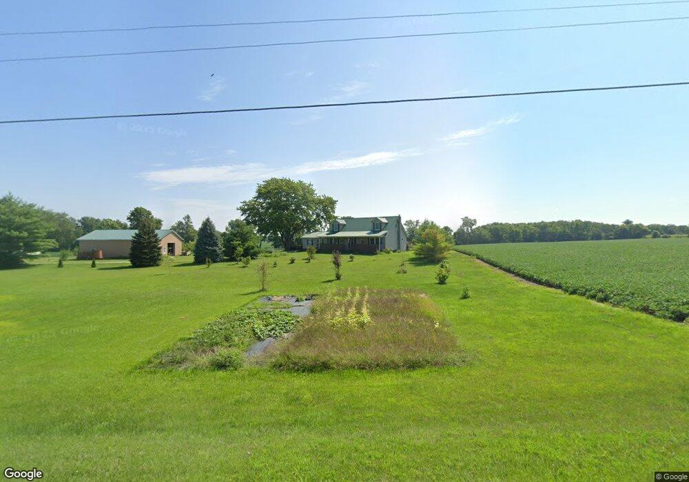
9218 State Route 638 Belle Center, OH 43310
Estimated Value: $302,000 - $324,737
3
Beds
3
Baths
1,906
Sq Ft
$163/Sq Ft
Est. Value
About This Home
This home is located at 9218 State Route 638, Belle Center, OH 43310 and is currently estimated at $310,184, approximately $162 per square foot. 9218 State Route 638 is a home located in Logan County with nearby schools including Benjamin Logan Elementary School, Benjamin Logan Middle School, and Benjamin Logan High School.
Ownership History
Date
Name
Owned For
Owner Type
Purchase Details
Closed on
Sep 14, 2020
Sold by
Hall Ralph O
Bought by
Fleming Alexandra L and Fleming Nicholas
Current Estimated Value
Home Financials for this Owner
Home Financials are based on the most recent Mortgage that was taken out on this home.
Original Mortgage
$225,834
Outstanding Balance
$200,413
Interest Rate
2.9%
Mortgage Type
FHA
Estimated Equity
$109,771
Create a Home Valuation Report for This Property
The Home Valuation Report is an in-depth analysis detailing your home's value as well as a comparison with similar homes in the area
Home Values in the Area
Average Home Value in this Area
Purchase History
| Date | Buyer | Sale Price | Title Company |
|---|---|---|---|
| Fleming Alexandra L | $115,000 | Mad River Title Agency |
Source: Public Records
Mortgage History
| Date | Status | Borrower | Loan Amount |
|---|---|---|---|
| Open | Fleming Alexandra L | $225,834 |
Source: Public Records
Tax History Compared to Growth
Tax History
| Year | Tax Paid | Tax Assessment Tax Assessment Total Assessment is a certain percentage of the fair market value that is determined by local assessors to be the total taxable value of land and additions on the property. | Land | Improvement |
|---|---|---|---|---|
| 2024 | $2,633 | $78,090 | $7,600 | $70,490 |
| 2023 | $2,633 | $78,090 | $7,600 | $70,490 |
| 2022 | $2,725 | $62,470 | $6,080 | $56,390 |
| 2021 | $2,340 | $62,470 | $6,080 | $56,390 |
| 2020 | $2,205 | $54,210 | $6,050 | $48,160 |
| 2019 | $2,214 | $54,210 | $6,050 | $48,160 |
| 2018 | $1,894 | $54,210 | $6,050 | $48,160 |
| 2016 | $1,762 | $48,290 | $5,500 | $42,790 |
| 2014 | $1,786 | $48,360 | $5,570 | $42,790 |
| 2013 | $1,773 | $48,360 | $5,570 | $42,790 |
| 2012 | $1,834 | $51,720 | $5,340 | $46,380 |
Source: Public Records
Map
Nearby Homes
- 301 Kendall St
- 307 E Main St
- 0 Ohio 273
- 402 N Elizabeth St
- . County Road 49
- 0 County Road 103
- 6836 County Road 101
- 9712 Heron Way
- 9792 Heron Way Unit Lot 52
- 9792 Heron Way Unit Lot 35
- 9722 Heron Way
- 9819 Heron Way
- 9820 Heron Way Unit Lot 32
- 0 C R 103 Unit 22337969
- 0 C R 103 Unit 225000597
- 0 County Road 37
- 8556
- 8556 State Route 117
- 212 S Sandusky St
- 2552 Township Road 37 W
- 9236 Ohio 638
- 9236 State Route 638
- 2083 Township Road 51 W
- 2083 W Tr 51
- 2049 Township Road 51 W
- 2029 Township Road 51 W
- 9269 State Route 638
- 1921 Township Road 51 W
- 1898 Township Road 51 W
- 8885 State Route 638
- 9560 State Route 638
- 8497 Township Road 107
- 8837 State Route 638
- 1783 Township Road 51 W
- 1723 Township Road 51 W
- 1723 Twp Rd 51
- 2639 Township Road 51 W
- 1685 Township Road 51 W
- 8531 Township Road 107