Estimated Value: $186,054 - $212,000
3
Beds
2
Baths
1,465
Sq Ft
$135/Sq Ft
Est. Value
About This Home
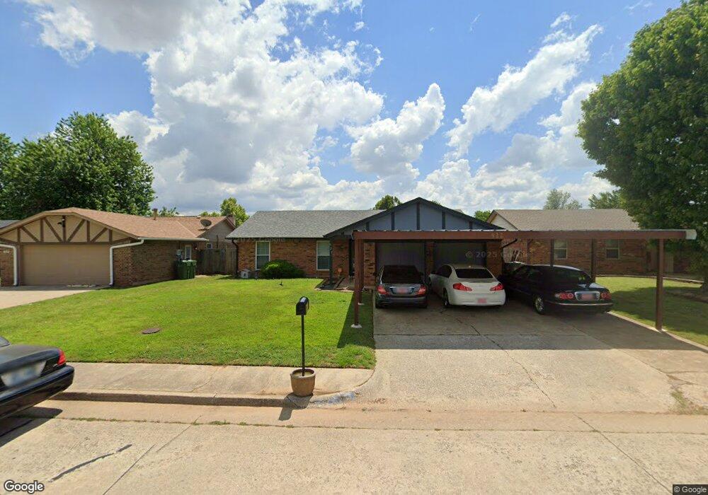
This home is located at 922 Brookhurst Blvd, Yukon, OK 73099 and is currently estimated at $197,764, approximately $134 per square foot. 922 Brookhurst Blvd is a home located in Canadian County with nearby schools including Skyview Elementary School, Lakeview Elementary School, and Yukon Middle School.
Ownership History
Date
Name
Owned For
Owner Type
Purchase Details
Closed on
Feb 23, 2007
Sold by
Votaw Lou Edith and Wallace Lou Edith
Bought by
Rogers John
Current Estimated Value
Home Financials for this Owner
Home Financials are based on the most recent Mortgage that was taken out on this home.
Original Mortgage
$109,017
Outstanding Balance
$65,333
Interest Rate
6.17%
Mortgage Type
FHA
Estimated Equity
$132,431
Purchase Details
Closed on
Jun 6, 2003
Sold by
Vetoyanis Christopher~Steven
Create a Home Valuation Report for This Property
The Home Valuation Report is an in-depth analysis detailing your home's value as well as a comparison with similar homes in the area
Home Values in the Area
Average Home Value in this Area
Purchase History
| Date | Buyer | Sale Price | Title Company |
|---|---|---|---|
| Rogers John | $82,500 | None Available | |
| -- | -- | -- |
Source: Public Records
Mortgage History
| Date | Status | Borrower | Loan Amount |
|---|---|---|---|
| Open | Rogers John | $109,017 |
Source: Public Records
Tax History Compared to Growth
Tax History
| Year | Tax Paid | Tax Assessment Tax Assessment Total Assessment is a certain percentage of the fair market value that is determined by local assessors to be the total taxable value of land and additions on the property. | Land | Improvement |
|---|---|---|---|---|
| 2024 | $1,502 | $15,313 | $1,980 | $13,333 |
| 2023 | $1,502 | $14,867 | $1,980 | $12,887 |
| 2022 | $1,462 | $14,434 | $1,980 | $12,454 |
| 2021 | $1,421 | $14,014 | $1,980 | $12,034 |
| 2020 | $1,359 | $13,606 | $1,980 | $11,626 |
| 2019 | $1,321 | $13,209 | $1,980 | $11,229 |
| 2018 | $1,283 | $12,825 | $1,980 | $10,845 |
| 2017 | $1,243 | $12,451 | $1,980 | $10,471 |
| 2016 | $1,211 | $12,151 | $1,980 | $10,171 |
| 2015 | $1,153 | $11,802 | $1,980 | $9,822 |
| 2014 | $1,153 | $11,458 | $1,980 | $9,478 |
Source: Public Records
Map
Nearby Homes
- 804 Royal Ln
- 1052 Royal Ln
- 1001 Cambridge Dr
- 1051 Royal Ln
- 723 Garden Grove
- 732 Royal Ln
- 736 Mabel C Fry Blvd
- 1033 Linn Ln
- 1100 Kingsway Ave
- 1040 Mabel C Fry Blvd
- 1004 Ranchoak Ct
- 3225 Pagoda Pead Dr
- 609 Crown Dr
- 1119 Oakwood Dr
- 761 Okie Ridge Rd
- 301 S Yukon Pkwy
- 1300 Katelyn Ct
- 1304 Katelyn Ct
- 1129 Cambridge Dr
- 9209 NW 147th Terrace
- 920 Brookhurst Blvd
- 924 Brookhurst Blvd
- 918 Brookhurst Blvd
- 923 Hampton Cir
- 926 Brookhurst Blvd
- 925 Hampton Cir
- 916 Brookhurst Blvd
- 921 Hampton Cir
- 923 Brookhurst Blvd
- 927 Hampton Cir
- 925 Brookhurst Blvd
- 921 Brookhurst Blvd
- 928 Brookhurst Blvd
- 919 Brookhurst Blvd
- 914 Brookhurst Blvd
- 929 Hampton Cir
- 920 Hampton Cir
- 941 Clear Creek
- 930 Brookhurst Blvd
- 917 Brookhurst Blvd