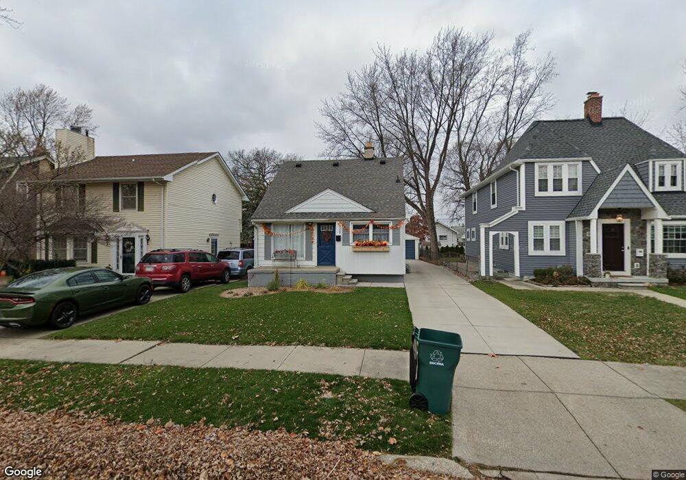
922 Cambridge Rd Berkley, MI 48072
Estimated Value: $334,571 - $399,000
5
Beds
2
Baths
1,358
Sq Ft
$280/Sq Ft
Est. Value
About This Home
This home is located at 922 Cambridge Rd, Berkley, MI 48072 and is currently estimated at $380,393, approximately $280 per square foot. 922 Cambridge Rd is a home located in Oakland County with nearby schools including Northwood Elementary School, Royal Oak Middle School, and Royal Oak High School.
Ownership History
Date
Name
Owned For
Owner Type
Purchase Details
Closed on
Jun 9, 2014
Sold by
Huffer Michael and Huffer Patricia J
Bought by
Olmstead Susan E
Current Estimated Value
Home Financials for this Owner
Home Financials are based on the most recent Mortgage that was taken out on this home.
Original Mortgage
$107,855
Outstanding Balance
$81,470
Interest Rate
4.25%
Mortgage Type
FHA
Estimated Equity
$298,923
Purchase Details
Closed on
Apr 28, 2010
Sold by
Olmstead Susan E and Olmstead Susan
Bought by
Huffer Michael E and Huffer Patricia J
Purchase Details
Closed on
Apr 6, 2010
Sold by
Olmstead Susan and Household Finance Corporation
Bought by
Huffer Michael
Purchase Details
Closed on
Jun 16, 1999
Sold by
Hawkins Jeffery
Bought by
Hawkins Susan
Create a Home Valuation Report for This Property
The Home Valuation Report is an in-depth analysis detailing your home's value as well as a comparison with similar homes in the area
Home Values in the Area
Average Home Value in this Area
Purchase History
We collect this data history from publicly available records. To have your information removed, we recommend requesting removal directly through your county’s website.
| Date | Buyer | Sale Price | Title Company |
|---|---|---|---|
| Olmstead Susan E | $75,000 | Diversified National Title | |
| Huffer Michael E | $24,504 | None Available | |
| Huffer Michael | $24,504 | None Available | |
| Hawkins Susan | -- | -- |
Source: Public Records
Mortgage History
We collect this data history from publicly available records. To have your information removed, we recommend requesting removal directly through your county’s website.
| Date | Status | Borrower | Loan Amount |
|---|---|---|---|
| Open | Olmstead Susan E | $107,855 |
Source: Public Records
Tax History
| Year | Tax Paid | Tax Assessment Tax Assessment Total Assessment is a certain percentage of the fair market value that is determined by local assessors to be the total taxable value of land and additions on the property. | Land | Improvement |
|---|---|---|---|---|
| 2025 | $4,618 | $141,380 | $0 | $0 |
| 2024 | $4,278 | $134,350 | $0 | $0 |
| 2023 | $3,932 | $126,200 | $0 | $0 |
| 2022 | $4,241 | $117,490 | $0 | $0 |
| 2021 | $4,982 | $111,610 | $0 | $0 |
| 2020 | $2,719 | $107,410 | $0 | $0 |
| 2019 | $3,791 | $101,740 | $0 | $0 |
| 2018 | $3,536 | $96,000 | $0 | $0 |
| 2017 | $3,459 | $94,810 | $0 | $0 |
| 2016 | $3,472 | $89,780 | $0 | $0 |
| 2015 | -- | $85,650 | $0 | $0 |
| 2014 | -- | $75,770 | $0 | $0 |
| 2011 | -- | $66,620 | $0 | $0 |
Source: Public Records
Map
Nearby Homes
- 1149 Cambridge Rd
- 1174 Columbia Rd
- 1802 W Farnum Ave
- 404 Josephine Ave
- 917 Maplegrove Ave
- 300-304 Baker St
- 304 Baker St
- 300 Baker St
- 1404 11 Mile Rd
- 1868 Cass Blvd
- 1349 West Blvd
- 10454 Borgman Ave
- 1377 Dorothea Rd
- 516 Woodcrest Dr
- 1440 Catalpa Dr
- 1247 Franklin Rd
- 1265 Franklin Rd
- 1664 11 Mile Rd
- 1109 Catalpa Dr
- 1202 Catalpa Dr
- 930 Cambridge Rd
- 948 Cambridge Rd
- 920 Cambridge Rd
- 960 Cambridge Rd
- 878 Cambridge Rd
- 921 Harvard Rd
- 972 Cambridge Rd
- 929 Harvard Rd
- 909 Harvard Rd
- 947 Harvard Rd Unit Bldg-Unit
- 947 Harvard Rd
- 959 Harvard Rd
- 984 Cambridge Rd
- 877 Harvard Rd
- 921 Cambridge Rd
- 929 Cambridge Rd
- 909 Cambridge Rd
- 947 Cambridge Rd
- 866 Cambridge Rd
- 971 Harvard Rd
Your Personal Tour Guide
Ask me questions while you tour the home.