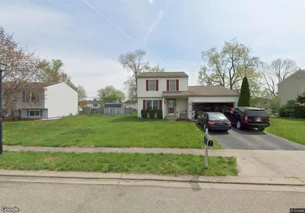
922 Lateglow Ct Newark, OH 43055
Estimated Value: $286,000 - $308,000
3
Beds
2
Baths
1,500
Sq Ft
$196/Sq Ft
Est. Value
About This Home
This home is located at 922 Lateglow Ct, Newark, OH 43055 and is currently estimated at $294,600, approximately $196 per square foot. 922 Lateglow Ct is a home located in Licking County with nearby schools including Legend Elementary School, Liberty Middle School, and Newark High School.
Ownership History
Date
Name
Owned For
Owner Type
Purchase Details
Closed on
Jun 21, 2019
Sold by
Emde Michael W
Bought by
Emde Mindi K and Wood Mindi K
Current Estimated Value
Purchase Details
Closed on
Jan 29, 2003
Sold by
Shr Matthew Breshears Pr
Bought by
Bank One
Purchase Details
Closed on
Oct 3, 1996
Sold by
Sovereign Dev Corp
Bought by
Al Matthew W Breshears
Home Financials for this Owner
Home Financials are based on the most recent Mortgage that was taken out on this home.
Original Mortgage
$110,941
Interest Rate
8%
Mortgage Type
FHA
Purchase Details
Closed on
Jun 17, 1996
Sold by
Owen Potato Farm Inc
Bought by
Sovereign Dev Corp
Create a Home Valuation Report for This Property
The Home Valuation Report is an in-depth analysis detailing your home's value as well as a comparison with similar homes in the area
Home Values in the Area
Average Home Value in this Area
Purchase History
| Date | Buyer | Sale Price | Title Company |
|---|---|---|---|
| Emde Mindi K | -- | None Available | |
| Bank One | $108,699 | -- | |
| Al Matthew W Breshears | $113,800 | -- | |
| Sovereign Dev Corp | $20,000 | -- |
Source: Public Records
Mortgage History
| Date | Status | Borrower | Loan Amount |
|---|---|---|---|
| Previous Owner | Al Matthew W Breshears | $110,941 |
Source: Public Records
Tax History
| Year | Tax Paid | Tax Assessment Tax Assessment Total Assessment is a certain percentage of the fair market value that is determined by local assessors to be the total taxable value of land and additions on the property. | Land | Improvement |
|---|---|---|---|---|
| 2024 | $2,769 | $77,460 | $23,700 | $53,760 |
| 2023 | $2,764 | $77,460 | $23,700 | $53,760 |
| 2022 | $2,194 | $54,710 | $13,830 | $40,880 |
| 2021 | $2,300 | $54,710 | $13,830 | $40,880 |
| 2020 | $2,358 | $54,710 | $13,830 | $40,880 |
| 2019 | $2,237 | $50,090 | $9,210 | $40,880 |
| 2018 | $2,227 | $0 | $0 | $0 |
| 2017 | $1,930 | $0 | $0 | $0 |
| 2016 | $1,691 | $0 | $0 | $0 |
| 2015 | $1,727 | $0 | $0 | $0 |
| 2014 | $2,213 | $0 | $0 | $0 |
| 2013 | $1,823 | $0 | $0 | $0 |
Source: Public Records
Map
Nearby Homes
- 1001 Kingsbury Ct Unit 1001
- 584 Moull St Unit A
- 508 Moull St
- 730 Maxola Ave
- 188 Meadow Dr
- 184 Meadow Dr
- 731 Grafton Rd
- 476 W Shields St
- 979 Granville Rd
- 565 Granville St
- 574 Blakeley Place Unit 574
- 222 Bachmann Ave
- 189 N Quentin Rd
- 408 Granville St
- 158 English Ave
- 361 Granville St
- 655 Evans St
- 32 Cottage St
- 34 Charles St
- 567 Kibler Ave
- 916 Lateglow Ct
- 930 Lateglow Ct
- 921 Adams Ave
- 913 Adams Ave
- 938 Late Glow Ct
- 938 Lateglow Ct
- 929 Adams Ave
- 907 Adams Ave
- 906 Lateglow Ct
- 927 Lateglow Ct
- 935 Adams Ave
- 935 Late Glow Ct
- 903 Adams Ave
- 946 Lateglow Ct
- 935 Lateglow Ct
- 907 Lateglow Ct
- 898 Lateglow Ct
- 943 Adams Ave
- 895 Adams Ave
- 912 Adams Ave
Your Personal Tour Guide
Ask me questions while you tour the home.