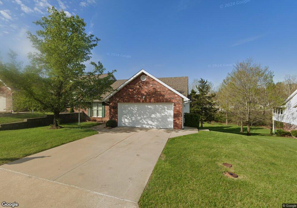
922 Manassas Place Jefferson City, MO 65109
Estimated Value: $322,000 - $359,000
2
Beds
3
Baths
1,774
Sq Ft
$189/Sq Ft
Est. Value
About This Home
This home is located at 922 Manassas Place, Jefferson City, MO 65109 and is currently estimated at $335,809, approximately $189 per square foot. 922 Manassas Place is a home located in Cole County with nearby schools including South Elementary School, Thomas Jefferson Middle School, and Capital City High School.
Ownership History
Date
Name
Owned For
Owner Type
Purchase Details
Closed on
Jul 12, 2024
Sold by
Odonnell John D and Odonnel Mildred
Bought by
Stevens Allen and Stevens Joyce
Current Estimated Value
Home Financials for this Owner
Home Financials are based on the most recent Mortgage that was taken out on this home.
Original Mortgage
$280,000
Outstanding Balance
$276,681
Interest Rate
7.03%
Mortgage Type
New Conventional
Estimated Equity
$59,128
Create a Home Valuation Report for This Property
The Home Valuation Report is an in-depth analysis detailing your home's value as well as a comparison with similar homes in the area
Home Values in the Area
Average Home Value in this Area
Purchase History
| Date | Buyer | Sale Price | Title Company |
|---|---|---|---|
| Stevens Allen | -- | None Listed On Document |
Source: Public Records
Mortgage History
| Date | Status | Borrower | Loan Amount |
|---|---|---|---|
| Open | Stevens Allen | $280,000 |
Source: Public Records
Tax History Compared to Growth
Tax History
| Year | Tax Paid | Tax Assessment Tax Assessment Total Assessment is a certain percentage of the fair market value that is determined by local assessors to be the total taxable value of land and additions on the property. | Land | Improvement |
|---|---|---|---|---|
| 2025 | $2,528 | $47,900 | $0 | $47,900 |
| 2024 | $2,528 | $42,390 | $0 | $42,390 |
| 2023 | $2,528 | $42,390 | $0 | $42,390 |
| 2022 | $2,536 | $42,390 | $0 | $42,390 |
| 2021 | $2,550 | $42,390 | $0 | $42,390 |
| 2020 | $2,581 | $45,068 | $0 | $45,068 |
| 2019 | $2,510 | $43,472 | $0 | $43,472 |
| 2018 | $2,507 | $42,522 | $0 | $42,522 |
| 2017 | $2,447 | $42,389 | $0 | $42,389 |
| 2016 | $2,085 | $42,389 | $0 | $42,389 |
| 2015 | $2,092 | $0 | $0 | $0 |
| 2014 | $2,092 | $42,389 | $0 | $42,389 |
Source: Public Records
Map
Nearby Homes
- 3515 Gettysburg Place
- 0 Wildwood Dr
- 732 Hobbs Rd
- TBD Carriage Ct
- 0 Carriage Ct
- 801 S Country Club Dr
- 710 Sardonyx Dr
- 4014 New Bedford Ct
- 3131 Country Club Dr
- 3120 Country Club Dr
- 1104 Fairgrounds Rd
- 3010 Oak Valley Dr
- 2901 Kenborg Hills
- 617 S Eagle Trace
- 401 Windridge Ct
- 4507 Merry Ln
- 3520 W Truman Blvd
- 3242 W Truman Blvd
- 415 Turnberry Dr
- 3816 Candlelight Dr
- 924 Manassas Place
- 918 Manassas Place
- 928 Manassas Place
- 916 Manassas Place
- 919 Manassas Place
- 930 Manassas Place
- 917 Manassas Place
- 923 Manassas Place
- 3480 Gettysburg Place
- 913 Manassas Place
- 925 Manassas Place
- 912 Manassas Place
- 3482 Gettysburg Place
- 911 Manassas Place
- 910 Manassas Place
- 920 Shiloh Place
- 914 Shiloh Place
- 906 Manassas Place
- 912 Shiloh Place
- 925 Sumter Place