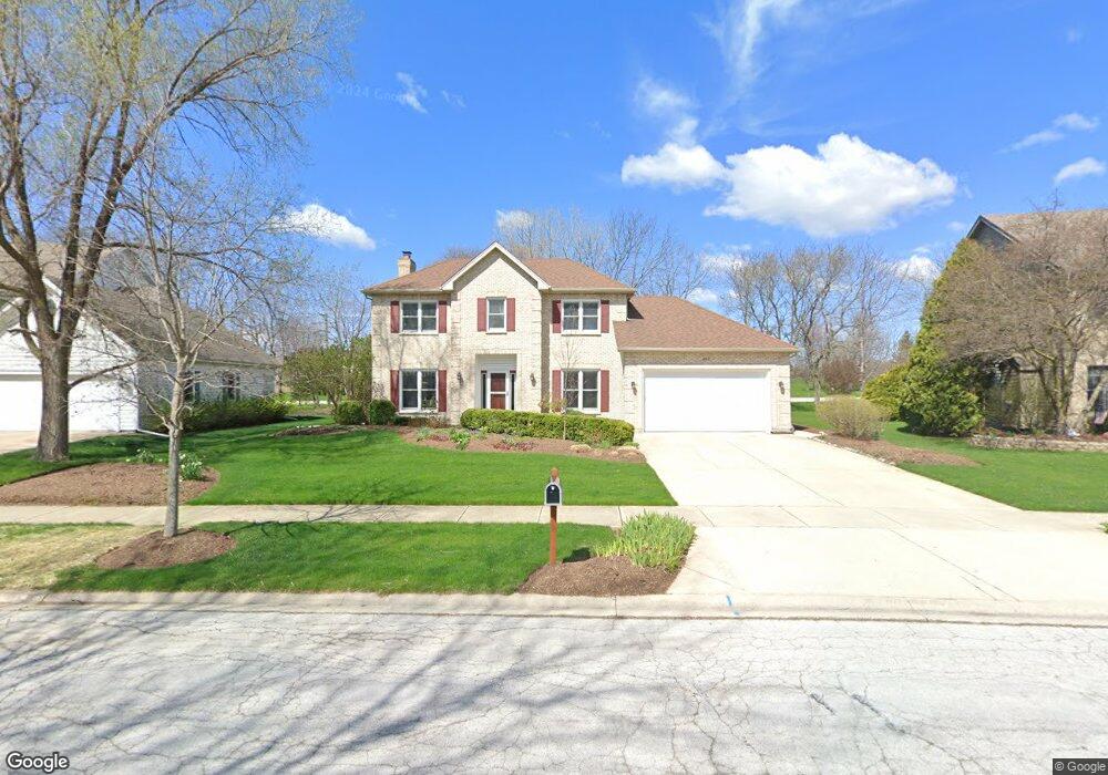
922 Merrill New Rd Sugar Grove, IL 60554
Estimated Value: $456,000 - $534,000
--
Bed
--
Bath
2,378
Sq Ft
$207/Sq Ft
Est. Value
About This Home
This home is located at 922 Merrill New Rd, Sugar Grove, IL 60554 and is currently estimated at $493,205, approximately $207 per square foot. 922 Merrill New Rd is a home located in Kane County with nearby schools including Kaneland Mcdole Elementary School, Harter Middle School, and Kaneland High School.
Ownership History
Date
Name
Owned For
Owner Type
Purchase Details
Closed on
Jul 10, 1998
Sold by
Hawkins Bryan E and Hawkins Cynthia L
Bought by
Stoll Arthur and Stoll Jennifer
Current Estimated Value
Home Financials for this Owner
Home Financials are based on the most recent Mortgage that was taken out on this home.
Original Mortgage
$75,000
Outstanding Balance
$15,415
Interest Rate
7.05%
Estimated Equity
$477,790
Purchase Details
Closed on
Jun 26, 1996
Sold by
Janeway Timothy A
Bought by
Hawkins Bryan E and Hawkins Cynthia L
Home Financials for this Owner
Home Financials are based on the most recent Mortgage that was taken out on this home.
Original Mortgage
$152,480
Interest Rate
8.13%
Create a Home Valuation Report for This Property
The Home Valuation Report is an in-depth analysis detailing your home's value as well as a comparison with similar homes in the area
Home Values in the Area
Average Home Value in this Area
Purchase History
| Date | Buyer | Sale Price | Title Company |
|---|---|---|---|
| Stoll Arthur | $239,000 | -- | |
| Hawkins Bryan E | $191,000 | Chicago Title Insurance Co |
Source: Public Records
Mortgage History
| Date | Status | Borrower | Loan Amount |
|---|---|---|---|
| Open | Stoll Arthur | $75,000 | |
| Previous Owner | Hawkins Bryan E | $152,480 |
Source: Public Records
Tax History Compared to Growth
Tax History
| Year | Tax Paid | Tax Assessment Tax Assessment Total Assessment is a certain percentage of the fair market value that is determined by local assessors to be the total taxable value of land and additions on the property. | Land | Improvement |
|---|---|---|---|---|
| 2024 | $10,856 | $135,891 | $32,234 | $103,657 |
| 2023 | $10,497 | $122,557 | $29,071 | $93,486 |
| 2022 | $10,101 | $113,143 | $26,838 | $86,305 |
| 2021 | $10,101 | $107,674 | $25,541 | $82,133 |
| 2020 | $9,596 | $105,377 | $24,996 | $80,381 |
| 2019 | $9,448 | $101,932 | $24,179 | $77,753 |
| 2018 | $8,907 | $94,232 | $24,242 | $69,990 |
| 2017 | $8,632 | $89,994 | $23,152 | $66,842 |
| 2016 | $8,425 | $86,028 | $22,132 | $63,896 |
| 2015 | -- | $81,259 | $20,592 | $60,667 |
| 2014 | -- | $77,700 | $19,690 | $58,010 |
| 2013 | -- | $78,517 | $19,897 | $58,620 |
Source: Public Records
Map
Nearby Homes
- 905 Merrill New Rd
- 611 Pine St
- 757 Merrill New Rd Unit 7
- 868 Edgewood Dr
- 1070 Wheatfield Ave
- 933 Lakeridge Ct
- 947 Lakeridge Ct
- 954 Black Walnut Dr
- 706 Brighton Dr
- 670 Sheffield Cir
- Lot 30 Chestnut Hill Ln
- 684 Greenfield Rd
- 693 Greenfield Rd
- 966 Wheatfield Ave
- 781 Manor Hill Place
- 7 Douglas Dr Unit 3
- 778 Black Walnut Ct
- 917 Wheatfield Ave
- 905 Wheatfield Ave
- 778 Wheatfield Ave
- 920 Merrill New Rd Unit 1
- 924 Merrill New Rd Unit 1
- 918 Merrill New Rd Unit 1
- 926 Merrill New Rd
- 923 Merrill New Rd
- 921 Merrill New Rd Unit 1
- 916 Merrill New Rd
- 919 Merrill New Rd Unit 1
- 925 Merrill New Rd Unit 1
- 914 Merrill New Rd Unit 1
- 917 Merrill New Rd Unit 1
- 938 Stamford Place
- 936 Stamford Place Unit 9
- 915 Merrill New Rd
- 912 Merrill New Rd Unit 1
- 934 Stamford Place
- 913 Merrill New Rd
- 910 Merrill New Rd
- 931 Merrill New Rd
- 939 Stamford Place