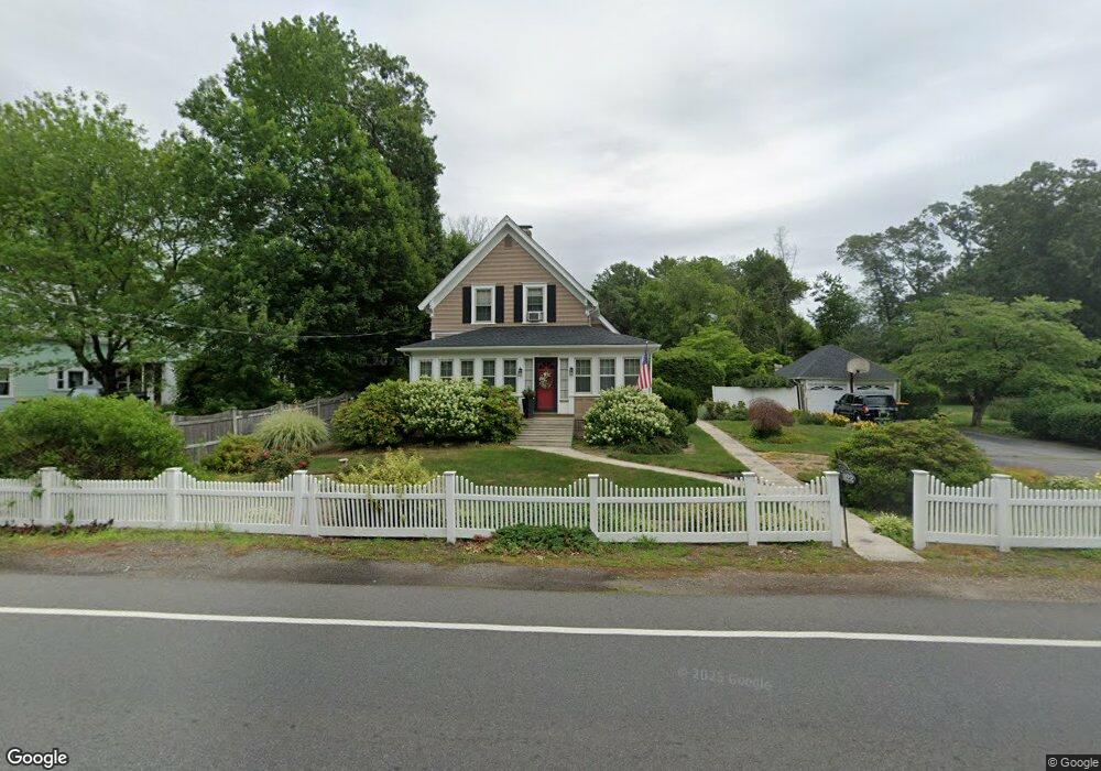
922 Plymouth St Abington, MA 02351
Estimated Value: $532,000 - $617,000
3
Beds
2
Baths
1,420
Sq Ft
$406/Sq Ft
Est. Value
About This Home
This home is located at 922 Plymouth St, Abington, MA 02351 and is currently estimated at $575,931, approximately $405 per square foot. 922 Plymouth St is a home located in Plymouth County with nearby schools including Beaver Brook Elementary School, Abington Middle School, and Woodsdale School.
Ownership History
Date
Name
Owned For
Owner Type
Purchase Details
Closed on
Jan 7, 2011
Sold by
Ricci Alfred W and Ricci Diane M
Bought by
Ricci Tr Alfred W and Ricci Diane M
Current Estimated Value
Purchase Details
Closed on
Sep 22, 2010
Sold by
Ricci Tr Alfred W and Ricci Diane M
Bought by
Ricci Diane M and Ricci Alfred W
Home Financials for this Owner
Home Financials are based on the most recent Mortgage that was taken out on this home.
Original Mortgage
$234,000
Interest Rate
4.48%
Mortgage Type
Purchase Money Mortgage
Purchase Details
Closed on
Jun 26, 2009
Sold by
Ricci Alfred W and Ricci Diane M
Bought by
T A
Purchase Details
Closed on
Jun 1, 1985
Bought by
Ricci Alfred W and Ricci Diane M
Create a Home Valuation Report for This Property
The Home Valuation Report is an in-depth analysis detailing your home's value as well as a comparison with similar homes in the area
Home Values in the Area
Average Home Value in this Area
Purchase History
| Date | Buyer | Sale Price | Title Company |
|---|---|---|---|
| Ricci Tr Alfred W | -- | -- | |
| Ricci Diane M | -- | -- | |
| T A | -- | -- | |
| Ricci Alfred W | $108,000 | -- |
Source: Public Records
Mortgage History
| Date | Status | Borrower | Loan Amount |
|---|---|---|---|
| Previous Owner | Ricci Diane M | $234,000 | |
| Previous Owner | Ricci Alfred W | $235,000 | |
| Previous Owner | Ricci Alfred W | $70,000 |
Source: Public Records
Tax History Compared to Growth
Tax History
| Year | Tax Paid | Tax Assessment Tax Assessment Total Assessment is a certain percentage of the fair market value that is determined by local assessors to be the total taxable value of land and additions on the property. | Land | Improvement |
|---|---|---|---|---|
| 2025 | $6,192 | $474,100 | $247,400 | $226,700 |
| 2024 | $6,088 | $455,000 | $225,700 | $229,300 |
| 2023 | $6,025 | $424,000 | $197,300 | $226,700 |
| 2022 | $5,831 | $383,100 | $173,700 | $209,400 |
| 2021 | $12,973 | $332,000 | $158,300 | $173,700 |
| 2020 | $5,557 | $326,900 | $153,700 | $173,200 |
| 2019 | $5,806 | $301,900 | $146,800 | $155,100 |
| 2018 | $4,391 | $291,400 | $146,800 | $144,600 |
| 2017 | $3,823 | $271,000 | $146,800 | $124,200 |
| 2016 | $4,730 | $263,800 | $140,200 | $123,600 |
| 2015 | $4,476 | $263,300 | $140,200 | $123,100 |
Source: Public Records
Map
Nearby Homes
- 800 Plymouth St
- 137 Peregrine Rd
- 679 Plymouth St
- 158 Central St
- 64 Centre Ave Unit 1
- 608 Plymouth St
- 87 Summer St
- 133 Spring St
- 10 Bank St
- 14 Daniel Teague Dr
- 40 Bedford St
- 170 Pleasant St
- 89 Andrew Ford Way
- 37 Rockland St
- 133 Andrew Ford Way
- 40 Lazel St
- 17 Pat Rose Way
- 20 Pat Rose Way
- 63 Dewey Ave
- 8 Pat Rose Way
- 932 Plymouth St
- 942 Plymouth St
- 937 Plymouth St
- 937 Plymouth St Unit 2
- 896 Plymouth St
- 30 Captain Standish Dr
- 905 Plymouth St
- 551 Summer St
- 960 Plymouth St
- 895 Plymouth St
- 957 Plymouth St
- 563 Summer St
- 20 Hersey Ln
- 30 Hersey Ln
- 527 Summer St
- 573 Summer St
- 34 Captain Standish Dr
- 880 Plymouth St
- 880 Plymouth St Unit B
- 42 Hersey Ln