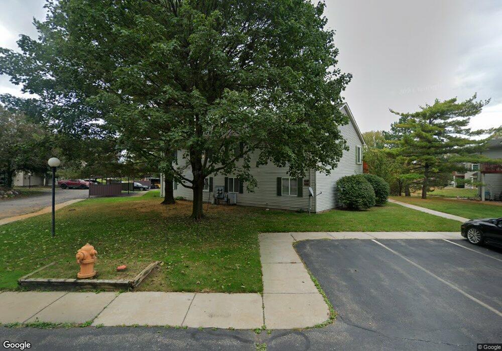
922 Saybrook Dr Unit 17 Waterford, MI 48327
Waterford Township NeighborhoodEstimated Value: $133,424 - $201,000
2
Beds
2
Baths
1,108
Sq Ft
$143/Sq Ft
Est. Value
About This Home
This home is located at 922 Saybrook Dr Unit 17, Waterford, MI 48327 and is currently estimated at $158,356, approximately $142 per square foot. 922 Saybrook Dr Unit 17 is a home located in Oakland County with nearby schools including Riverside Elementary School, Pierce Middle School, and Waterford Mott High School.
Ownership History
Date
Name
Owned For
Owner Type
Purchase Details
Closed on
May 17, 2004
Sold by
Blue Alice G and Mero Annmarie
Bought by
Carroll Cynthia L
Current Estimated Value
Home Financials for this Owner
Home Financials are based on the most recent Mortgage that was taken out on this home.
Original Mortgage
$114,000
Outstanding Balance
$54,987
Interest Rate
5.91%
Mortgage Type
Purchase Money Mortgage
Estimated Equity
$103,369
Purchase Details
Closed on
Nov 7, 2001
Sold by
Blue Alice G
Bought by
Blue Alice G
Purchase Details
Closed on
Jul 14, 1999
Sold by
Paser Beverly
Bought by
Blue Alice G
Purchase Details
Closed on
Oct 27, 1994
Sold by
Podleski Gregg T
Bought by
Paser Beverly
Home Financials for this Owner
Home Financials are based on the most recent Mortgage that was taken out on this home.
Original Mortgage
$69,000
Interest Rate
8.86%
Create a Home Valuation Report for This Property
The Home Valuation Report is an in-depth analysis detailing your home's value as well as a comparison with similar homes in the area
Home Values in the Area
Average Home Value in this Area
Purchase History
| Date | Buyer | Sale Price | Title Company |
|---|---|---|---|
| Carroll Cynthia L | $114,000 | Interstate Title Inc | |
| Blue Alice G | -- | -- | |
| Blue Alice G | $96,900 | -- | |
| Paser Beverly | $73,000 | -- |
Source: Public Records
Mortgage History
| Date | Status | Borrower | Loan Amount |
|---|---|---|---|
| Open | Carroll Cynthia L | $114,000 | |
| Previous Owner | Paser Beverly | $69,000 |
Source: Public Records
Tax History Compared to Growth
Tax History
| Year | Tax Paid | Tax Assessment Tax Assessment Total Assessment is a certain percentage of the fair market value that is determined by local assessors to be the total taxable value of land and additions on the property. | Land | Improvement |
|---|---|---|---|---|
| 2024 | $817 | $62,120 | $0 | $0 |
| 2023 | $779 | $58,520 | $0 | $0 |
| 2022 | $1,255 | $54,430 | $0 | $0 |
| 2021 | $1,187 | $54,420 | $0 | $0 |
| 2020 | $713 | $47,250 | $0 | $0 |
| 2019 | $1,159 | $44,230 | $0 | $0 |
| 2018 | $1,150 | $34,550 | $0 | $0 |
| 2017 | $1,058 | $34,550 | $0 | $0 |
| 2016 | $1,059 | $31,980 | $0 | $0 |
| 2015 | -- | $30,780 | $0 | $0 |
| 2014 | -- | $30,320 | $0 | $0 |
| 2011 | -- | $30,490 | $0 | $0 |
Source: Public Records
Map
Nearby Homes
- 867 Saybrook Dr
- 4935 Pontiac Lake Rd
- 5251 Pontiac Lake Rd
- 261 Hershey Blvd
- 5357 Farm Rd
- 5184 Denwood St
- 571 Cristy Ave
- 4840 Hobson Ave
- 1360 Nancywood Dr
- 001 Hobson Ave
- 1727 Crescent Lake Rd
- 00 Gilbo Ave
- 5675 Pontiac Lake Rd
- 4882 Elizabeth Lake Rd
- 4875 Fenmore Ave
- 5726 Sutherland Dr
- 5667 Brunswick Blvd
- 241 Reymont Rd
- 5788 Strathdon Way
- 5807 Shetland Way
- 5027 Saybrook Ct Unit 14
- 5026 Amhurst Ct Unit Bldg-Unit
- 5034 Saybrook Ct Unit Bldg-Unit
- 5022 Amhurst Ct
- 5024 Amhurst Ct
- 853 Saybrook Dr Unit 36
- 857 Saybrook Dr Unit 35
- 855 Saybrook Dr Unit 33
- 863 Saybrook Dr Unit 32
- 865 Saybrook Dr Unit 29
- 920 Saybrook Dr Unit 20
- 924 Saybrook Dr
- 5029 Saybrook Ct Unit 16
- 5025 Saybrook Ct Unit 15
- 5027 Saybrook Ct
- 944 Saybrook Dr Unit 11
- 958 Saybrook Dr Unit 6
- 5030 Saybrook Ct
- 5034 Saybrook Ct
- 5027 Saybrook Ct Unit 4, 14