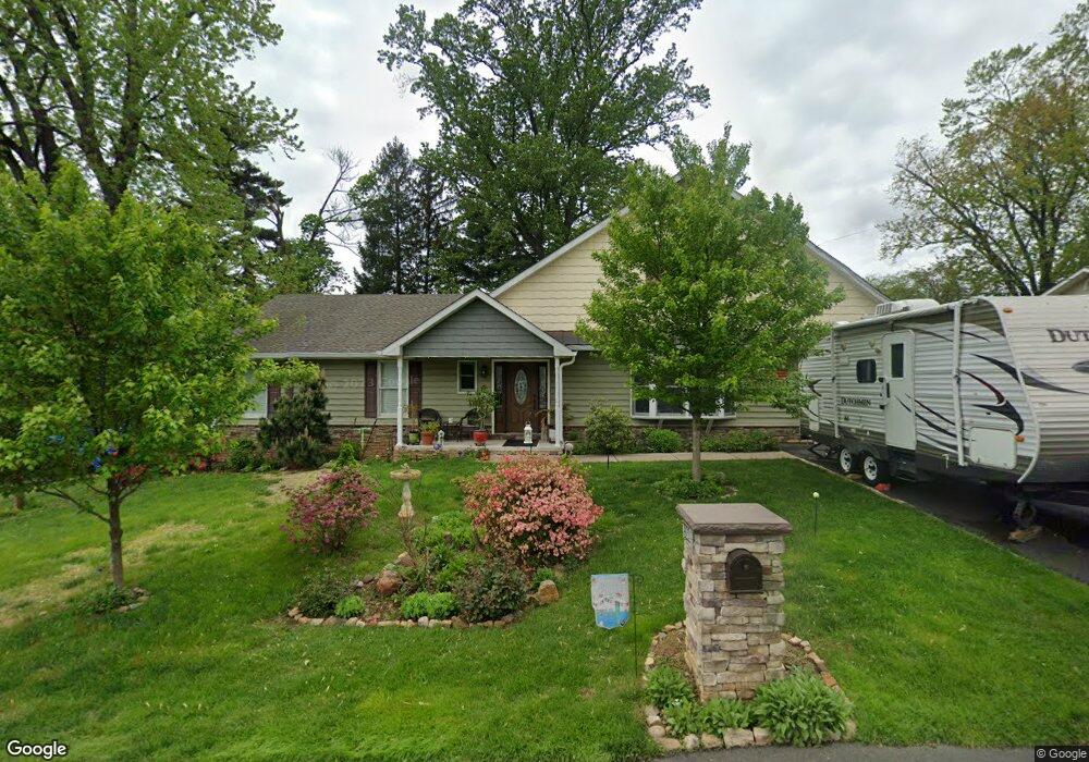
922 Walsh Ave Langhorne, PA 19047
Estimated Value: $386,000 - $475,000
3
Beds
2
Baths
1,766
Sq Ft
$248/Sq Ft
Est. Value
About This Home
This home is located at 922 Walsh Ave, Langhorne, PA 19047 and is currently estimated at $437,605, approximately $247 per square foot. 922 Walsh Ave is a home located in Bucks County with nearby schools including Hoover Elementary School, Maple Point Middle School, and Neshaminy High School.
Ownership History
Date
Name
Owned For
Owner Type
Purchase Details
Closed on
Aug 12, 2003
Sold by
Lyons Deborah Marie
Bought by
Lyons Wayne R and Lyons Deborah M
Current Estimated Value
Home Financials for this Owner
Home Financials are based on the most recent Mortgage that was taken out on this home.
Original Mortgage
$116,600
Interest Rate
5.82%
Mortgage Type
Purchase Money Mortgage
Purchase Details
Closed on
Nov 4, 1954
Bought by
Mannices Geo and Mannices Josephine
Create a Home Valuation Report for This Property
The Home Valuation Report is an in-depth analysis detailing your home's value as well as a comparison with similar homes in the area
Home Values in the Area
Average Home Value in this Area
Purchase History
| Date | Buyer | Sale Price | Title Company |
|---|---|---|---|
| Lyons Wayne R | $175,000 | Fidelity National Title Insu | |
| Mannices Geo | -- | -- |
Source: Public Records
Mortgage History
| Date | Status | Borrower | Loan Amount |
|---|---|---|---|
| Closed | Lyons Wayne R | $116,600 |
Source: Public Records
Tax History Compared to Growth
Tax History
| Year | Tax Paid | Tax Assessment Tax Assessment Total Assessment is a certain percentage of the fair market value that is determined by local assessors to be the total taxable value of land and additions on the property. | Land | Improvement |
|---|---|---|---|---|
| 2025 | $5,636 | $25,890 | $4,640 | $21,250 |
| 2024 | $5,636 | $25,890 | $4,640 | $21,250 |
| 2023 | $5,547 | $25,890 | $4,640 | $21,250 |
| 2022 | $5,401 | $25,890 | $4,640 | $21,250 |
| 2021 | $5,401 | $25,890 | $4,640 | $21,250 |
| 2020 | $5,336 | $25,890 | $4,640 | $21,250 |
| 2019 | $5,217 | $25,890 | $4,640 | $21,250 |
| 2018 | $5,122 | $25,890 | $4,640 | $21,250 |
| 2017 | $4,991 | $25,890 | $4,640 | $21,250 |
| 2016 | $4,991 | $25,890 | $4,640 | $21,250 |
| 2015 | $3,582 | $17,600 | $4,640 | $12,960 |
| 2014 | $3,582 | $17,600 | $4,640 | $12,960 |
Source: Public Records
Map
Nearby Homes
- 731 Highland Ave
- 751 Duxbury Dr
- 790 E Parker St Unit A1
- 801 E Parker St Unit B2
- 2823 Avenue E
- 2816 Avenue E
- 565 Hulmeville Rd
- 56 W Lincoln Hwy
- 1314 Poplar St
- 24 W Lincoln Hwy
- 409 Fairview Ave
- 1516 Fairview Ave
- 1632 Winter Ave
- 710 Fox Ct
- 547 Hulmeville Ave
- 174 E Highland Ave
- 0 Highland Ave E Unit PABU2082086
- 6369 Powder Horn Ct
- 1605 Old Lincoln Hwy
- 308 W Richardson Ave
- 906 Walsh Ave
- 927 Walsh Ave
- 610 Russell Ave
- 936 Walsh Ave
- 874 Walsh Ave
- 935 Walsh Ave
- 907 Hulmeville Rd
- 946 Walsh Ave
- 871 Hulmeville Rd
- 951 Walsh Ave
- 920 Virginia Ave
- 945 Hulmeville Rd
- 862 Walsh Ave
- 956 Walsh Ave
- 869 Walsh Ave
- 916 Virginia Ave
- 936 Virginia Ave
- 863 Hulmeville Rd
- 959 Walsh Ave
- 959 Hulmeville Rd